
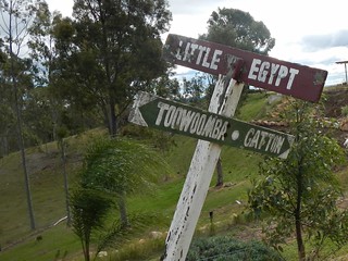
Queensland has its very own “Egypt” – a spectacular plateau to the south-east of Toowoomba with amazing views of the Lockyer Valley. Today’s adventure took us to the heights of Egypt following portions of the Bicentennial National Trail (BNT) as well as old tracks that were once used in the Flight Centre Epic mountain bike race.
We rode from Withcott with some new friends, Tamsin and Richard, who were familiar with many of the trails in the area, and were able to point us in the right direction when planning the ride.
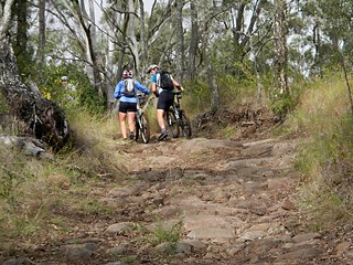
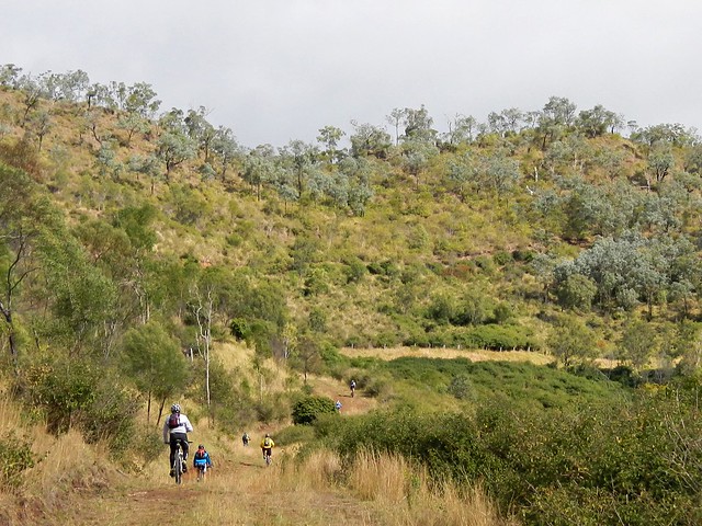
There’s no chance to “warm up” when riding along the BNT out of Withcott. The hills start almost immediately. One of the first major climbs is “Silver Pinch” which takes you up to Silver Ridge, near the Toowoomba Golf Club at Middle Ridge.
As with most climbs, we were rewarded afterwards with a wonderful twisty descent down Horsfalls Lane towards Upper Flagstone Creek. It was a cold day, and I was grateful for the warm gear I was wearing as the wind whipped past us on the way down.
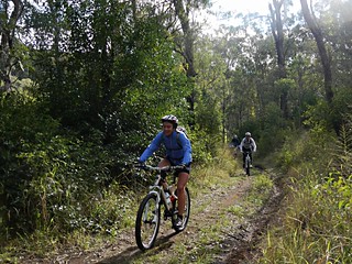
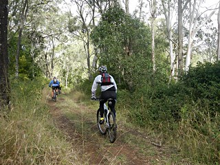
After following the creek for a short while, we left the paved road and followed the BNT up a dirt track leading up to Preston.
And this was to be the pattern of the day. Tough climbs. Short break at the top. Wonderful quick descent ![]()
Some of the hills were a bit too steep to ride in places, but it still felt great to be out in this wonderful part of the world.
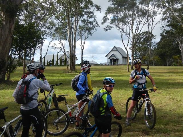
We eventually made it up the climb to Preston – a picturesque hilltop village with its own Chapel and Vineyard. (Note to self, lets come back here in a few weeks with the family for a leisurely drive)
One of the hidden treasures of Preston is a lookout, not far from the winery. I only found out about this gem by reading Shannon Wall’s excellent blog “Biking the BNT” in which he describes his adventures riding a mountain bike along the BNT from Cooktown to Aratula (over 3,000 km). The panorama is worth the small detour from the main road. Thanks for letting us know about it, Shannon!
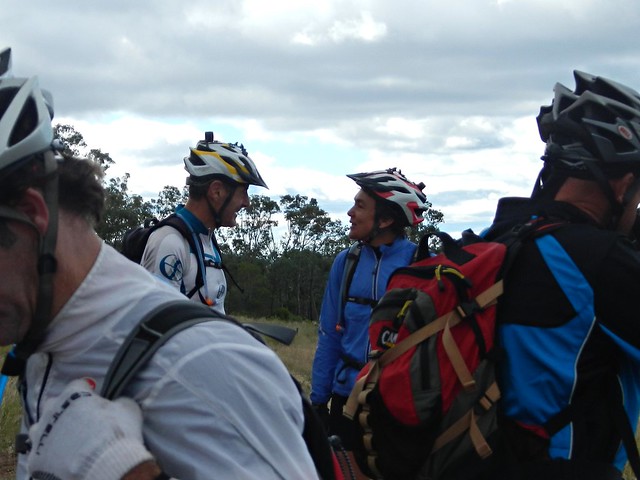
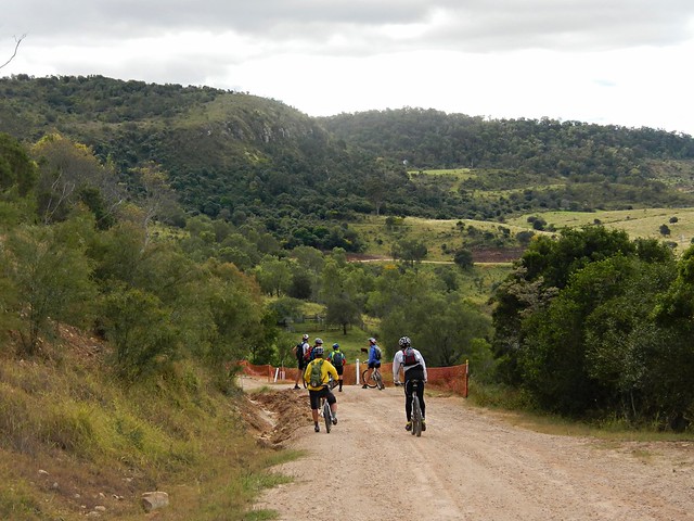
Richard suggested we leave the BNT at this point, and ride up to the Egypt Plateau via the small villages of Rockmount and Stockyard.
What followed was another eye-watering descent down from Prestonm in which we lost about 500 metres of altitude over 10 km.
Wow!
At the bottom, Paul pointed out to me that while he enjoyed the ride down, he was reluctant to give up so much altitude. Because as any intrepid mountain biker will tell you, you must pay your dues to the gravity gods. What goes down must go up. And so we met Kennedys Road.
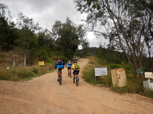
It starts with a bit of a giggle. There are a few letter boxes at the bottom, and a rusty old fridge, that makes an effective letter box if you’re expecting large parcels.
But the climb is tough.
As usual, I was the last one up the hill.
I kept my legs turning over by reciting Banjo Patterson’s “Clancy of the Overflow” to myself. The rhythm and imagery kept my mind off the effort.
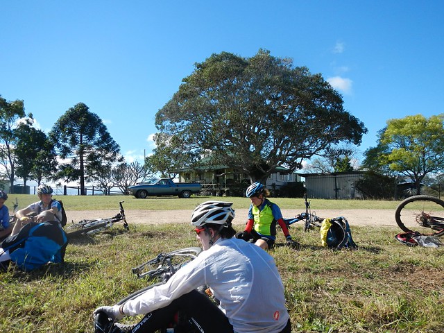
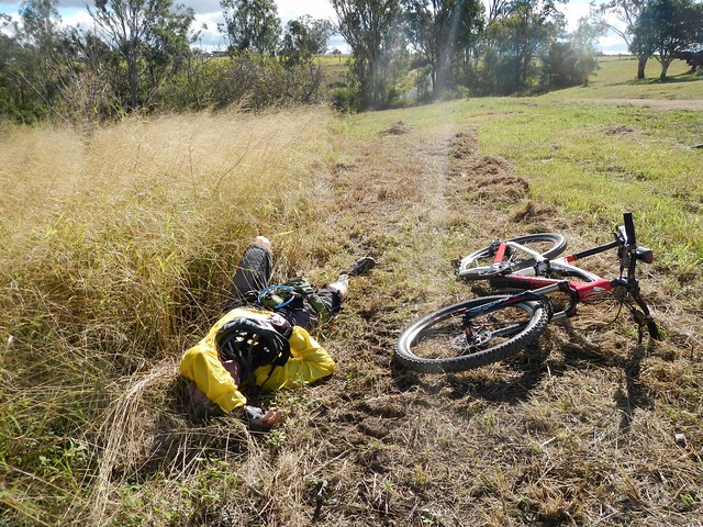
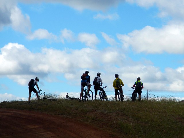
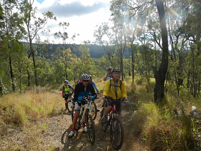
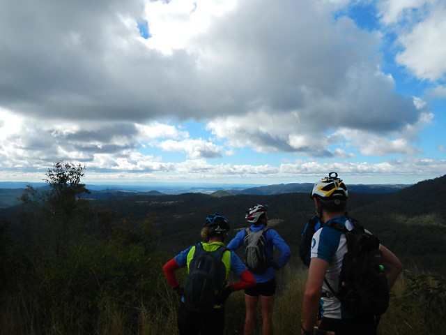
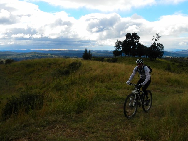
And so we made it up onto the Egypt Plateau, where we all collapsed on the grass opposite an old fig tree, and enjoyed our lunch. Eric (relaxing on his back) says the best sauce is hunger. I agree with him. Peanut butter sandwiches never tasted so good.
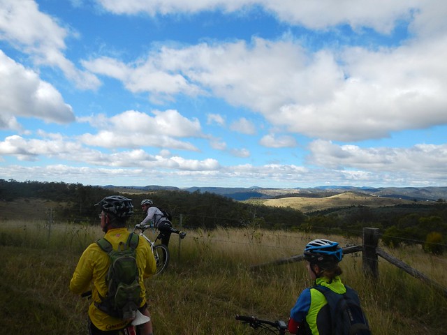
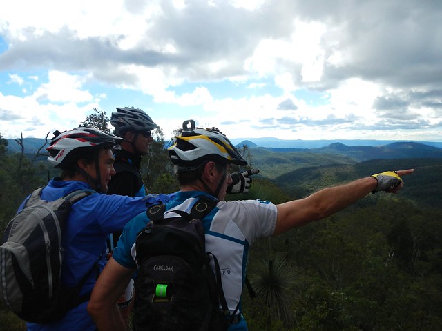
We stopped quite often to soak up the views. The rolling hills seemed to go on forever.

For some reason an old song by Elvis Presley starting going through my head. No prizes for guessing which one.
Each corner revealed a new vista…
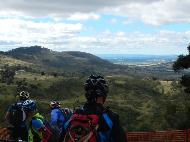
… so we stopped quite often to enjoy the view.
Incidentally, this is one of the reasons I don’t do races. How could you possibly enjoy the view? (The other reason is that I don’t ride fast enough).
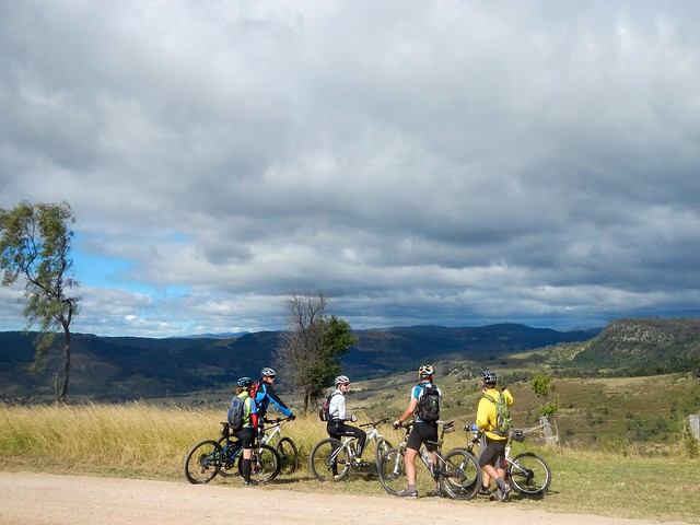
Great views with great friends. I can’t really thing of anything I’d rather be doing on a Saturday!
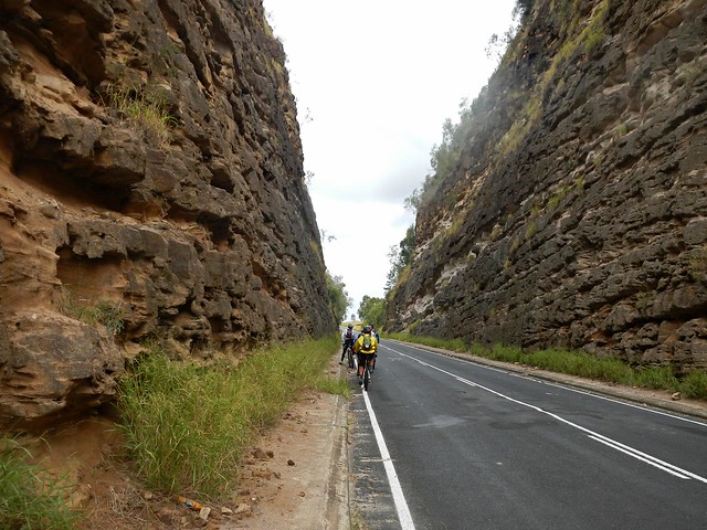
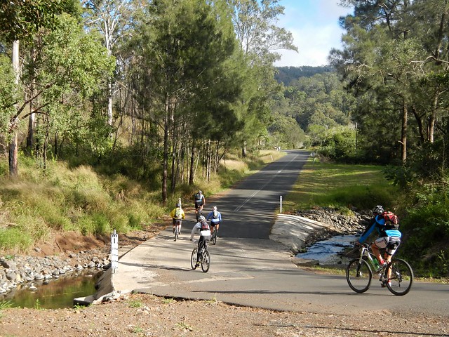
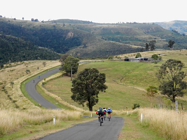
Eventually we hit the main road near Ma Ma Creek and started riding southwards. This imposing road cutting stretched high on either side of the road. There were warnings at either end alerting us to the possibility of falling rocks. Eric (ever wise) advised us all to keep riding. I couldn’t resist and had to stop and get a photo of it.
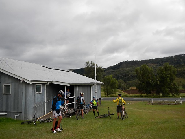
After about 55km riding, we stopped to fill up with water at this goregous old galvanized iron hall at Ma Ma Creek.
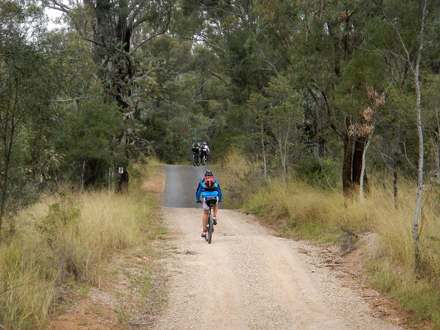
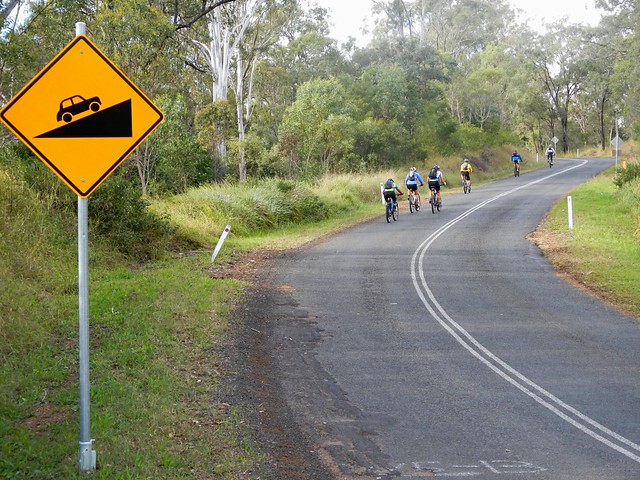
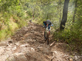
We then left the paved road, and started our way up a dirt track ominously named “Razorback Road”. This was the third major climb of the day. Good old Clancy came to lend a hand yet again as I re-recited the poem to myself.
This track was part of the “Epic” mountain bike race a few years ago. I thought about hardened racers grinding up this road. It was hard work at my slow pace. Imagine how painful it would be riding up this hill as fast as you could go?
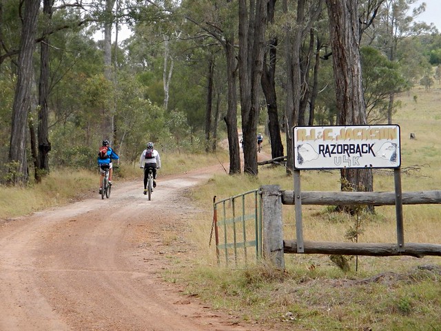
The road passes through a couple of cattle properties on its way up to the Gap at the top.
The rugged landscape was stunning.
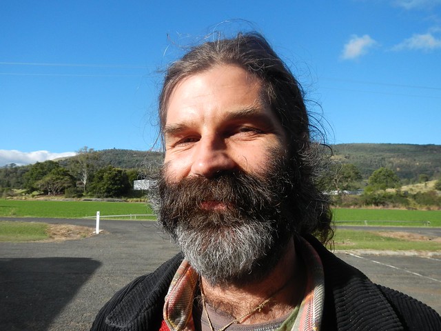
Jason kindly hung back on the climb to ride with me. He’s new to mountain biking, but his legs are accustomed to working hard on the road bike. It’s hard to keep up with him on the hills.
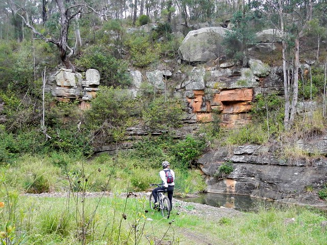
At the bottom of another exhillarating descent, we came across this gorge at Lagoon Creek.
It’s amazing what you find off the beaten track.
After one more climb, we eventually reached the top of West Haldon Road. In the Epic MTB Race, some riders were clocked at 110 km/h riding down this hill. It had a bit too much loose gravel for my liking, so I decended much more sedately today!
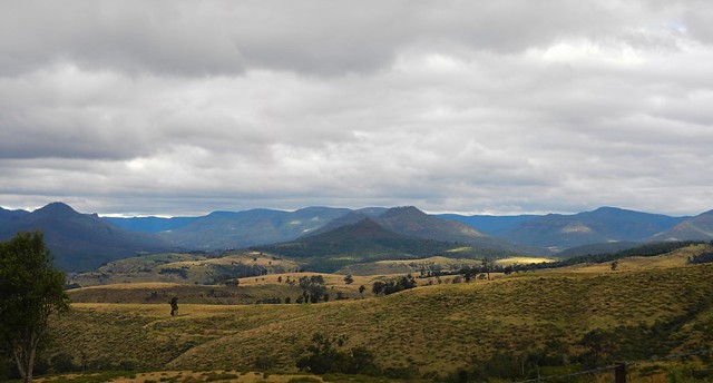
To the south we looked towards Glenrock National Park below the peaks of Goomburra. I haven’t been there. Yet ![]()
What a wonderful place we live in!
We enjoyed the relaxing doanhill coast into Mount Sylvia. Our generous driver for the day, “Wavey Davey” met us here and drove us home. Point to point rides are always logistically challenging, and I’m so grateful for the time “Wavey” kindly gave to us today. Thanks mate!
Thanks also to Tamsin and Richard for showing us around their specatcular back yard.
We rode 85km, and climbed over 2,100m in vertical ascent, in under 7 hours, including breaks. I burned about 3,700 kcal. It was a cold day, and we worked very hard.
This ride deserves 9.5 out of 10 on the tough-o-meter.
To anyone who rode this route for the Epic race – you are tough as nails. Well done!
Oh – can anyone tell me how it this place got to be named Egypt please?


No comments:
Post a Comment