Please note: you can find a more up to date version of this blog at http://blog.neilennis.com

Sunday, September 29, 2013

Somerset Lookout

Read More

Somerset Lookout

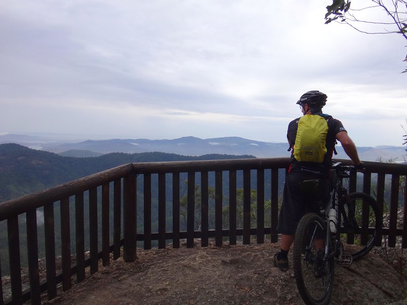
We’ve been to Somerset Lookout a few times. It’s a spectacular precipice on the edge of the western escarpment of D’Aguilar National Park, overlooking Somerset Dam.


The Somerset Region is named after pastoralist and politician, Henry Plantaganet Somerset who, in the 1870′s, became the first European to cross the D’Aguilar Range from Samsonvale to Cressbrook in the vicinity of present day Joyners Ridge Road. While not belittling Somerset’s achievement, it’s interesting to note that the Jinbara and Undambi Aboriginal people had been doing this for centuries before him. Perhaps Somerset should have just stopped and asked someone for directions :)


Chamber Rd, D'Aguilar National Park

Chamber Rd, D'Aguilar National Park


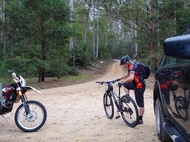
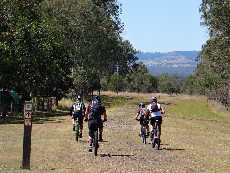
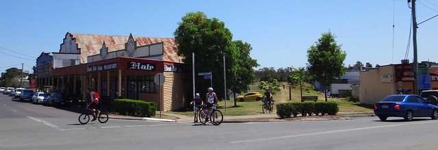
Today’s point-to-point ride started at Chambers Road in Mount Brisbane. While Darb was griding up this steep gravel road, our riding buddy, Paul was heading for the end-point of the ride, Neurum Creek. He planned to ride the route in reverse, and meet up with us near the halfway point.


Peggs Rd, D'Aguilar National Park

As usual, I was the designated driver for the day. It was my challenge to make sure I didn’t lose Darb when he disappeared down a twisty bush track, while keeping an eye our for Paul, making sure we didn’t pass each other unawares.


I love navigational challenges!


Chamber Rd, D'Aguilar National Park

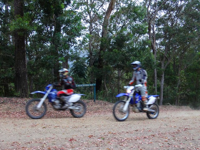
The other challenge about this section of forest is that it’s shared, so it was important to keep an eye out for friendly motocross riders who were also riding the trails.


Chamber Rd, D'Aguilar National Park

Survey Marker, D'Aguilar National Park

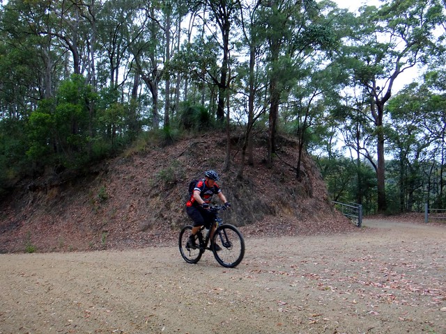
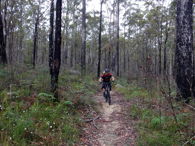
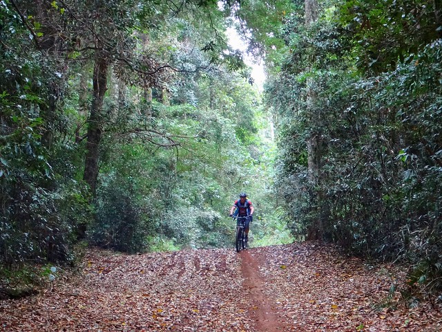
Darb is a powerful hill climber. I shouldn’t have been so surprised to see him make it to the top of Chambers Road in record time. He didn’t even stop, but kept grinding up Peggs Road.


Peggs Rd, D'Aguilar National Park

Peggs Rd, D'Aguilar National Park

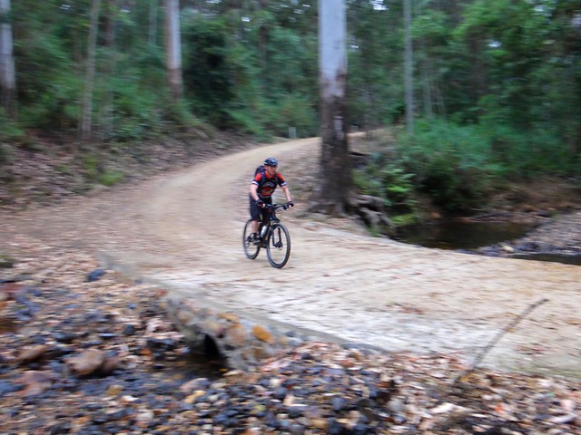
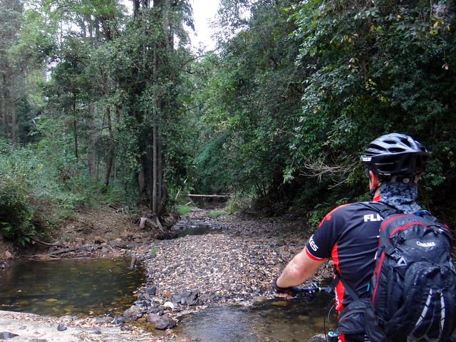
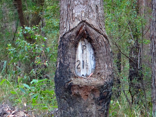
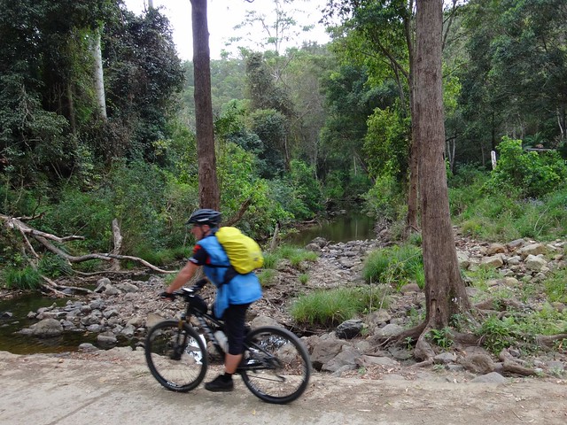
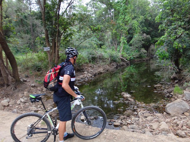
Peggs Road is challenging. After the tough climb to the top, there’s a wonderful winding descent to Byron Creek. The downhill section is the perfect place to catch your breath, because once you hit the creek crossing there’s another long climb up to Selin Road.


Peggs Rd, D'Aguilar National Park

But, as usual, Darb nailed the climb up to Selin Road in record time. Later, when I looked at his Strava page for the ride, I noticed he had more Gold Medals than an East German weight-lifting team.


Looking Back

Mountain Bike, D'Aguilar National Park

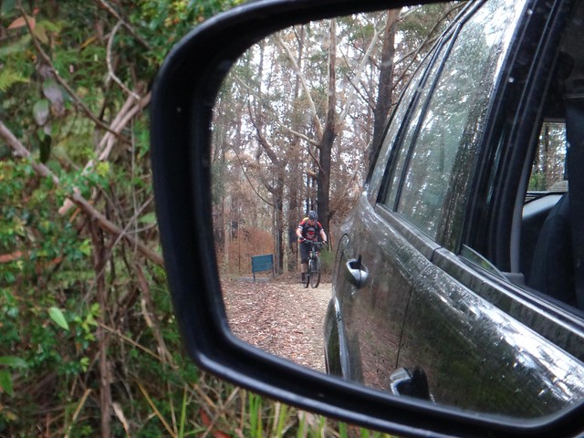
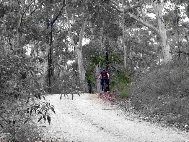
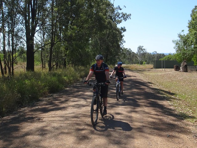
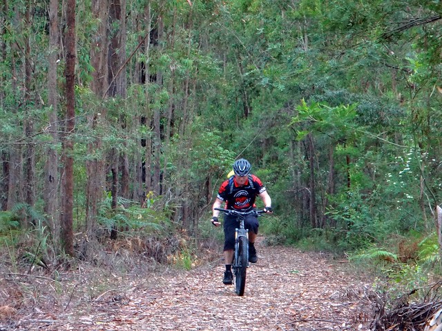
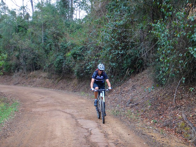
This was a different sort of Mountain Biking experience for me. We were both riding the same trails – except I was doing it in a car. Darb and I got into a rhythm where I’d drive ahead to the next interesting point on the trail, and wait for him to catch up. Usually I didn’t have to wait long. Mountain Bikes can move very quickly on rough forest trails.


Single Track, Mt Mee

Single Track, Mt Mee

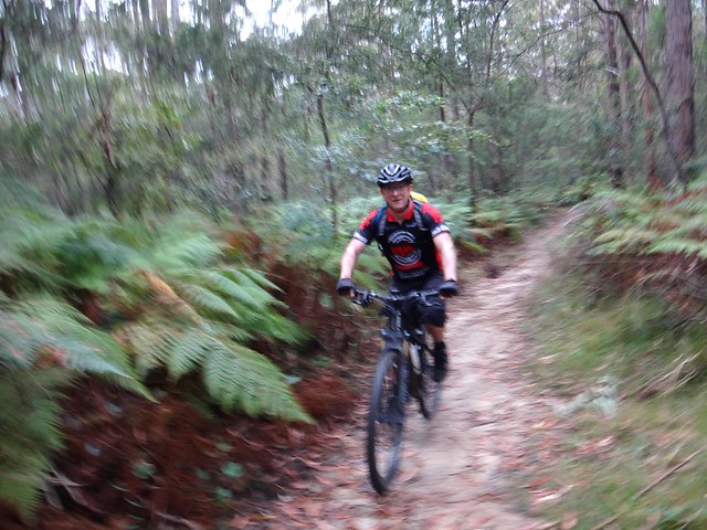
To mix things up a bit, Darb went off on some single tracks while I stuck to the road. When I next saw him he couldn’t stop grinning. Those narrow winding trails were a lot of fun.


Somerset Lookout

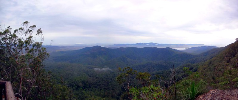
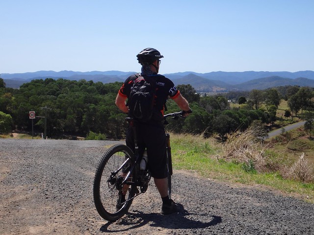
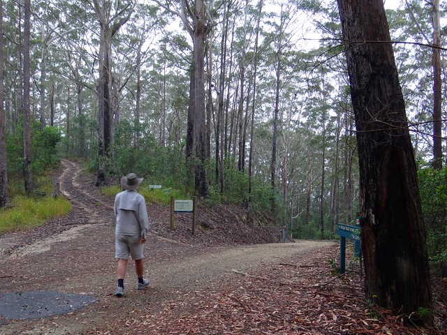
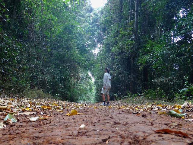
A popular destination for hikers, Somerset Lookout never disappoints. We could see Wivenhoe and Somerset dams in the distance, as well as the Stanley and Brisbane Rivers. We live in a wonderful part of thw world!


Wild Flowers

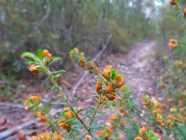
Like before, I rushed off ahead in the car then waited at the intersection of the road and the single track till Darb passed by on the bike. I was waiting here for what seemed like ages until I realized that Darb had been too quick for me. Although I had arrived at the point as quickly as possible in the car via the gravel road, Darb had been quicker on the narrow track. He had been and gone before I’d even got there. Nothing to see except wildflowers and tyre tracks :)


Single Track, Mt Mee

The Gantry


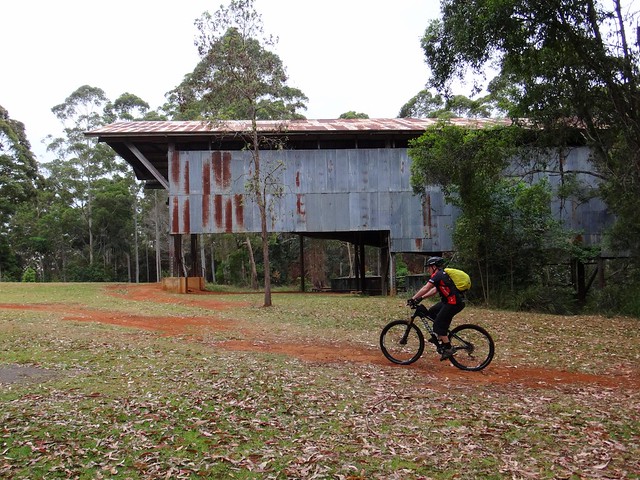
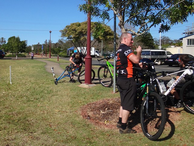
In order to catch up with my unstoppable riding buddy, I played it safe and headed for our “lunch” stop at The Gantry. “Lunch” is a misnomer – it wasn’t even 10am, but I think Darb had earned his lunch.


The Gantry is all that remains of The Hancock Sawmill that was built in the 1930′s to mill timber that was logged in this forest. It mas much easier to cut up the wood on the mountain than haul it down to Caboolture or D’Aguilar. The timber-getting days are over, and the forest is slowly growing back, although it may take a couple of centuries to regain some of the gigantic mature sentinels that once towered over this forest.


Single Track, Mt Mee

Single Track, Mt Mee


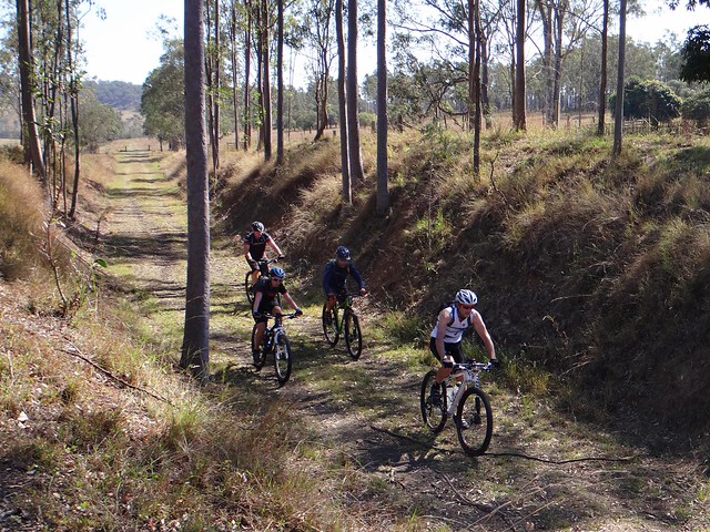
After our break, I sent Darb off into another part of the forest that was inaccessible to me in the car. He emerged a bit later than expected, with cuts from Lantana branches on his forearms.


“That was tough”, he puffed as he reached the top of the hill.


The overgrowth on those tracks made any sort of progress hard work.


Lovedays Road

Lovedays Road


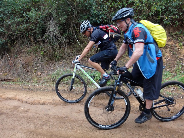
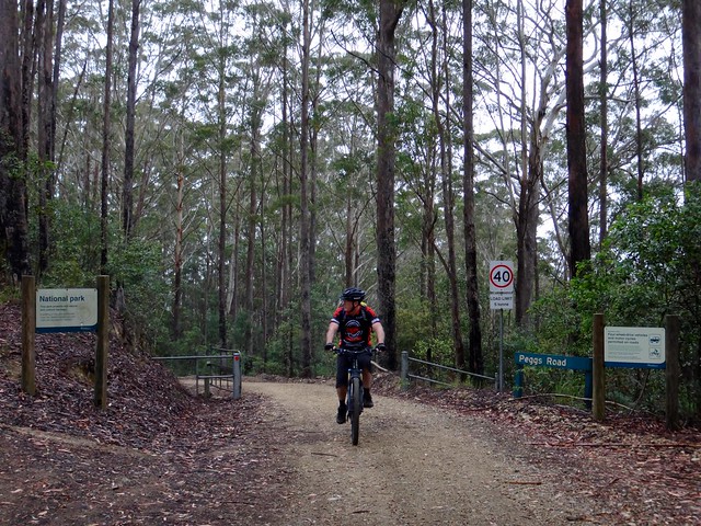
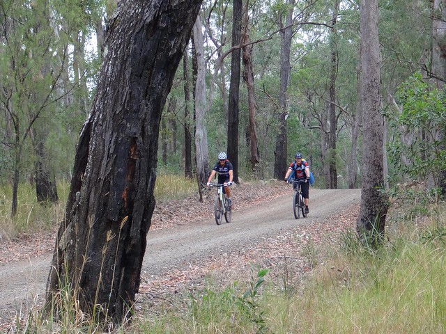
Approaching us from the opposite directioin, Paul met us on Lovedays Road. He had ridden the tough climb up from the Neurum Creek Camp Ground and caught us pretty close to the Gantry. Considering he had started a couple of hours after we did, this was an impressive effort.


Lovedays Road

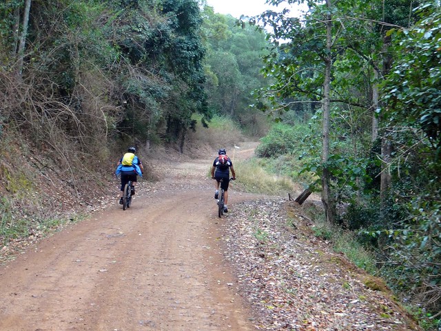
Driving with Mountain Bikers is tricky in hilly country. While they’re slower than motor vehicls going UP a hill, there are very few cars that can keep up with a skilled Mountain Biker going DOWN a dirt road. I played it safe and stayed behind the riders as we descended some of the steeper hills. I couldn’t keep up with them. Gee those guys are quick!


Lovedays Road

I just waited till they got to the bottom, then passed them on the way up the next hill.


Neurum Creek

Neurum Creek


With more downhills than up, we were in Neurum much sooner than we’d anticipated.


The 40km had taken Darb about four and a half hours including a total of about an hour in breaks. That’s an impressive pace for a route that had about 1,500 metres of climbing.


Darb said he’d rate it about 8.5 out of 10 on the tough-o-meter. I think the cooler weather was kind to us today. In hot weater, or in muddy conditions after rain, it would have been much harder.


Thanks, Darb and Paul, for another fun day out!


Sunday, September 22, 2013

Brisbane Valley Rail Trail

Read More

Rail Trail, Coominya

Today’s ride was from Esk to Walloon following the Brisbane Valley Rail Trail for most of the way. I was support driver for Becca, Eric, Darb and Jason, dropping the riders off in Esk, then making sure they had a vehicle to get home from Walloon.


We’ve had many happy rides ending in Walloon. It has a railway station which makes it an easy destination for long point-to-point rides.


We’ve also experienced some amazing rides along the Brisbane Valley Rail Trail from Fernvale in the south to Linville, Blackbutt and eventually Yarraman in the north. The rail trail isn’t an end in itself: in the past we’ve used it as any easy off-road route between different ride locations, allowing us to stitch together epic adventures covering large distances.


Rail Trail, Esk

Rail Trail, Esk

Like rail journeys in bygone years, today’s journey started in the middle of town heading down a straight flat track, surrounded by bustling townspeople going about their business. The only difference was that there was no smokey engine pulling these carriages.


BVRT Railway Bridge (Jason Reed)

BVRT Railway Bridge (Jason Reed)


Bridges over creeks are closed to traffic for safety reasons. There are large sandsone blocks in the creek beds to make it easier to cross the creek without getting your fee wet.


Rail Trail, Mount Hallen


Mount Hallen Railway Station used to be the first stop on the south-bound line 10 km from Esk on the way to Ipswich. Our pedal-powered “train” rushed through there after about half an hour…


Rail Trail, Coominya


… In fact, it was little over an hour before the “Mountain Bike Expresss” pulled into Coominya, 25 km down the line. The flat gradients made it easy to keep up a quick pace.


Rail Trail, Coominya

The word “Coominya” comes from the Yugarapul aboriginal words “Kung-i-nya” which means “View of the water”. One sign in town suggested it might also be a question: “Where is the water?”


Rail Trail, Coominya

Charles Lumley Hill was an early European settler in the area. He owned “Bellvue Station”, a large cattle property. The railway station was originally called “Bellvue” and serviced his property, as well as allowing transportation of timber to the city. Hill asked for the name of the station to be changed to avoid confusion with his property, and so the name “Coominya” was chosen.


Lockyer Creek (Jason Reed)

Lockyer Creek (Jason Reed)


Lockyer Creek has deep banks as you ride south-east from Coominya to Lowood. In flood times, this waterway becomes a raging torrent. But on this mild spring day the water looked delightful.


Rail Trail, Lowood


The trail passes quite close to the road, south of Lowood. The railway engineers elevated it slightly here to avoid flood water. It was uncanny how train-like the riders looked, silently pedalling along the track. I don’t think they had any idea I was watching…


Rail Trail, Lowood, Qld

Rail Trail, Lowood, Qld

The “train” arrived in Lowood earlier than expected (as trains sometimes do), so we decided to have an early lunch. The busy town was startling after the solitude of the trail.


Rail Trail, Vernor (Jason Reed)

Rail Trail, Vernor (Jason Reed)


East of Lowood, the trail follows the Brisbane River. Driving a motor vehicle along the adjacent road, it’s difficult to enjoy the view. One of the delights of trail riding is being able to take your time and soak up the gorgeous scenery.


Vernor, Qld


At this point we left the the rail trail and headed up “into the hills” south of Vernor. The steepness of Ogg Road was a pleasant surprise after 40 km of relative flatness. As always, the views at the top were worth the effort of the climb…


Friendly Horse

… and the horses were friendly too!


Overgrown Trail (Jason Reed)

Overgrown Trail (Jason Reed)


One of the consequences of leaving the rail trail was that the tracks became rougher. In places the grass was quite high, and the only way through was by pushing the bikes.


Haigslea

I eventually caught up with the riders again as they rode up the hill towards Haigslea Cemetery, near Walloon. They had ridden 62 km in about 4.5 hours including an hour of breaks. Total ascent for the ride was about 600 metres.


Becca and Jason had ridden “The Epic” the previous week, and thought this trip was a pleasant change from the rigours of racing. They rated it 5 out of 10 on the tough-o-meter. Darb rates in about 7 out of 10. Eric had mechanical problems and couldn’t finish.


I think this would be a relatively easy ride in either direction for most mountain bikers. Taking advantage of the railway service in Walloon, it would be an ideal start for a multi-day adventure northwards via the rail trail to exciting destinations in the South Burnett or along the Bicentennial National Trail.


Esk Walloon 2013-09-21 from Darb Ryan on Vimeo.


Here’s Darb’s excellent video of the ride.


And here’s his track log…