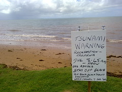
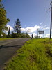
All of South-Eastern Australia was on a tsunami alert this morning after the earthquake in Chile. On the hill behind this makeshift sign a lone TV cameraman sat watching the horizon for the scoop of the day which (thankfully) never came.

Sunday, February 28, 2010
Tsunami – Redcliffe Style
Read More
Saturday, February 27, 2010
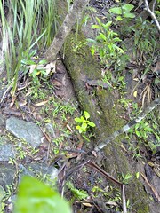
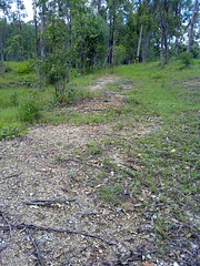
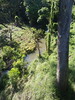
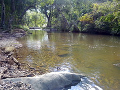
Irrigation Dam, Joyner’s Hill
Read More
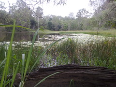
William Joyner purchased the “Samsonvale Run” in 1845 from Darling Downs squatters James Sibley and Joseph King.
He died in 1847 in a shipping accident, and his wife, Isabella decided to sail up from Sydney and manage the property.
This irrigation dam is about a kilometer from where the family built “Aust House” in 1865.
This area is rarely visited, and some of the scrub is very thick. It made me wonder what Isabella would have thought of it when she arrived in 1847.
View Larger Map
Tuesday, February 23, 2010
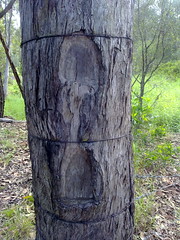
Martin Lavelle Was Here
Read More

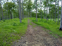
Surveyor Martin Lavelle marked this tree in 1867 while he was surveying the Griffin area on the northern banks of the Pine River.
Surveyors often used natural features as reference points when preparing a plan of an area. When trees or stumps were used, they would cut a mark in the tree to make it easier to find by others.
This stump is known affectionately by locals as “Tom Petrie’s Stump”, probably because it marks the corner of a property that he purchased in 1870.
The surrounding area is being redeveloped from rural land into a housing estate. Happily, the developers have agreed to protect the tree, erect bollards around it, and place an informative marker near it so people can understand its significance.
Next time you see an old tree with a large triangle cut out of it, listen closely and you might hear the whisper of an old story.
Sunday, February 21, 2010
Along the Old North Road (Part 2)
Read More
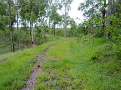
Last week Simon and I road from Wamuran to Moorina along the historic Old North Road.
This week we wanted to complete the southern section of where we think the road went, between Kurwongbah and Moorina.
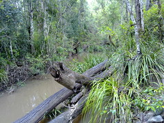
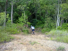
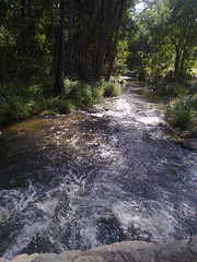
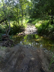
We started at Dunlop Lane then headed north along Smiths Road where it crosses Mosquito Creek. I looked around here for any traces of an old bridge but could find nothing except an old beam in one of the banks.
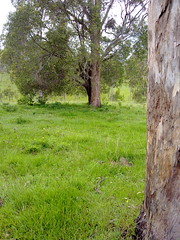
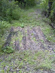
Merelyn very kindly let us look around her property which is on the southern end of historic Franz Road where it used to meet Alf Dobson Road. She showed us the remnants of the Old Road, with what I think are survey marks clearly chopped out of a dead tree near the road.
Merelyn has records of the road reserve being re-gazetted from it’s historic route past her front door, to a point along one of the boundaries of her farm.
The ground is heavily compacted showing evidence of frequent traffic at some time in the past.
Merelyn has had conversations with several old-timers who tell her cattle used to be driven southwards along the road prior to the early 20th century.
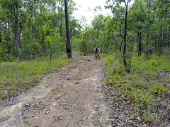
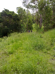
Cliff, Owen and Cathy very kindly let us ride through their farm trying to find any remnants of the road.
As Franz Road heads north, we tried to retrace the road by referencing an old survey plan by William Fryar in 1868.
These old trees are close to where Fryar’s plan showed trees that he used as reference markers for his pegs. Unfortunately the original trees are long gone.
I would have made a hopeless surveyor, and found it difficult to differentiate between what I thought were remnants of the old road, and more recent farm tracks.
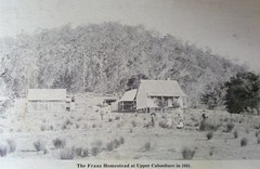
Cathy showed us this old photo of the old Franz homestead near where we passed.
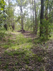
Judy and Ken kindly showed us the remnants of an old road passing through their property.
Judy tells me that the road was used by Cobb & Co in the 19th century.
It winds up a fairly steep hill, and in some places it’s possible to see evidence of past maintenance, including an old log bridge, and frequent large rocks lining the sides of the road.
Saturday, February 20, 2010
Geocaching in Upper Caboolture
Read More
Here’s some pictures of our Geocaching (http://geocaching.com) expedition today. If you like discovering new places, and don’t mind the challenge of trying to find something that has been craftily hidden, then you might really enjoy Geocaching. All you need is a GPS and a sense of adventure.
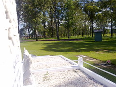
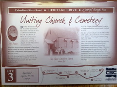
This is a historic church and cemetery in Upper Caboolture where we found a geocache. I was bowled over when I found the grave of a woman who had been born in 1799. The peaceful rural views are beautiful.


I also took the family back to Zillman’s Crossing to find a Geocache there.
We didn’t end up finding it because I think it got washed away in the recent floodwater after the rain.
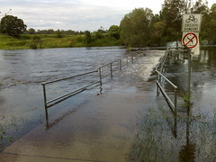
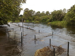
Thursday, February 18, 2010
Bike Path Ends Here
Read More
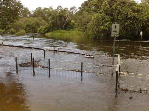
The North Pine River is flooded at the moment from all the rain we’ve been having.
Some of the crossings are quite low, so I think I was being a tad optimistic this morning when I hoped I’d be able to ride over a few of them (I didn’t).
Makes you wonder what it was like in the old days before we had the dam upstream.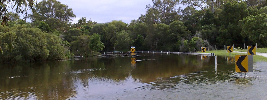
View Larger Map
Monday, February 15, 2010
Along The Old North Road
Read More

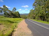
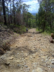
Simon and I caught the train up to Caboolture today and cycled back via Wamuran and Dayboro.
The aim was to explore an old historical road in our area and have fun while we were doing it.
“The Old North Road” is a historic road which was established in 1843 by The Archer brothers (David, Thomas and John) and Evan Mackenzie as a quicker way to travel from Brisbane to Durunder Station and Kilcoy.
Parts of it remain to the North West of Brisbane (where it’s known as “Old Northern Road”, and up near Wamuran on the D’Aguilar Highway where it’s still known as “Old North Road”.
One of the pleasant surprises we found along the way was Zillman’s Crossing. It’s a causeway where The Old North Road crosses the Caboolture River in Rocksberg. This delightfully picturesque spot belies its history where horses, carts, and later cars would have a terrible time getting over the crossing.
We also crossed Gregors Creek, an old dirt track at the southern end of F.Lindsay Road. This was originally part of the Old North Road, but became disused over the years. Click on the video for a superb demonstration of prowess as Simon shows how to cross a creek on a bike.

As this newspaper article from the Moreton Bay Courier (October 24 1846) reports, Gregors Creek was site of a gruesome murder.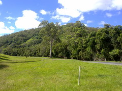
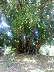
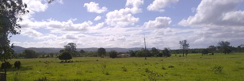
A little further south, and The Old North Road passed below Franz Mountain in Moorina. It overlooks a secluded valley which follows the banks of Burpengary Creek. Today the road is called “Franz Road” and passes sout-east through some private property towards Narangba.
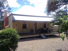
One of the beautiful old properties close to Franz Mountain is “Mary Annes Cottage“. This delightful cottage was built around 1880 by the son of one of the Moravian Missionaries, Maurice Schnieder and his wife Mary Ann. An outstanding native fig tree (Ficus Virens) stands proudly on the property, and is believed to be over 500 years old.
Meg Thomas, owner of Mary Anns Cottage has a fascinating collection of documents detailing the history of the property:


We’ll try to complete the northern section of The Old North Road next week, from Moorina to Whiteside.
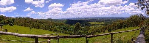
But to cap this leg of the journey off, we decided to follow an old dirt “short cut” up the side of Mt Mee. Exceeding a grade of 25% over a couple of kilometres, this has to be the steepest road I’ve ever tried cycling up. But the views were spectacular, and the exhillarating journey down the mountain after the summit made it a worthwhile climb.

Subscribe to:
Posts (Atom)