It rained most of last week, so I used my opportunity today to catch up on missed rides.
I think I over-did it a bit.
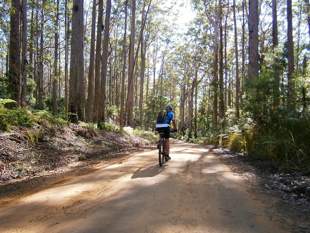
I started from home in Lawnton and made my way via Clear Mountain and Samford to Mount Nebo which took me a couple of hours.
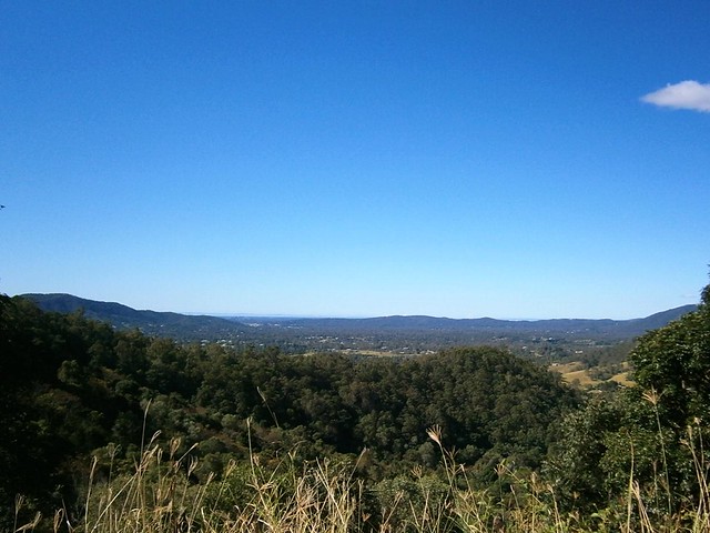
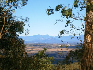
Due to the clean air after the rain, I had some great views from The Goat Track east to Moreton Bay.
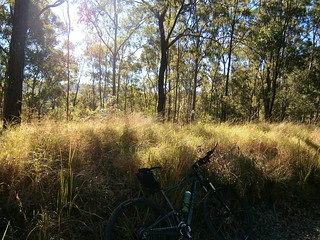
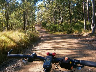
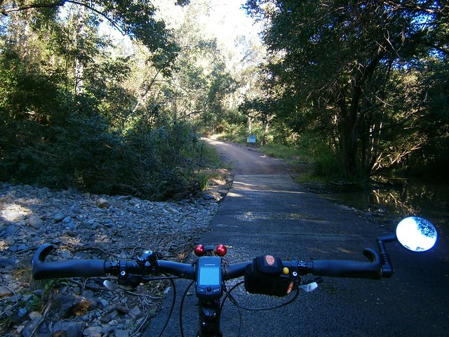
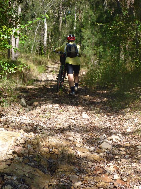
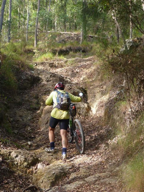
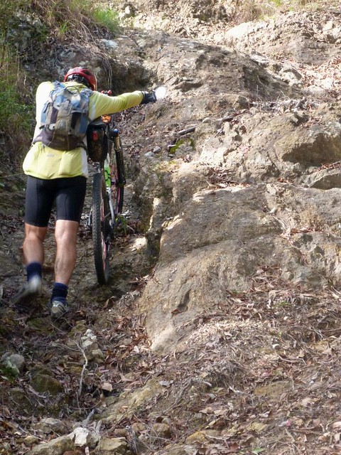
From Mount Nebo I turned onto South Boundary Road – a wonderful fire trail which runs through most of the southern section of D’Aguilar National Park. Today, that meant an enjoyable 15km descent (with a few short climbs) from Mount Nebo down to the creek crossing at the bottom of Centre Road.
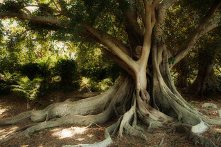
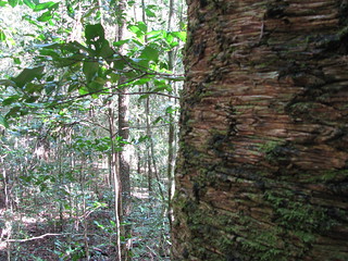
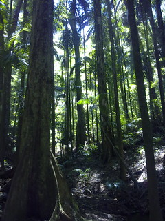
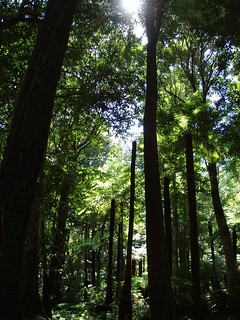
The fascinating thing about this long descent is that you start in wet rainforest, but the vegetation slowly changes until you’re riding through breezy open Eucalyptus meadows. Some of the downhill sections are too quick to look around at the trees for very long, so it was worthwhile stopping every now and then to take it all in
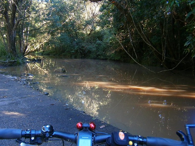
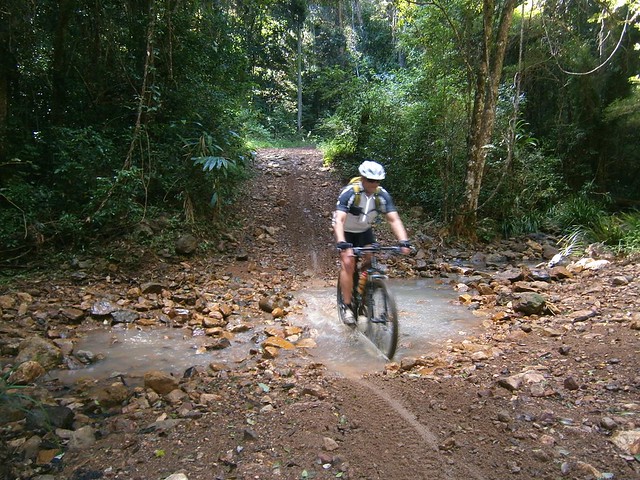
Eventually the descent came to an end at the Ennogera Creek crossing on Centre Road. Ennogera Creek is pretty significant for a couple of reasons. It was dammed in 1866 to form Ennogera Reservoir – Brisbane’s first (and Australia’s second ever) dam. It’s purpose was to supply drinking water for the burgeoning new colony. Waterworks Road in the Gap, Ashgrove and Red Hill is named after this reservoir. From the dam wall, Ennogera Creek runs through the Brisbane suburbs of The Gap, Ashgrove and Newmarket before eventually becoming Breakfast Creek and emptying into the Brisbane River.
Thousands of people see Ennogera Creek from their cars every day as they pass along Ashgrove Avenue or Kelvin Grove Road, but I bet you’d only get a handful of people each week who see it this far upstream.
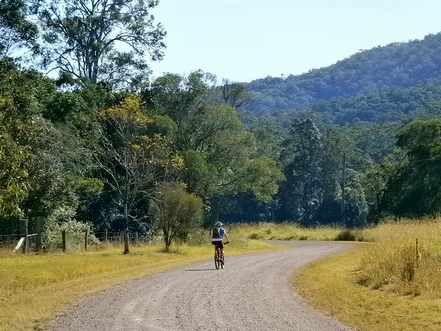
As with all good descents on a bike, you have to pay for it at some stage with a long climb up a hill. So from the creek, I pushed up Centre Road for a couple of km and finished my ride via Bellbird Grove, Camp Mountain, Ironbark Gully and Bunyaville.
All up this took me almost 6 hours (excluding stops). I rode a total of 85km, with just over 1,900m of vertical ascent, and burned about 4,900 kcal (10 Big Macs). I think this one rates about 8.5 out of 10 on the tough-o-meter. That final big hill riding back through Ironbark / Lomandra was pretty painful!
We rode through the Teviot Range today on a big loop through Hardings Paddock, Flinders Plum, Flinders Peak and Undullah.
The traditional owners of this area are the Ugarapul Aboriginal people. Mount Flinders is sacred to them because they believe that the powerful spirit, “Yurrangpul”, lives there, and guards their traditions and sacred places. His name is similar to the local word for green tree frog: “Yurrang”. The green tree frog is the totem of the Ugarapul people.
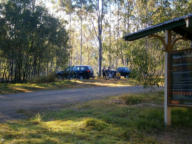
Hardings Paddock is about an hours drive south-west of Brisbane. Not wanting to start our ride too early on a winters morning, we arrived there about 8.30am.
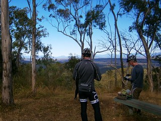
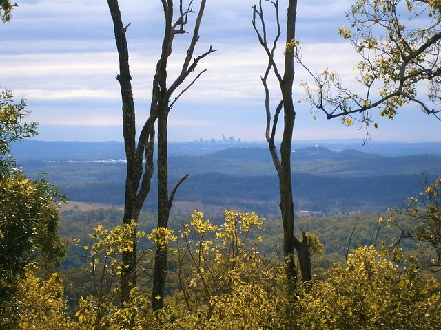
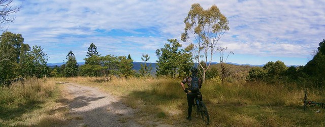
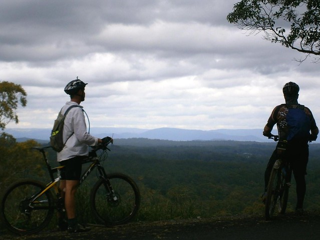
Our first stop was Goolman Lookout which has great views to the south-west as well as back into Brisbane. Mount Goolman was originally called “Murdoch Peak” by John Oxley in 1824, but it was later renamed “Goolman” after a local indigenous word meaning “Stone Axe”.
The last hundred metres up to the lookout is steep, and we had to push the bikes most of the way – something we’d get used to for most of the day
The air was quite clear, and the view to the city in the north-east were amazing.
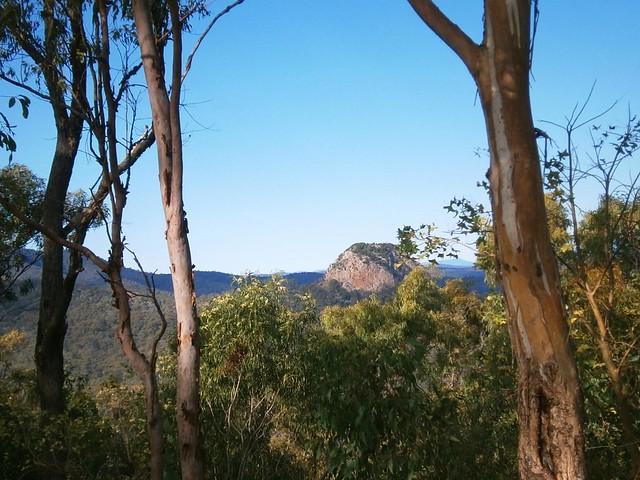
From there we were able to get a good look at Ivorys Rock – a round hill to the south of the lookout.
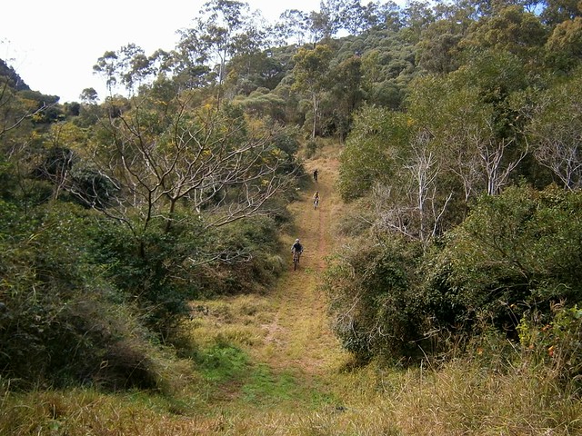
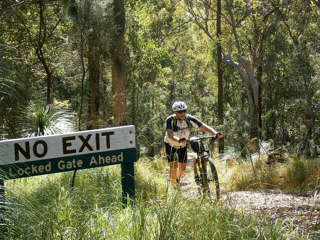
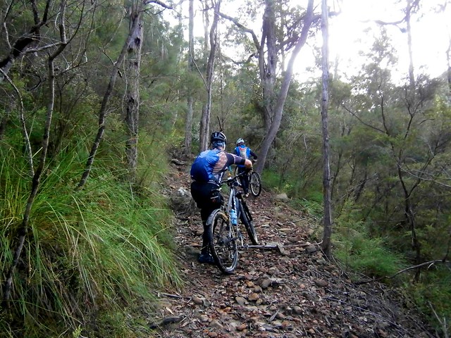
The track from Goolman Lookout to Flinders PLum picnic ground is well maintained and clearly marked. The only problem is that in parts it’s very steep. On several occasions we had to get off the bikes and push them up the steep hills. The up-side of this is that we we enjoyed riding down the other side. There were warning signs saying “Extreme Caution” before some of the descents, which in mountain biking parlance means it’s going to be a particularly fun ride.
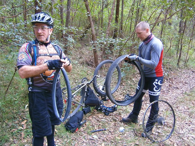
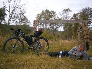
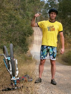
Troy’s bike has been lovingly set up for long-distance touring. I am amazed at the distances this man can cover in one day. So I thought it was quite ironic that he was the only one who suffered a puncture. The white ball-shaped object on the ground near Troy’s feet is actually an inner tube wrapped in an old sock. Troy says a sock is a much better way of stowing a tube compared to a plastic bag because it offers more protection. The last thing you want when changing a tube is to discover your new tube has a hole in it because you didn’t protect it well enough!
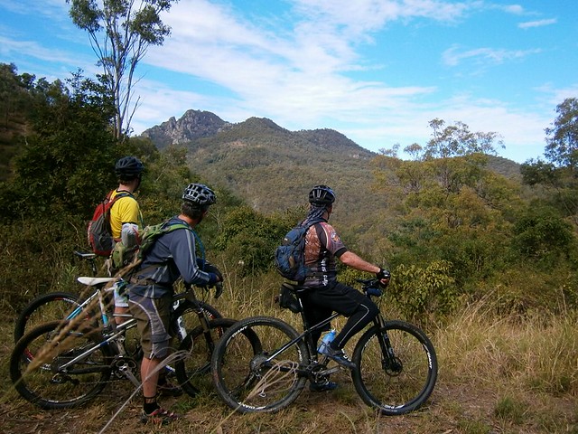
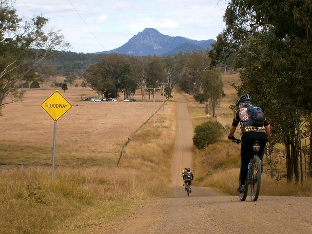
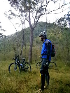
After a tough 5km climb across the southern face of Mount Flinders, we eventually made it to the top of Mount Elliott Road, with more amazing views.
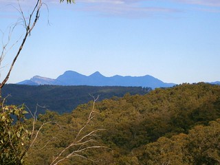
From here you can see all the way to Mount Barney and the Border Ranges. From here it’s also a long descent down to Undullah – so we enjoyed a long white-knuckle descent down the steep gravel road.
The bottom of the hill was a great place to chill out, take a break and a bite to eat. It’s also where we parted company with Troy who continued his epic ride to Kerry, south of Beaudesert.
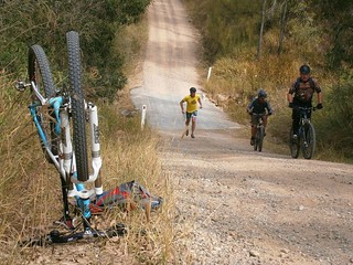
Perhaps the funniest mechanical incident of the day happened when Pete got to the bottom of a steep hill, went to apply some power, and discovered he no longer had a chain. After a quick bit of back tracking, we managed to find the chain, and put it back on with a spare link. (Hint: Don’t leave home without a spare link for your chain!)
We rode northwards into Ripley before finally turning back towards our starting point. Wards Road offered some more great views of Flinders Peak.
We rode about 50km in about 6 hours including breaks (moving time 4 hours). It included almost 1,700m of ascent. I burned just over 3,200 kcal. This would be a tough ride in summer or in wet weather. The dry cool weather of Winter is the best time to do this ride. On the tough-o-meter I rate it 8.5 out of 10.
I had the pleasure today to read an old newspaper article from “The Brisbane Courier” which describes what the South Brisbane and West End areas of Brisbane were like in the 1820′s. The story was published in 1930 by someone who, fifty years earlier had made “the acquaintance of an old man – a time- expired convict – who was one of the first contingent of prisoners in 1825 to quit Redcliffe and ascend the Brisbane River in a cutter”. It’s a valuable recollection in that it describes the Paradise that was Brisbane prior to European Settlement.
If, like me, you’ve ever stood in your backyard and wondered what it would have been like three or four hundred years ago, or even earlier, then this article might give you a fleeting glimpse.
When I read this I get a better idea of the grief and anger many indigenous Australians feel about the loss of their land.
If you want, you can click on the image of the newspaper clipping to the left and read it. To make it easier, I’ve included a transcript of the article as well.
RECENT issues of “The Brisbane Courier” have referred with a certain amount of pride to the fact that the P. and O. Coy. have decided to extend the service of their fine steamers to Brisbane. When one considers that less than a century ago men frequently waded across the Brisbane River at various spots between the present site of the Victoria Bridge and Queensport it can be realised that the work of improving the river has been one of great magnitude. Many years ago I was told by a gentleman then engaged in the pilot service at Brisbane that on one occasion at low tide he waded across the river from Queensport to Pinkenba. I had it from an ex-convict that during the years of the convict settlement in Brisbane, that is, after the year 1825, the soldiers when off duty were in the habit – at low tide – of wading about in the shallow pools of water where the Victoria Bridge now stands, and catching large quantities of fish. They caught the fish with their hands, and put them into bags or baskets slung over their backs.
SCENIC BEAUTIES.
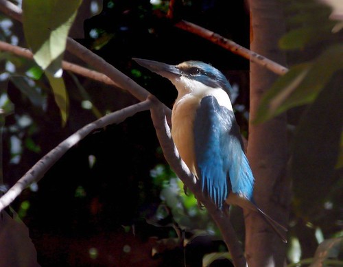
It was my experience, more than half a century ago, to make the acquaintance of an old man – a time- expired convict – who was one of the first contingent of prisoners in 1825 to quit Redcliffe and ascend the Brisbane River in a cutter. This man was well educated, as was evidenced by the fragments of old manuscripts which he had written and placed at my disposal for perusal. He exacted from me a promise that I would not divulge the contents of his notes so far as they related to the convict system, but their perusal conveyed particulars of some dreadful incidents in the administration of the penal affairs of the settlement. The writer of those notes was an ardent lover of Nature, and the beauties of the scenery along the banks of the river probably appealed to him in a manner that was lost upon his fellow prisoners. He drew vivid pictures of the scenes of enchanting beauty which unfolded themselves as each successive reach of the river came into view. To use his own words: “It looked as though some race of men had been here before us, and planted this veritable garden of Eden.” The convicts were being conveyed to a prison from which possibly the majority would be released only by death, and yet the gateway to that prison lay between river banks lined with foliage whose beauty it were almost impossible to describe. Skirting the water’s edge for miles on each side of the river was dense vine-clad jungle, festooned with the blue and the purple convolvulus, while on the tidal brink grew the beautiful salt-water lily – its flower white as alabaster, its glorious perfume filling the air with fragrance. Kingfishers – some scarlet breasted, others white, all with backs of azure blue – darted hither and thither, while anon the solitude was disturbed by the raucous laughter of the kookaburra.
MAN VERSUS NATURE.
But the conditions of an earthly paradise were not to continue indefinitely, for in the course of time – particularly after the abolition of the convict system, and with the advent of free colonists in the Brisbane area – there came the inevitable day when
“The sound of the axe was heard in the land” -
when the war of devastation – man versus Nature – called by most people the march of progress – began, and the beautiful jungles were swept away. A few giant Moreton Bay fig trees were spared for some years longer. One of these stood in William-street, where now is the residence of Mr. Tom Mulcahy, of the Home Secretary’s Department. Another grew on the present site of the Treasury Buildings. Prior to the erection of these buildings that grand old tree stood sentinel over the Chief Secretary’s office – a small one-storied building, where some of the most important laws in force in Queensland first saw the hand of the Parliamentary draftsman. It was under the shadow of that old tree that Sir Thomas M’Ilwraith – then Premier – signed the historical telegram to Mr. H. M. Chester, police magistrate of Cooktown, instructing him to proceed post haste to New Guinea to hoist the Union Jack on the shores of Port Moresby, and to proclaim the annexation of New Guinea in the name of Great Britain. Incidentally it may be stated that M’Ilwraith’s action was repudiated by the Imperial Government, of which Gladstone was the head.
NATURE’S FAIRY BOWER.
One of the most enchanting spots within the Brisbane area was an immense jungle in the western portion of South Brisbane. It began at about the spot where the Victoria Bridge now stands, and it followed the course of the river right away to Hill End, along the whole length of what is now the Montague-road. This jungle was a tangled mass of trees, vines, flowering creepers, staghorns, elkhorns, towering scrub palms, giant ferns, and hundreds of other varieties of the fern family, beautiful and rare orchids, and the wild passion flower. While along the river bank were the waterlily in thousands, and the convolvulus of gorgeous hue. What posterity lost by the destruction of this magnificent jungle in all its pristine glory only those who were privileged to see it can form any conception. Here at our very door we had a wealth, a profusion, of botanical beauty which can never be replaced by the hand of man. Too late have we recognised the desirableness of conserving these glorious works of Nature. The Lamington plateau and Mount Tamborine certainly are beauty spots, and rich from a botanic point of view, but it is not every city dweller who can get to them. A few weeks ago there appeared In the “Courier” a letter from the pen of Mr. Fred. W. Taylor, dated North Tamborine, February l8, in which these words occur: “On ascending the mountain (Tamborine) from the Tamborine station one travels through avenues of wonderful scrub, with palm trees waving their proud plumes to the whispering breeze, and there are vast reserves of virgin scrub prolific in orchids, staghorns, &c., on stately forest trees.” These words would have applied with equal truth to the magnificent stretch of primeval foliage at West End had the early residents of Brisbane exercised sufficient foresight to preserve to posterity that magnificent botanical heritage.
GRIM RELICS.
It was during the destruction of this jungle that evidence of the brutal convict system was brought to light, for, amid this primeval grandeur, there were found the skeletons of several human beings, rusted leg-irons still encircling the bones. Obviously the convicts had escaped from the settlement – either by crossing the river on logs or by wading across at low tide. They preferred to die in this veritable garden of Nature rather than continue to live amid all the horrors of the convict system. But while all lovers of Nature must deplore the destruction of these enchanted spots, there is consolation in realising that after all such destruction was the first step in the direction of a free settlement, which displaced the brutal and degrading convict system.
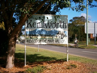
There is an amazing sense of freedom in being able to indulge a whim and go anywhere on your bike that takes your fancy. On a Friday afternoon I though it might be fun to ride a loop from Mapleton to Kenilworth and back. My friend Ron courageously agreed to ride with me for the day.
Mapleton is a small village in the Blackall Range on the edge of a huge forest. Kenilworth is a small village on the banks of the beautiful Mary River nestled between the Connondale and Blackall Ranges. So the ride would cover a variety of landscapes, and include a lot of hills!
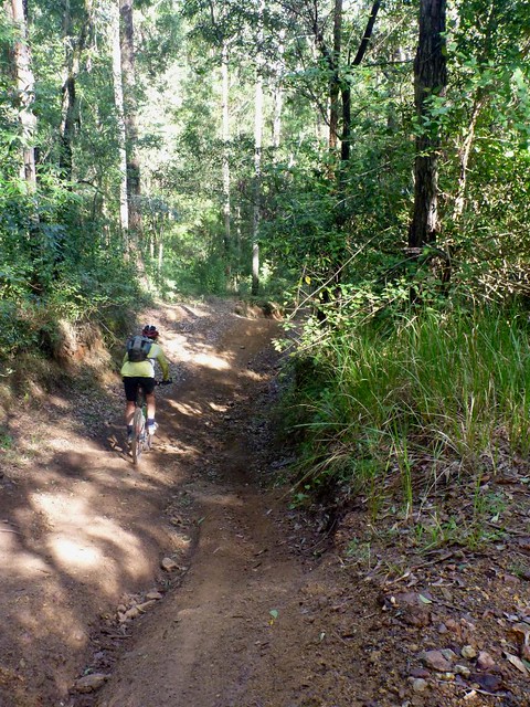
The smooth clay surface of Mapleton Forest Drive was pleasant to ride on. The tall eucalypts shaded the road for most of the way, and the gentle descent helped us keep up a brisk pace.
The descent gradually became rougher, steeper and faster until we were flying down towards Cedar Creek trying to avoid ruts and rocks in the track. I was grateful for my full suspension, which smoothed out most of the bumps. Ron was riding a hardtail (no rear suspension) and I think his bones got quite a rattling.
Eventually, the descent spat us out onto Cedar Creek Road – a rural community nestled into the end of a valley. Since the road was effectively a cul-de-sac, there wasn’t much traffic, and we had the road to ourselves.
At this point we had two alternatives. We could have ridden the entire length of the road and followed 15km of bitumen into Kenilworth. Or we could head up into the hills of Gheerulla…
(Photo by Ron Perske)
“Sorry, Ron. I didn’t realize Gheerulla would be this steep”. Ron didn’t seem to mind as we both heaved our bikes up the hill.
We eventually made it to the top, from where we could enjoy a few challenging down-hill runs.
(Photo by Ron Perske)
The down-hills in Gheerulla reminded me of “Whoa Boy” in D’Aguilar National Park. They were long, steep and had waterbars every few metres to stop soil erosion. The waterbars made the ride feel like a bit of a roller-coaster as we hung on tightly trying to make sure the bikes didn’t slide out of control on the way down. I made sure I hung my backside as far out over the back of the bike as I could.
After a few wrong turns in the Gheerulla forest we eventually found our way to Oaky Creek Road and then the main road into Kenilworth.
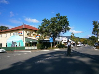
We eventually rolled into Kenilworth for lunch. It’s a goegous little town – the main street has numerous cafes, and a typical country pub. It’s popular with day trippers and touring motor cyclists.
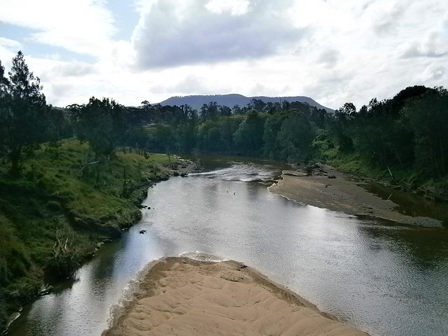
Like a crazy tourist, I stopped in the middle of the bridge on the way out of town to get a photo of the Mary River. Luckily no cars were passing while I stopped.
The final part of our trip was the climb up Delicia Road. This started out as a tough climb with some amazing views to the south over the Obi-Obi valley.
(Photo by Ron Perske)
Delicia “Road” gradually increased in steepness until we had to push the bikes up the hill.
(Photo by Ron Perske)
It got steeper….
(Photo by Ron Perske)
…and steeper. Eventually I declared that whoever had named this precipitous sherpa track “Delicia Road” should be imprisoned. It wasn’t a road. It wasn’t a track. In places it wasn’t even a hiking trail – there was no trail.
Ron was amazing. He just said “It is what it is. It stands between you an the rest of your life. You can either sit down and cry, or keep pushing and get home”. I took his sage advice and kept pushing.
(Photo by Ron Perske)
And, almost miraculously, we reached the top, asked some friendly locals for some extra water, and took a few photos.
This was an amazing experience. I’ve done longer rides, but this one was really tough. It was worth it for the views, and for being able to share it with a friend. It’s not every day you get to rock-climb with a bike on your back, and live to tell the tale.
Unless you want a packet of pain, I would strongly recommend against trying to take a bike up Delicia Road, although it would ideal as a class 5 or 6 hike.
We rode 50km with about 1,500m of ascent in about 6 hours (including breaks). I burned about 3,300 kcal. Ron and I both think this one rates about 9.5 out of 10 on the tough-o-meter.
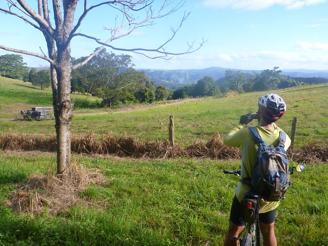
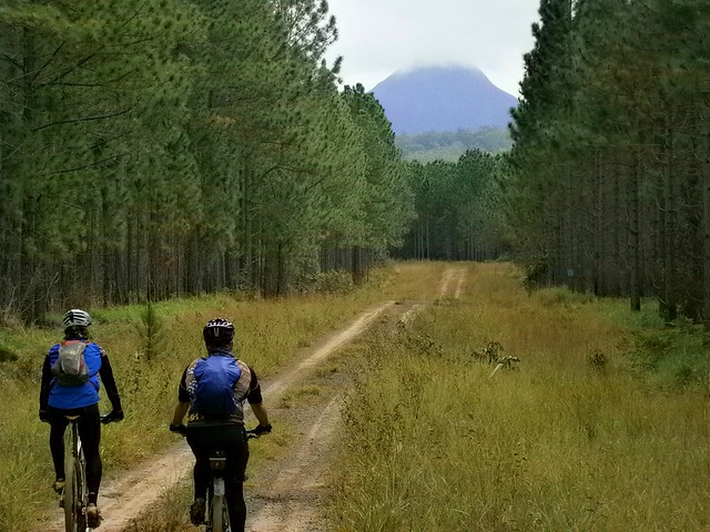
Mount Mellum is a scenic spot up in the hills between Maleny and Landsborough. We rode there today from Beerburrum on our way up to Mooloolah. The aim of the exercise was to find an alternative route from the Glasshouse Mountains to Mooloolah via Peachester so we can eventually organize another Cross Country Group Ride out that way in a few months.
Craig lives in the area, and knows it well because he spends many hours mountain biking through it each week. I met Craig a couple of weeks ago while riding at the Glasshouse Mountains. One of the great things about this sport is the lovely people you meet on the trail.
He kindly offered to show Tony and me around his “back yard”.
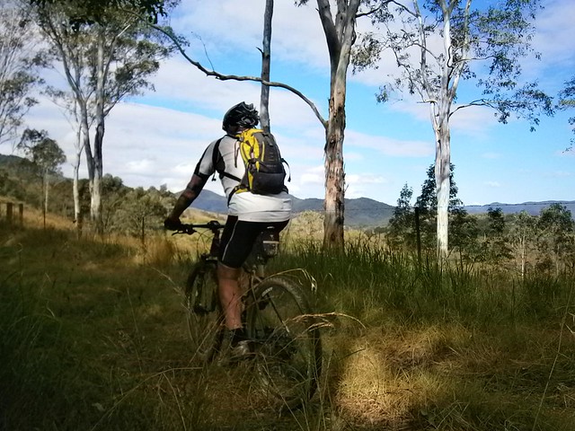
We started the ride with a climb up to the saddle between the twin peaks of Tunbubudla. This was quite rocky and steep in parts so we had to walk some sections.
Once we got to the “saddle” between the twin peaks, we have a rest. Since the twin peaks look like a pair of breasts from the distance, we surmised you could call this geological formation a “cleavage” instead of a saddle
From there we headed north towards the lookout and then to Beerwah. Although the rain threatened to come most of the day, it stayed dry. But the clouds looked fascinating as they shrouded the peak of Mt Beerwah.
At the lookout we met up with Craig’s friend, Gordon, who rode with us to Mooloolah. Gordon had a wonderful quote. He likens mountain biking to “Bushwalking on Wheels” because you get to explore the great outdoors – you just get to cover greater distances than when you walk.
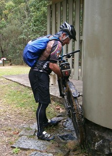
We rode around the northern face of Mt Beerwah. This was a really fun undulating track. The only downside was that the recent rain made the mud and sand stick to the bikes. When we discovered a water tap at the picnic grounds we made sure we used it to wash it all off.
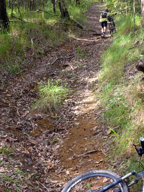
Out the back of Peachester we followed Macdonalds Road. It’s quite steep in places and eventually devolves into a road reserve covered in overgrowth. We found a fun but tricky technical descent down the track, followed by a tough climb up to Mount Mellum.
After enjoying the views at Mount Mellum, we followed Old Landsborough Road down into Dullarcha National Park. This finished in a fun 2 km descent down to the Dullarcha Rail Trail.
From there we followed the bike paths back to Beerburrum.
Some of the views on this ride were amazing. Thank you Craig! We couldn’t have done it without your guidance.
Just over 60km, with almost 1,100m of ascent, and just over 3,100 kcal of energy. This one rates 8 out of 10 on the tough-o-meter.