Please note: you can find a more up to date version of this blog at http://blog.neilennis.com

Saturday, March 31, 2012

Mount O’Reilly

Read More

Harland Road

Mount O’Reilly is a forest covered mountain west of Samford, east of Mount Glorious, and sandwiched between Cedar Creek to the north, and the South Pine River to the south.


Our aim today was to ride to the top along Harland Road, and then follow a steep fire trail southward under some powerlines to the main road, 500 metres below.


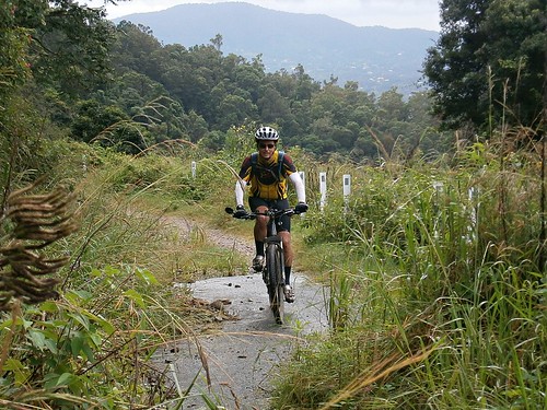
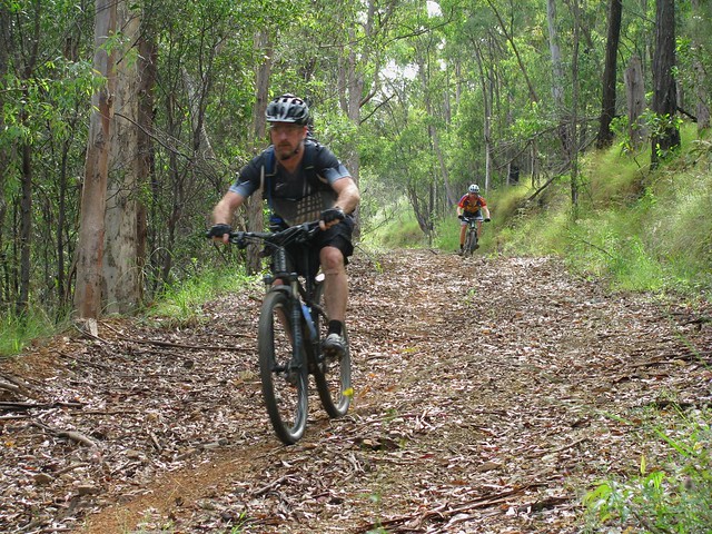
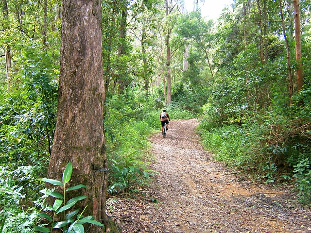
To get there, Simon and I took “the scenic route” from Lawnton to Bunyaville, then over the Samford Range to Ironbark, along the Lanita rail trail, through the back blocks of Samford Valley, up the Goat Track to Mount Nebo, and then up to Mount Glorious.

Harland Road

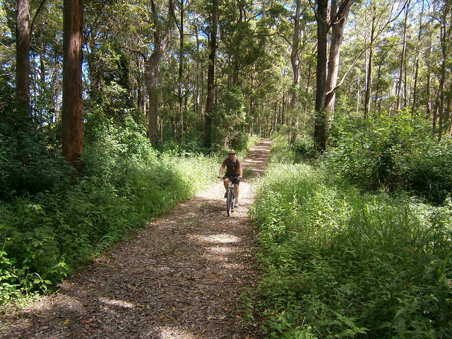
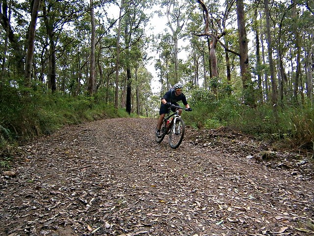
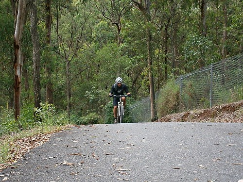
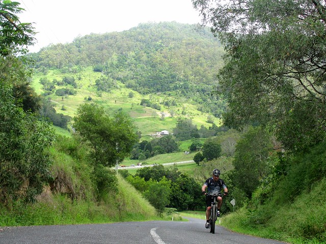
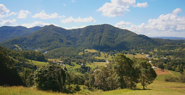
At Mount Glorious, we turned down Harland Road which meanders through some spectacular forests before devolving into a dirt track which goes over the summit of Mount O’Reilly.

Mount O'Reilly Fire Trail

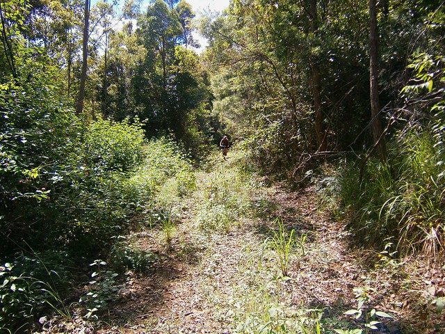
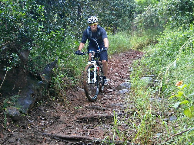
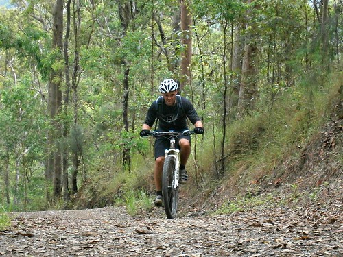
Once at the summit, we turned south to follow an overgrown fire trail southwards. I found the traces of a track on Google Earth and thought it would be worth a try. The only problem is that Google Earth didn’t show you how rocky or overgrown it was.

Land Slip

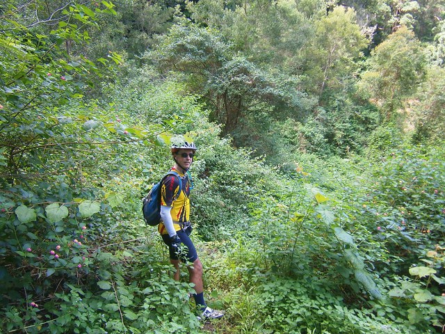
But the thing that stopped us dead in our tracks was a land slide halfway down the mountain. The road follows the side of the mountain in some places, and in one spot, the side of the mountain had fallen away. There was a gulf over a hundred metres wide, which was too deep and dangerous for us to cross. There was no way around it, no way through it. So we had to turn around and head back up to the top of the mountain again.


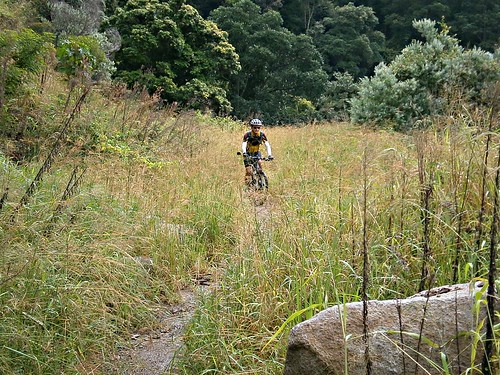
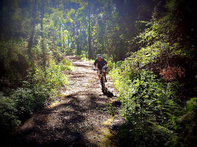
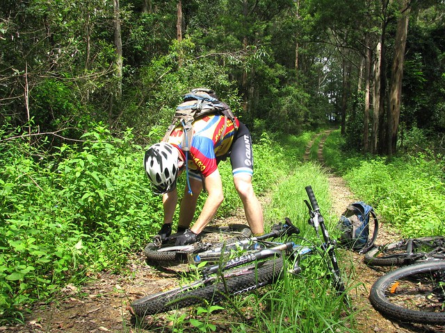
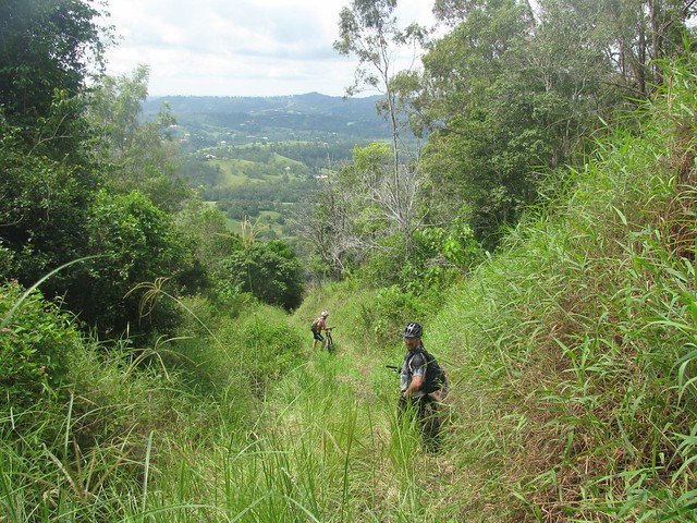
Once at the top, the alternatives were to grind our way back up Harland Road to Mount Glorious (a tough climb), or to scramble down the northern side of Mount O’Reilly to Cedar Creek following a trail that Darb, Graham and I took a few of weeks ago.


Lake Samsonvale

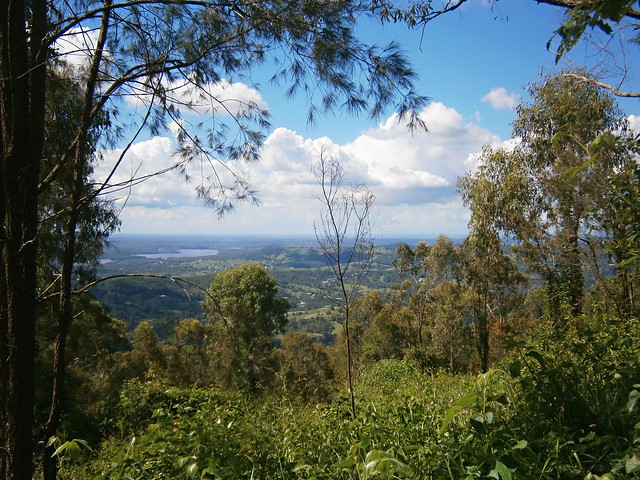
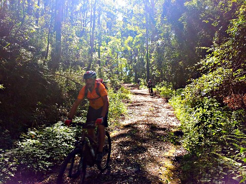
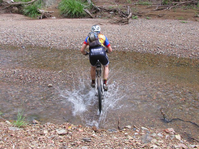
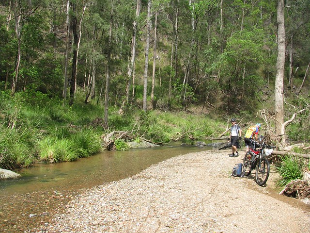
Simon and I decided to try our chances scrambling down to Cedar Creek. It was as thick and as overgrown as last time, and the views were just as spectacular.


Mount Lawson

We eventually made it down to Cedar Creek and slowly made our way home to Lawnton via Winn Rd.


All up the trip was just under 90km and took 7 hours. I took it slower than usual so Simon could enjoy the ride a bit better. With over 5,300kcal of energy burnred, and 1,730 meters of vertical ascent, it was still a challenging ride. I’m giving it 8.5 out of 10 on the tough-o-meter.


Sunday, March 18, 2012

The Long Way Round

Read More

The recent wet weather has made some of the local tracks difficult to ride, so I decided to try a route which would work well even after heavy rain. The result was this very large (> 120km) loop of the North of Brisbane.


Incidentally, if you’re a Mountain Biker new to Brisbane – this is one way to see a bit of everything: Rainforest, Bush, Mountains, City Centre, Mangroves… all in one day.


I started from Lawnton, and met up with Paul at Bunyaville, where we headed west to Ironbark and the Pony Trails in Samford Valley.

Samford Pony Trails


Some of the pony trails around Samford are rocky and steep. The recent rain has made them muddy too – which just adds to the fun.


We followed the pony trails to the bottom of “The Goat Track”.


Goat TrackGoat Track


Nature continues to reclaim the Goat Track. A trafficable road with cars and trucks going up and down it 15 months ago, it’s now overgrown with land slips and drops off the edge – a perfect mountain biking trail. It offers some great views of Moreton Bay to the east, and is still the easiest and safeest way up to Mount Nebo if you keep your wits about you.


If you ride DOWN it, I’d suggest you take it easy, especially near some of the land slips.


At Mount Nebo we topped up on snacks and drinks, and made our way to the trail head for South Boundary Road.


South Boundary Road


South Boundary Road is a dirt fire trail that runs from Mount Nebo to The Gap. The landscape varies as it undulates from one end to the other. East to West is a tough climb, but heading the opposite way down to The Gap offers some really fun fast descents.


Either way you need to be prepared to do some climbing.


This time we passed dozens of walkers training for the 100km Oxfam Trail walk. (A 100km walk? Those guys are crazier than me). If any of you walkers are reading this, thanks so much for thoughtfully moving to the side of the trail as we came hooting down it on our bikes. We really appreciate it!


At the end of South Boundary Road we skirted the northern part of Gap Creek and started the climb up the side of Mount Coot-tha.

Highwood RoadHighwood Road

While many road cyclists grimace at the thought of taking the “easy” bitumen route up Mt Coot-tha, Mountain Bikers do it the hard way – up the side of the mountain. Highwood Road starts with a short climb up a 20% bitumen gradient, followed 1,110 metres of pain up a steep dirt fire trail with a dozen water bars thrown in to make the climb even harder.


Paul and I nailed the hill yesterday – the first time for me.


Once we reached the top, we then followed the “Powerful Owl” trail behind Channel Nine, which undulates for a while before steeply descending to Silky Oak Picnic Area. A few friends had warned me to beware of the steep drop at the end which consisted of 100 metres of a controlled skid to the bottom over rocks and ruts. Thankfully, the DERM graders had been through recently. The path was smoother and safer than before, and the ride down was much easier than I had anticipated.


From here, we followed bike paths through Toowong into the centre of Brisbane, out through the Roma Street Parklands and finally joining the Kedron Brook Cycleway which we followed to Toombul, Nudgee and Deagon, before finally heading west through Bracken Ridge and Bald Hills home again.


I really should pay tribute to Paul. By the time we got to the Kedron Brook Cycleway, the climbing and distance had started to affect both of us. Paul was hurting but didn’t want to spoil the ride by finishing early. So he persevered, despite the fact that the last 40km were in the rain.


We were soaked and exhausted by the time we got back to Lawnton.


All up, 124km with almost 1,900m of vertical ascent, and over 6,500 kcal of energy.


I drank a lot of sports drinks, a few cakes, a few bottles of Orange Juice and lots of water.


I rate this one 10 out of 10 on the tough-o-meter because of:

1. The distance. We were on the road for 10 and a half hours which is a logistical issue if you need to be back home before dark.

2. The climb up Highwood Road. AFter toughing it out on the hills of South Bondary Road, that last little climb is NASTY.

3. The rain at the end. A little bit of rain is nice. It keeps you cool. A lot of rain is uncomfortable.


Saturday, March 17, 2012

Walloon Revisted – The Movie

Read More

My friend and riding buddy, Tony, took a great video of our ride to Walloon last week. Enjoy :)


Sunday, March 11, 2012

Walloon Revisited

Read More

Dundas Road

I’ve ridden to Walloon a few times in the last year, and had been planning a return visit for the last couple of months. The only problem is that we’ve had heavy rain which made some of the tracks difficult to ride.


Thankfully, we’ve had a lot of sun over the last few days, so the tracks had a chance to dry out. The only fly in the ointment was that my camera got water damaged when I fell in the creek last week, so I only had my mobile phone to take photos. Darb got some video, so I’ll add that when it becomes available.


Aaron and I started from my place in Lawnton, meeting Darb at Leitches Crossing (still flooded). We then made our way to Bunyaville to meet Neil B. From there we made our way to Ironbark Gully, and on to the Lanita Road Rail Trail.


We then followed the pony trails through the back of Samford to the Goat Track. This road has slowly deteriorated since it was closed over a year ago from heavy rain. It’s very rutted, with several nasty looking holes close to a sheer drop near the edge of the road. It’s a fun road to ride up, and is still the easiest way to get up the D’Aguilar Range to Mount Nebo, but since it’s no longer being maintained by the council, and since bits of it keep falling off, it’s getting more dangerous.


Dundas Road

Once we reached Mount Nebo, we then headed down Dundas Road. This enjoyable trail starts behind the Mt Nebo Rubbish Dump and heads a couple of kilometres westward and downhill to a water tank and camping ground. I stopped to take a few photos, only to discover my camera wasn’t working, so I had to quickly get my mobile phone out to get these photos. You can’t see it in the picture, but the guys were going pretty fast down this hill, and whizzed by me with only a couple of inches to spare.


After the camping ground, the road gets considerably steeper, turning into “Whoa Boy” break. Originally I thought it was called this because when you get to the top and look down, you say to yourself “Whoa Boy”. But actually, it’s named after all the water bars on the track. A water bar is a hump of dirt that crosses a steep track. The hump stops rain water from eroding the track. It also makes the track a lot of fun to ride down – more daring riders use the humps as a jump, and launch into the air. It also makes the track a lot more diabolical to ride up – it’s hard work riding up a steep hill anyway, but then having to ride up the back of an extra steep hump makes it even more difficult.


Another name for a water bar is a “Whoa Boy” which is what the old drovers used to call them because they’d slow their horses down as the cart went over the hump, often saying to the horse “Whoa Boy”.


Mountain Bikers don’t say that. They usually just give a “Whoop” and fly over the hump.


But…. this hill is so steep, and so long, and I used my brakes so much that they over heated. And suddenly they were gone. I pulled the brake lever, and nothing happened. Worse than that, the lever just squeezed right into the handlebars. It’s a horrible feeling. I’m very fortunate that this happened near the bottom of the descent, and that I still had my front brakes. After stopping the bike for a few minutes the brakes came back, and we were able to continue the journey.


Once we got down the other side of the D’Aguilar Range we headed west along Banks Creek Road. The road crosses Banks Creek several times, and there was enough water flowing at the crossings for us to get our feet wet. But the major surprise was Savages Crossing. This is where we had to cross the Brisbane River. But the river was swollen after recent rain, and had covered the causeway by about 30cm (knee height). A couple of the guys rode across the 50 metre causeway. I’m sure it was safe, but I didn’t want to risk damaging the bike, so I waded across, carrying the bike.


From there we stopped at the Fernvale Bakery for lunch, and followed the Brisbane Valley Railtrail and soem quiet gravel roads southwards to Walloon.


One of Walloons major assets is its wonderful pub, where we stopped for a few beers, before hopping on the train and heading home.


All up we rode about 85km. I burned about 4,500kcal in just under 6 hours of riding (excluding breaks). I’ll give this one 8.5 out of 10 on the tough-o-meter. The weather was perfect – perhaps a little warm, and the major descent required a lot of concentration. I’d also recommend this as a winter ride when the weather is drier, and the creeks / rivers are lower.


Saturday, March 03, 2012

What If?

Read More

Two years ago I asked a few friends if they knew of any way to ride a bike from Cedar Creek (a few kilometres north of Samford) up to Mount Glorious. At the time, no one had any clear ideas about how to do it. But today we found a challenging way to go the other way, riding down to Cedar Creek from Mount Glorious.


Tony, Graham and I started the day from Samford, heading west to the D’Aguilar Range via some local Pony Trails. We made our way up the hill to the Dundas Road water tank and campsite before taking a long descent down Goodes Road.

Goodes Road

Goodes Road descends almost 500 metres in 4.5km. That’s a long way down in a fairly short distance. It’s a lot of fun to ride down, provided you keep your wits about you. It’s very hard work to ride up.

Splash!

After the long descent we eventually we reached England Creek. This beautiful clear creek meanders westward through the National Park eventually draining into the Brisbane River near Fernvale. Today it was full of beautiful fresh water. Tony and Graham rode through it effortlessly. I however, stalled midway through, fell off and got totally saturated.

England Creek

Since England Creek marks the bottom of the descent, and the start of the long climb out, we decided to take a quick break.

Repairs

Graham broke his chain while riding up Joyners Ridge Road, and didn’t have a spare link or chain breaker with him. Luckily I did, so he was able to get back on his way fairly quickly. The only problem was that leeches found us while we stopped in the damp undergrowth, so we all had to pick off a few of the horrible little creatures before setting off again.

Rainforest

The climb up Joyners Ridge Road from England Creek is about 10km in length. But during that time we had to make a total ascent a total of 835 meters. So by the time we got to the top we were quite hot. So the cool rain-forest at the top of the climb was a delight to ride through.


After a quick break at Mount Glorious, we headed east along Harland Road, past an old saw mill near the summit of Mount O’Reilly to look for a way down the mountain. Harland Road is beautiful to ride along. It slowly gets narrower and more overgrown until it eventually disappears completely.


At this point we just steered the bikes down the hill along what appeared to be a ridge-line until we could no longer ride, and had to walk the bikes, scrambling down some very steep hill sides.


My predefined route was useless at this point. It went off over the side of the hill through terrain that we would never have been able to negotiate.

Are you sure this is the right way?

Eventually Graham found a rough 4wd track. Rocky, and overgrown, it was still too rough to ride, but it slowly improved until we were able to finish riding down the hill.

Mount O'Reilly

Eventually we made it down to Morrison Road at Cedar Creek. Looking back over my shoulder, I thought “did we actually ride down that?”


Well – we probably walked about 600m of it, but we did ride the rest.


Thanks so much, Tony and Graham, for helping me to answer my “what-if” question today :)


All up, 55km, 4,300kcal and 1,600m of vertical ascent. This one rates a definite 10 out of 10 on the tough-o-meter. Just doing the Goat Track, Dundas Rd, Goodes Rd and Joyners Ridge Rd is difficult. But adding Harland Rd into the mix, and scrambling through some thick undergrowth to get down a steep hill side made it insane (but fun).


Only try the Harland Road part of this ride if you’re willing and able to scramble down some very steep, overgrown, rocky hill sides carrying your bike. Don’t try it solo – it’s too dangerous to do alone.