Please note: you can find a more up to date version of this blog at http://blog.neilennis.com

Wednesday, November 30, 2011

Joyners Ridge

Read More

Westridge Outlook

A few months ago I rode a loop down Joyners Ridge Road at Mt Glorious which included a tough climb up Goodes Road. Last time I had to walk up some of the steep bits, but this time I gave it all my effort, and conquered the hill :) I think the weekly sessions smashing hills at Clear Mountain must be paying off!


I started at the bottom of “The Goat Track” and slowly climbed up to Westridge Outlook for a quick rest and some great views westward to Wivenhoe Dam and the Great Dividing Range.

Joyners Ridge Road

The road then went higher up to Mount Glorious before the long descent down Joyners Ridge Road, through the rainforest, all the way down to England Creek at the bottom.


Joyners Ridge Road is wonderful to ride down. The rainforest at the top gives way to open forest with great views over the mountains.

Goanna

You see quite a few of this fat goannas in D’Aguilar National Park.

England Creek

England Creek marks the bottom of the 9km descent. It’s a good place to have a break because from this point, it’s a 4.5km, steep, slow climb up to Dundas Road, gaining 450m.

Dundas Road

All up, about 35km with about 1,250m of vertical ascent and 3,300kcal burned. I’m giving it 8 out of 10 on the tough-o-meter.


Sunday, November 27, 2011

Spicers Gap

Read More

Governors Chair Lookout, Spicers Gap

Spicers Gap was used for thousands of years by indeigenous Australians as a pathway over the Great Dividing Range from the inland to the coast. It was named by Alan Cunningham in 1828, but it wasn’t until 1847 that European Settlers became aware of the route, when stockman Henry Alphen discovered it was a much easier way of moving his stock over the range than the treacherous Cunninghams Gap 7km to the north. It then became a popular route for bullock drays moving bales of wool, 6 tons at a time to the Moreton Bay settlement.


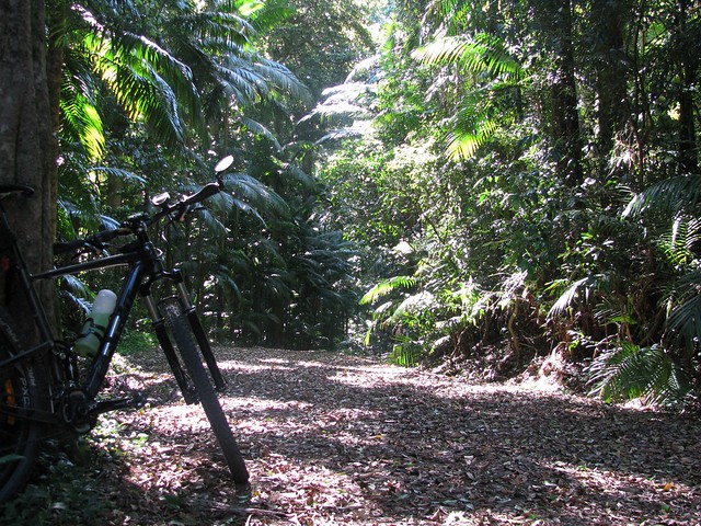
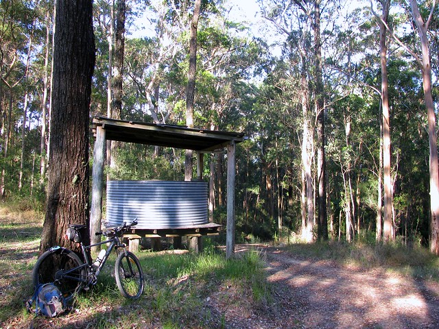
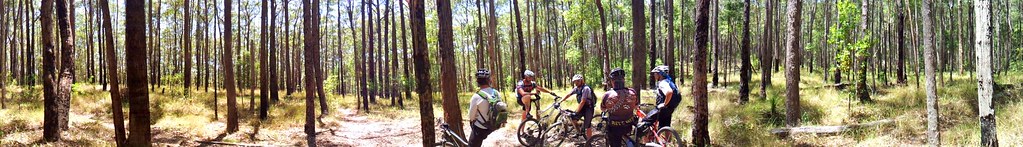
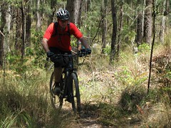
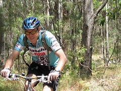
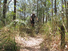
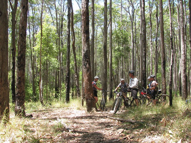
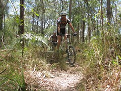
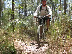
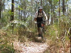
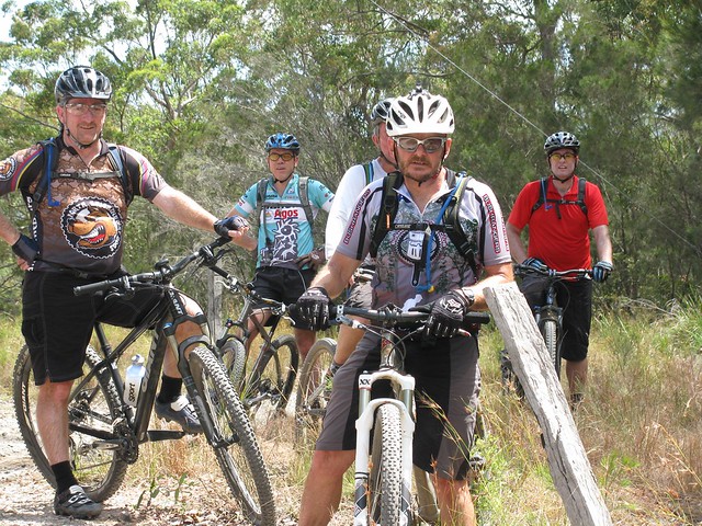
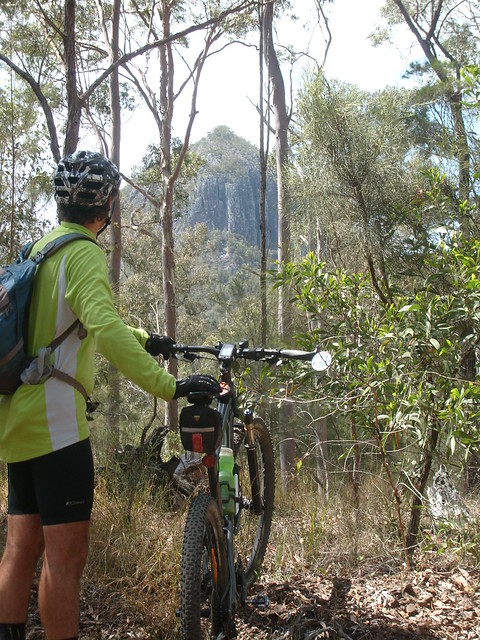
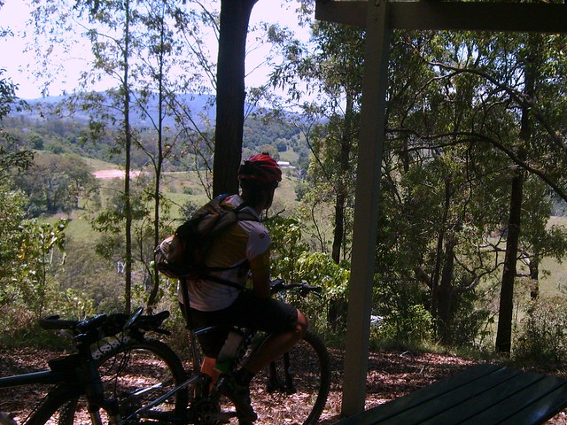
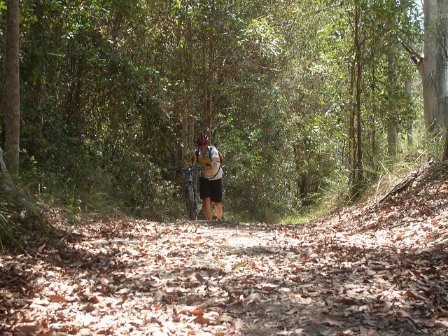
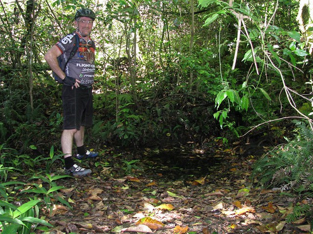
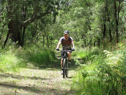
Today Darb and I decided we’d see how much “Bullock Power” we had in the tank and road our mountain bikes up and over Spicers Gap.

The Long Climb Up

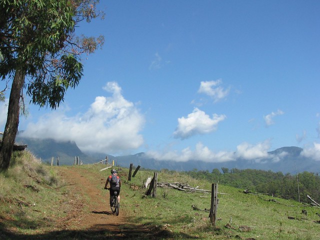
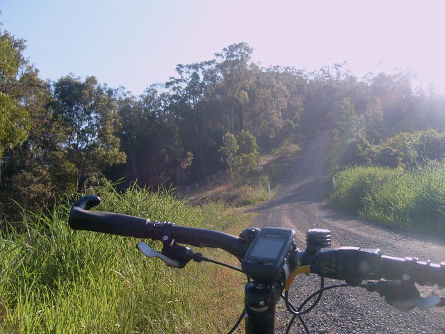
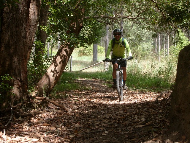
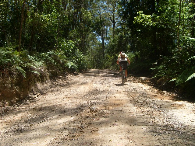
The road up is steep, and rough in places, rising about 600 metres in about 6km. Darb and I just put the bikes in “Granny Gear” and took our time riding up. Late November days in this part of the world are hot and humid, so we though the smart thing was to take a nice steady pace.

Moss's Well

Just before we got to the lookout at the top, we stopped at Moss’s Well. From a distance it looks just like a puddle, but this freshwater mountain spring produces clean fresh water. It was named after Edward Moss, a contractor who was supposed to fix the boggy roads by laying logs across them. He never finished this “Corduroy Road”, but he was credited with finding this spring.

Governors Chair Lookout, Spicers Gap

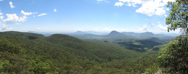
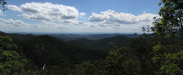
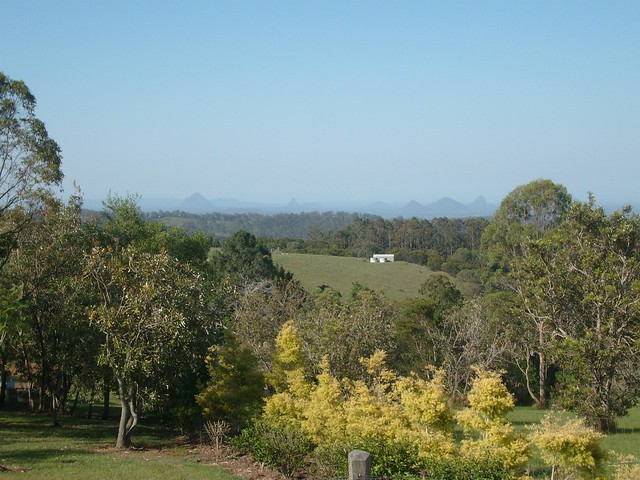
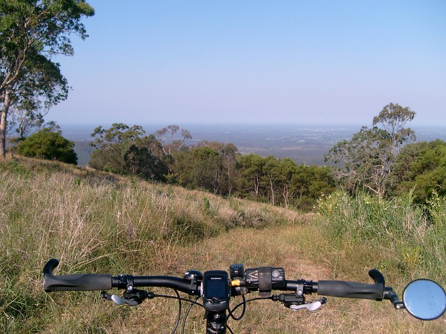
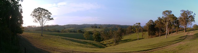
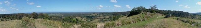
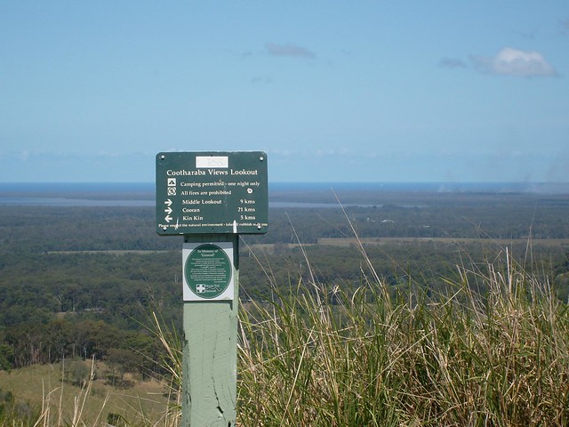
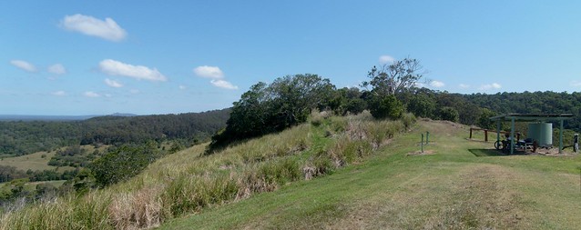
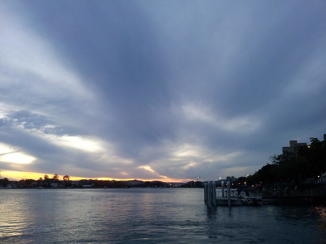
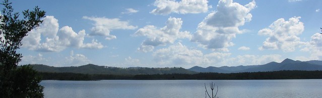
The panoramic view at the top from “Governors Chair” lookout is magnificent.

Enjoying the viewMount Maroon

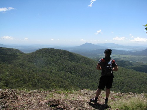
It’s called “Governors Chair” because several notable people including Governors Fitzroy and Bowen came here and sat on the rock to enjoy the view. You can see for miles.

Old Logging RoadOld Jinker

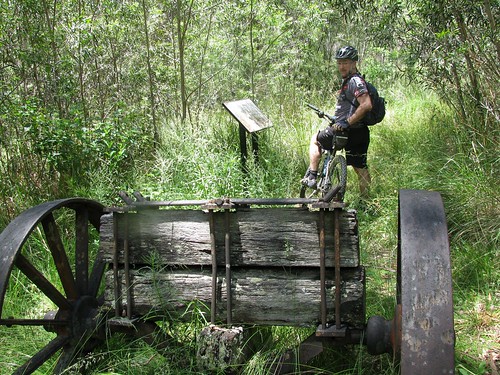
The road at the top has been preserved to show some of the different methods used in nineteenth century road construction. There’s also an old Jinker up here. Darb wondered whether a man on a bike had as much power as a bullock. Needless to say the Jinker stayed put, so the Bullocks won this round :)

Millar Vale Creek

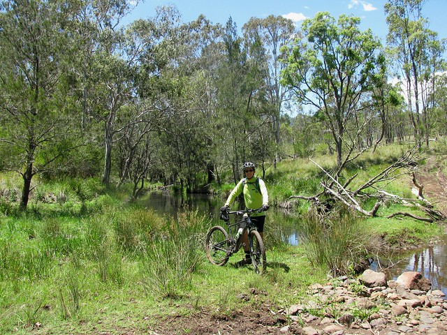
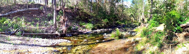
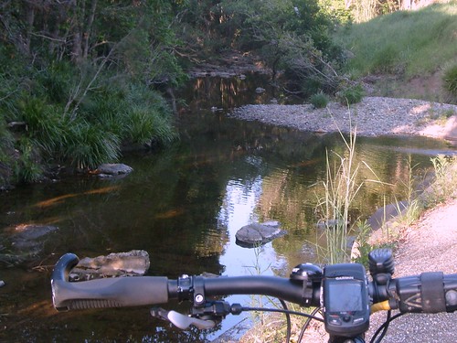
At the mid-point of the journey, just before we met the western section of the Cunningham Highway on the other side of the Great Dividing Range, we crossed Millar Vale Creek. It might look like a typical counhtry creek, but if you look on a map, Millar Vale Creek eventually flows into the Condamine River, which eventually flows into the Balonne River, which…. eventually flows into the Murray River, and into the Southern Ocean over 3,000km away. So if you spit into Millar Vale Creek, it goes a heck of a long way!


All up 35km in about 4 hours with 1,250m of vertical ascent, and 3,200 kcal burned. Because of the summer humidity, boggy blacksoil, and flies (myriads of them) I’m giving this one 8.5 out of 10 on the Tough-o-meter. If you do it in winter when it’s cool, dry and the flies aren’t around, it would probably rate as 7.5 to 8 for toughness. So if you want an easier day, do it in Winter :)


Thanks for a great ride, Darb. And thanks, once again, to Gillian and Mark for giving us this idea in the first place via your wonderful book “Where to Mountain Bike in South East Queensland


Saturday, November 19, 2011

Parklands

Read More


Parklands State Forest is near Nambour on Queensland’s Sunshine Coast. It attracts hundreds of mountain bikers every week. The steep, snaking, rocky trails are beautiful but tough, and a good way to help you figure out how good you really are at riding a mountain bike.


I fell off twice, and Tony fell off once. Thankfully neither of us were hurt. I think it was a combination of the technical tracks, and the tiredness we were feeling towards the end of the ride.


The ride today was a tad over 17km, but it took us over 2 hours of hard riding. Many of the tracks had tree-roots over them which were tricky to ride over. There were quite a few logs too – but they were put there intentionally to make the track more fun, and were reasonably easy to roll over.


AdrianDonAllan

Many thanks to Adrian, Don and Allan from the Bushrangers Mountain Bike Club for showing us around their “patch” today.


A break in the bush

My favourite place was “The Meadows” – a grassy flattish section in the middle of the park with tracks going off in every direction like strands of spaghetti. I think if you weren’t familiar with Parklands it would be really easy to get lost. So if you’re thinking of visiting, try going with a local (or download my track log below into your GPS :) ).

PeteEricAaron

Thanks to Pete, Eric, Aaron and Tony – mates from MTBDirt who drove up with me to Parklands so we could try out these amazing trails.

Taking a Break

Just over 17km, with about 550m of ascent, and about 1,800 kcal burned. You need at least moderate skills to get around these tracks, and good fitness to get up the hills. I’m giving it 9 out of 10 on the Tough-o-meter. Thankfully the tracks were dry. After a lot of rain, I think it would be even harder.


One final thought – when we arrived at the track at about 8:30am, the guys from the Bushrangers Club had already ridden about 16km. They then rode with us. In fact Allan rode the entire 17km with us. We felt pretty tired after the ride, so I think Allan put in an amazing effort – especially considering he was riding a single-speed bike – no gears to help him up the hills, just raw man power. Good on ya, Allan!


Tuesday, November 15, 2011

Ocean View

Read More

Ocean View is a quiet place high up in the hills near Mount Mee. I thought I’d go for a ride there this afternoon, and try my luck at some steep descents and one horribly steep climb.

Glasshouse Mountains from Ocean View

Some of the homes around here have amazing views over the forest and farmland towards the coast.

Dean Drive, Ocean View

I followed one of the roads looking for this track that just disappears over the edge of the mountain and heads steeply down to Rocksberg below.

Thornhill Chase, Rocksberg

Thornhill Chase – the steep road down to Rocksberg was an intense ride. I skidded most of the way down this 2km road and had to walk the final bit to make sure I didn’t skid into the gate at the bottom of the hill.

Five Pound Crossing

Rocksberg was originally settled by the Zillman family in the mid to late 19th century. It’s the source of the Caboolture River which crosses the road at places with fascinating names like “Cockies Crossing”, “Ten Bob Crossing”, “Zillmans Crossing” and this one, “Five Pound Crossing”. The old photo is from the State Library of Queensland and shows some of the Zillman family playing in the water at “Five Pound Crossing”. Incidentally, “Ten Bob Crossing” – just a few hundred metres down the road, is still a great place to swim on a hot day.

Ocean View Paddock

Unfortunatley, what goes down must eventually come back up, and I had to start the long climb up Mountain View Road. This gravel road is a challenging climb. I rode all of it except for 150 metres which were in the middle of a bush fire (that was my excuse) and also happened to be a bit too steep even for a hill-o-phile like me. This view at the top is a panorama stitched together from several photos overlooking some pleasant farmland on the edge of the hill.

Sunset. Townsend Road, Ocean View

I made it back to Townsend Road just as the sun was going down over the D’Aguilar Ranges. As I saw it, I said out loud “Now THAT’s bloody beautiful”, and then happened to notice an old bloke at his letterbox looking at me. I think he agreed with me, so I didn’t feel too embarrassed.


All up about 24km with 750 metres of vertical climbing and 1,530kcal burned. I’m going to give this one 10 out of 10 on the tough-o-meter. The descent was precarious, I was by myself, and it took all my concentration to stay on the bike. The climb was the toughest I’ve done – 4km with some sections having a gradient well in excess of 30% (according to my Garmin track log). It was pretty hot (over 30C) and smokey from bushfires, so in my judgement this short ride really pushes the envelope.


If you can ride Mountainview Road from the bottom (Moorina Rd Intersection) to top (Oceanview Rd Intersection), please let me know. I live in hope that this monster of a hill can be beaten!


Sunday, November 13, 2011

Noosa Trails Network

Read More

Cootharaba Lookout

Gillian Duncan and Mark Roberts gave an excellent description of the Noosa Trail Network in the latest edition of their book “Where to Mountain Bike in South East Queensland”.  I thought I’d take a couple of friends and explore those trails today.  This is the location of the Noosa Enduro – a tough 100km race held every winter along these trails.  After riding them, I now have a new appreciation for the hardent competitors that take on this rugged part of the world.


Mount Cooroora

We started at the Sunshine Coast Hinterland town of Pomona and headed west through Tuchekoi National Park towards Cooran. The track took us around Mount Cooroora – a 438 metre high monolith at the centre of the national park.

Cooran Trail

Near Cooran the trail passes through privately owned farmland. This means there are a multitude of gates to open and shut. I think we counted at least 20 on our ride. But the trails through the farmland are pleasant, flowing, leaf-littered shady tracks – a joy to ride on a hot day.

Slow Climb

From Cooran we headed north into Woondum National Park along Tablelands Road. We climbed over 400m in an hour along this road to our high-point in the National Park. It’s a slow climb through lush rainforest, but considering the steepness of the down-hill on the northern side of the park, this is the only way to ride it. There’s no way you could ride up from the north. Many thanks to Paul for giving me this advice before we left!

Johnstons Lookout

Although it took us an hour to climb 400m, it only took us seven minutes to descend the steep, narrow track through the rainforest on the northen end of Woondum National Park. I’m so glad I had full suspension on my bike – I travelled pretty quickly down some of those rocky sections and the shock absorbers were working overtime. After the descent we had a short break in the shade at Johnstons Lookout which overlooks some of the farmland to the north-west of the small hamlet of Kin Kin.

Yet another climb

The Noosa Trail Network has a lot of hill climbs like this one along Simpsons Road, east of Kin Kin.


The tough climb up to Cootharaba View Lookout is worth it for the panoramic views. You can see for miles in almost any direction.

Picnic Shelter - Cootharaba Lookout

The picnic shelter at the Cootharaba Lookout is a welcome rest-stop after the preceding climb.


This ride was just over 60km, but it took us almost 8 hours including breaks. That should give you an idea of the slow-going and tough climbs. I had one puncture along the way because of some of the sharp rocks, but thankfully the “Stans No-Tubes” sealant in my tyres sealed up the hole quickly, so all I had to do was pump up the tyre again and keep going. If you’re going to try this course, don’t expect to average more than 10km/h, which means you’ll need plenty of water. You can re-fill at Cooran and Kin Kin. There are a lot of rocks in places, so make sure you’re prepared for punctures. And the steep climbs mean you’re going to need plenty of high-energy snacks.


I burned up about 4,300 kcal, and all-up we climbed a total of about 1,550 vertical metres. On the tough-o-metre this one scores 9 out of 10.


Monday, November 07, 2011

We Love Brisbane

Read More

Liz and I took the kids into the city on Sunday for a ride on the City Cat, a stroll around South Bank, and a wander through GOMA. I’ve lived in this wonderful city most of my life, and I think I take it for granted, because I was quite surprised how beautiful it is.

Klezmer Band

As usual, South Bank was abuzz with lots of activity. This Klezmer band got my toes tapping.

Victoria BridgeBrisbane

We enjoyed the walk along the riverside, watching the sun bouncing off the buildings. I was really surprised to see a vegetable garden down this end of South Bank. Rather than flowers, someone has planted Cauliflower, Fennel, Coriander and a myriad of other edible plants. It’s great to see.

Brisbane from the City Cat

At the end of the day, we hopped back on the City Cat and rode back to Bretts Wharf at Hamilton.

Brisbane from the City CatWindy

Harrison decided he preferred to stand up the front and let the wind blow him around.

Brisbane from the City Cat

A great day. We made it up as we went along, and as luck would have it, everything turned out really well!


Wednesday, November 02, 2011

Eagles

Read More

Sea Eagle - Lake Samsonvale

I took Liz’s Canon Powershot camera on my bike ride today in the hope I might spot some wildlife near the dam. As though responding to some cue, these eagles started soaring overhead while I rolled along underneath with my eyes pointing upwards when I should have been watching the track.


Luckily I didn’t hit in obstacles :)

Sea Eagle - Lake Samsonvale

Sea Eagle - Lake Samsonvale

These two photos were a bit of a fluke. I hoped the eagles would drift between me and the moon so I could get both in the shot. By some great stroke of luck, that’s exactly what happened.

Sea Eagle - Lake Samsonvale

They were effortless – hardly any flapping, just slowly circling overhead. They seemed to be enjoying their flight as much as I was enjoying my ride.

Wallaby - Lake Samsonvale

And to top the afternoon off, this shy wallaby stopped long enough for me to get a photo. I kept the tree between me and him, so he couldn’t see me, got the camera ready, stepped sidways into view, and took the shot before he bounded off into the undergrowth.

Clear Mountain and Mount Samson

It’s always a nice ride up by the lake.