Please note: you can find a more up to date version of this blog at http://blog.neilennis.com

Sunday, July 29, 2012

Somerset Track

Read More

Somerset Lookout, Mount Mee

Here’s some photos of a recent hike along the Somerset Track, Mount Mee, that I did with my friend and business partner, Mark.

KookaburraWildflower, Somerset Track

Somerset TrackScribbly Gum

The 5km walk to the lookout covers a variety of terrain including rainforests, hoop pine plantations and open eucalyptus forests.

Somerset Lookout

Somerset Lookout, Mount MeeSomerset Lookout, Mount Mee

The views west from the lookout are spectacular, and well worth the hike out.

Somerset Lookout, Mount Mee

It’s an ideal spot to sit on the rock and have a bite to eat before walking back.

Somerset Track

We crossed a few creeks on the return leg. Some of them were crystal clear.


Sellin Road, Mount Mee

Brisbane CBDSellin Road, Mount Mee


On the drive home, we had a quick stop on Sellin Road to enjoy some amazing views of the Brisbane CBD off in the distance to the south-east.


13.1km in about 3 hours – this is a moderately difficult walk. Young teens would be able to handle it, but I would take younger kids.


Taylors Break

Read More

Branch Creek

I’ve ridden Taylors Break in D’Aguilar National Park a couple of times. My friend Rob kindly organized another ride here, so I jumped at the chance to check it out again.


PaulAaronRob

I met with Paul, Aaron and Rob at the bottom of the Goat Track, and we rode up to the start of this fun descent near the corner Hammermeister Road and Forestry Road at Mount Nebo.

Taylors Break

The track starts with a gentle gradient near Mount Nebo. A bulldozer has cleared it recently, so the ride near the top of the hill is quite pleasant.


The steepness increases as you get further down the mountain…

Taylors BreakTaylors Break

Towards the bottom, the gradient is very intense, and there are lots of loose rocks, so it’s advisable to walk it if you’re not 100% confident. Rob showed us how you can “get air” even when you’re walking the bike :)


Taylors Break

You can ride the descent if you keep your wits about you, and get your weight as far back on the bike as possible.


Branch Creek

Branch Creek

The prettiest part of the ride is Branch Creek at the bottom of the descent. The shaded pools would make a great swimming spot in summer – but today we were content to enjoy the view and take pictures.


We also decided to have a bit of a break because this point was the start of the long climb up Cabbage Tree Range Road – a one hour uphill ride which rises about 500 metres in 7km.


This ride was 27km long, and we completed it in about three and a half hours. We did about 1,200m of vertical ascent and I burned about 2,500 kcal. Despite the relatively short distance, it’s still a challenging and enjoyable ride. I’m rating 7.5 out of 10 on the tough-o-meter. We enjoyed it more because it was a cool day, we kept an easy pace, and stopped lots.


If you do this ride, take it easy at the bottom of Taylors Break. It’s very steep and loose. If you’re unsure of a section, play it safe and walk it.


Sunday, July 15, 2012

Family Fun

Read More

There actually is much more to my life than riding bikes :)


This weekend, our youngest daugher Lilly had a major role in her school play, “Yee ha”. In the wild west, something stinks, and it’s not the drains. In a hilarious take on the real world, the local mayor is in cahoots with a gang of criminals, and is trying to rip off the town to line his own pockets.


Yee Ha!Yee Ha!

Lilly played the part of “Big Chief Walking Weasel”. She calls her tribe “Google” because “They’re her search Injun’s” (Ba boom!)


Yee Ha!Yee Ha!

It was a fun play – we really enjoyed the color and the songs. But most of all, we were proud of our young star who performed magnificently.


The Bat CaveThe Bat Cave


So on the following day we thought we’d “chill out” and take a drive to Samford and relax. On the way we stopped at “The Bat Cave“. I’ve ridden there before on the bike, but I wanted to show it to Liz and the kids.

Yugar Railway TunnelThe Bat Cave


The tunnel was built in 1919 as part of the now defunct railway line between Samford and Dayboro. It was closed in the 1950′s when the line stopped being used, and was eventually recycled by the University of Queensland to be used by a colony of bats. Hence the name “Bat Cave”.


The Bat Cave

Today the disused railway line is used by horse riders, mountain bikers and hikers as a recreational trail.


Kids by the Lake

After a delicious snack at Samford we drove up to Samsonvale Cemetery. It’s on the shore of Lake Samsonvale. An entire town used to be here, but it disappeared under the lake when the North Pine Dam was built. Ironically, the “dead centre” of Samsonvale is all that remains of the town.


FishingWhistling Kite

It’s a beautiful spot to relax, cast in a fishing line, or watch the local Whistling Kites look for food.

The Angel of Samsonvale

It’s also a great place to read the grave stones, some of them heart breakingly tragic, and think about how short life is, and how wonderful it is to be alive, and to share it with such special people as our families.


Saturday, July 07, 2012

The “Super W”

Read More

My friends have named a tough ride in D’Aguilar National Park the “Super-V” because of the tough elevation profile you get when you ride it: A loooooong way down, then an equally long way up. I walked the “Super-V” just over a year ago with my son, Lachlan.


Today I thought I’d mix it up a bit and add an extra climb to make it a “Super-W” :)


Giant Fig

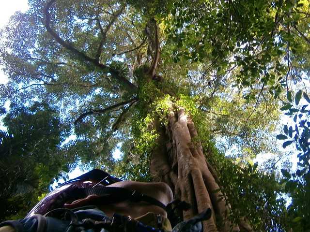
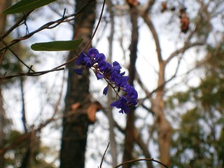
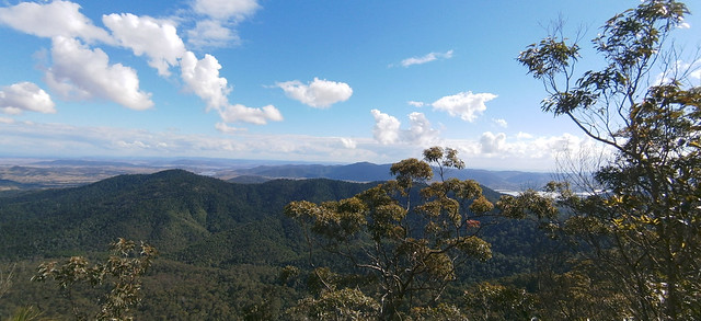
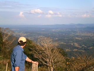
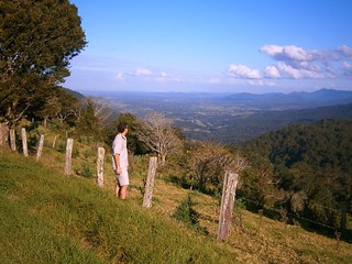
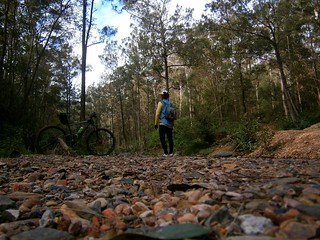
I started from the Goat Track and made my way up the bitumen to Mount Glorious, then set off down Lawton Road. This is a special place in the rainforest with Piccabean Palms and wonderful Giant Figs. I just had to stop and get a few pictures.


Dave and KellyNeil

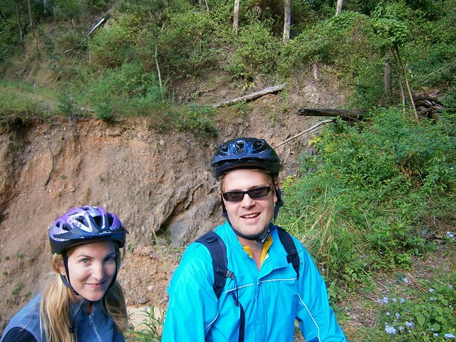
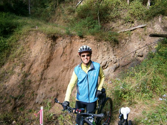
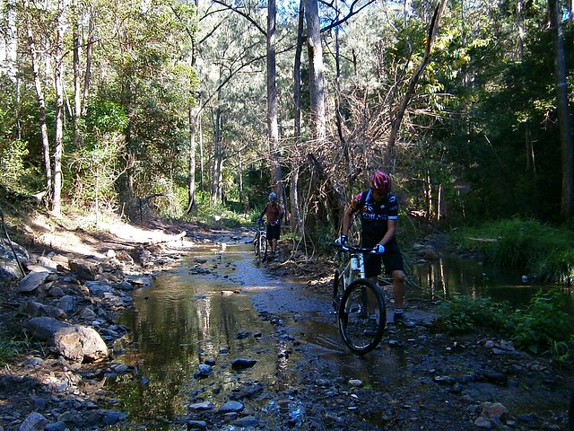
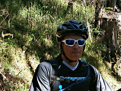
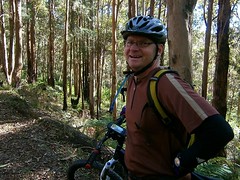
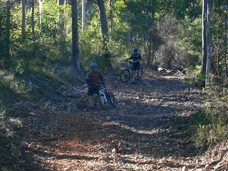
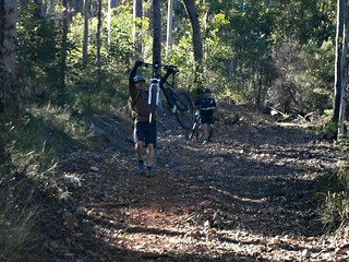
I enjoyed the roll down Lawton Road which is a fun steep descent near the top… until I met up with Kelly and Dave. They were riding their bikes back up the track because they were unable to get past one of the landslides: A huge gulf has opened on the road with nowhere to go above it, and nowhere below. All that remains is a 10cm wide precipice which is hard work to carry a bike over. I suggested that between the three of us we might be able to help each other get the bikes across and continue with the ride.


DaveKelly

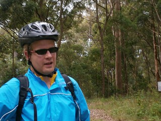
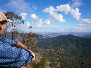
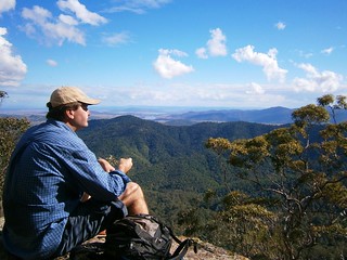
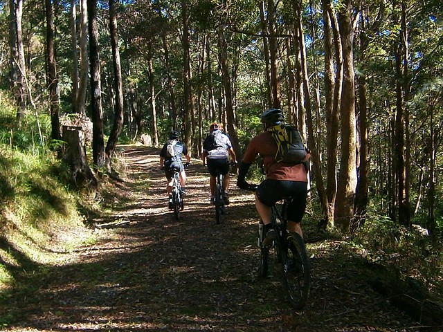
We rode together up the steep climb to Northbrook Mountain and then parted ways. They were headed down Kipper Creek Road towards Wivenhoe Dam. I was headed back towards England Creek. I love meeting new people on the trail :)


England Creek Road

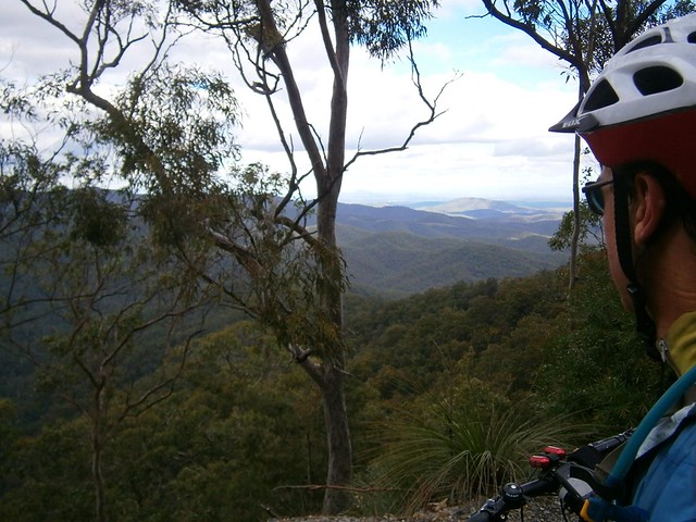
The ride down England Creek from Northbrook is amazing. It just descends for what feels like ages. I lost 500m of altitude in about 7km, and I’m glad I rode down it, instead of UP it like my friend Flyboy (Dave).

England CreekEngland Creek

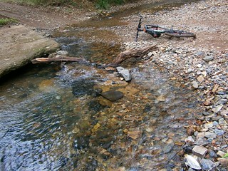
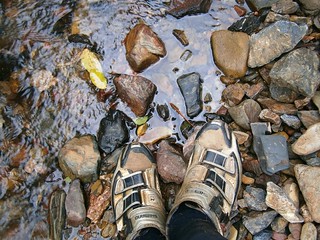
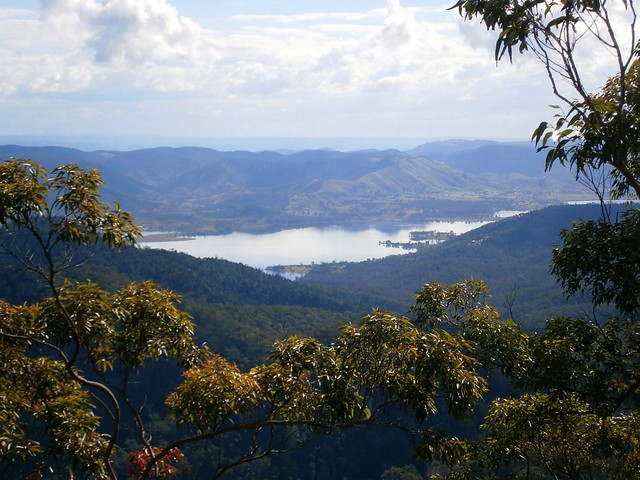
Eventually I reached the bottom, and the delightful bush camp at the England Creek Crossing. I wasn’t staying the night this time, so I just devoured a banana and took a few pics of the beautiful creek.


From there it was a bit of a climb up to the intersection at the bottom of Joyners Ridge Road. Normally if you were doing the “Super-V” you’d turn left into Joyners Ridge Road and make your way back up the hill to Mount Glorious. But today I was going a bit further, so I kept going straight ahead down again towards another crossing on England Creek.

England CreekEngland Creek

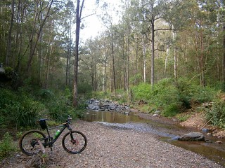
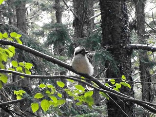
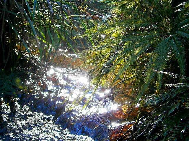
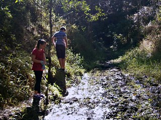
England Creek is spectacular. The water is crystal clear. There’s no sound at all except bellbirds, wind in the Eucalypts, and water babbling over the pebbles. I don’t know what cosmic lottery I won to be able to enjoy these simple pleasures, but I’m continually grateful.


From this point, the hard work begain in earnest. I had to make the slow steep climb up Goodes Road. This is a cruel climb, rising almost 500m in 5km. It’s very steep, and after the long ride I’d done it was really difficult to turn the pedals and get up the hill.


I repeatedly yelled to myself in U.S. Army Marching style:


IF. IT. IS to BE

IT. IS. UP to ME!


If anyone would have caught me yelling out like a madman, I’m sure I would have been sectioned and locked up.


By some minor miracle, I made it to the top without passing out. I didn’t walk – I’m really proud that I was able to ride the whole way.


From there, I followed Dundas Road back to Mount Nebo and civilization, and enjoyed the fast roll down the bitumen back to the Goat Track.

Goat Track

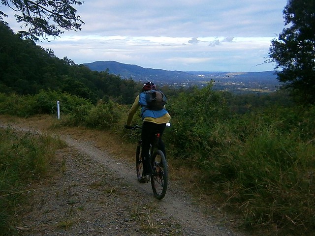
After a tough ride, I love the quick drop back down the Goat Track. It was cold, and I had my plastic vest on, but it was enjoyable.


Can you see the “W” in there?


This ride was just under 45km, and took me almost 4 and a half hours. I burned about 4,500 kcal (about 8 big macs) and climbed about 1,700m. This one rates 8.5 out of 10 on the tough-o-meter. If you do it in summer, I’d rate it 9 out of 10.