Please note: you can find a more up to date version of this blog at http://blog.neilennis.com

Thursday, December 31, 2009

Browns Creek

Read More

Glass House Mountains


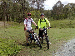
What an amazing ride!


I found this one by accident, after playing around with google maps for an hour or two. My aim was to find some quiet country roads, and see if I could add in a bit of dirt track, gravel roads, and some hill climbs. And I got it all.


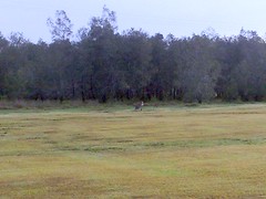
Mosquito Creek Winery is hidden away in the back of Kurwongbah. The problem is that the creek bisects the road, so you can’t drive through it.

Mosquito Creek CrossingMosquito Creek Crossing

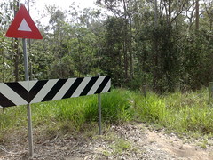
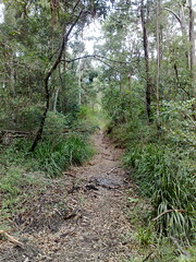
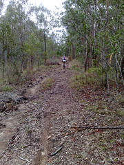
But with a bit of persistent rummaging around, I found a horse trail winding through the scrub, and was able to cross the creek and emerge triumphantly on the other side.


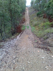
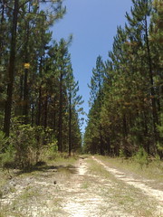
The other pleasant surprise is Browns Road. It’s a “phantom road” which appears on the map, but is not much more than a dirt track. I waded through some muddy grass at the end of McCormack Road, and eventually found a muddy washed out dirt track, with lots of ruts, bumps and puddles. It wound its way between several hidden away farms for a few kilometres before finally emerging at the end of a gravel road

Browns Creek Road


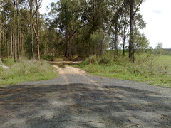
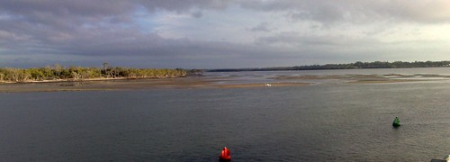
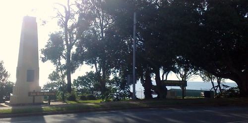
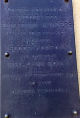
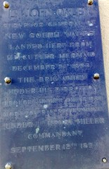
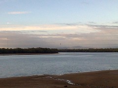
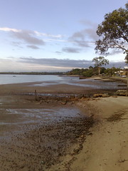
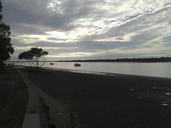
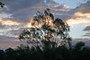
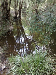
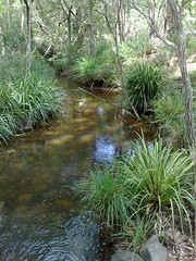
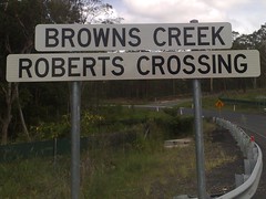
And then a couple of kilometres later, the icing on the cake, a picturesque location with some fascinating history. Browns Creek:

Browns CreekBrowns CreekBrowns Creek


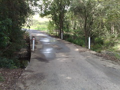
In her book “Reminiscences of Early Queensland”, Constance Campbell Petrie recounted some fascinating history about Browns Creek. The incident probably occurred sometime in the 1840’s.


Another good corrobboree was based on an incident which happened when my father was a boy. This time it had reference to a young gin — Kulkarawa— who belonged to the Brisbane or Turrbal tribe. A prisoner, a coloured man (an Indian), Shake Brown by name, stole a boat, and making off down the bay, took with him this Kulkarawa, without her people’s immediate knowledge or consent. The boat was blown out to sea, and eventually the pair were washed ashore at Noosa Head—or as the blacks called it then, ” Wantima,” which meant ” rising up,” or ” climbing up.” They got ashore all right with just a few bruises, though the boat was broken to pieces. After rambling about for a couple of days, they came across a camp of blacks, and these latter took Kulkarawa from Shake Brown, saying that he must give her up, as she was a relative of theirs ; but he might stop with them and they would feed him. So he stayed with them a long time, and the bon-yi season coming round, he accompanied them to the Blackall Range, joining in the feast there.


Before the bon-yi gathering had broken up. Shake Brown, grown tired of living the life of the blacks, left them to make his way to Brisbane. He got on to the old Northern Road going to Durundur, and followed it towards Brisbane. Coming at length to a creek which runs into the North Pine River, there, at the crossing, were a number of Turrbal blacks, who, recognising him, knew that he was the man who had stolen Kulkarawa. They asked what he had done with her, and he replied that the tribe of blacks he had fallen in with had taken her from him, and that she was now at the bon-yi gathering with them. But this, of course, did not satisfy the feeling for revenge that Shake Brown had roused when he took off the young gin from her people, and they turned on him and killed him, throwing his body into the bed of the creek at the crossing. A day or two later, men with a bullock dray going up to Durundur with rations, passing that way, came across Brown’s body lying there, and they sent word to Brisbane, also christening the creek Brown’s Creek, by which name it is known to this day.


Kulkarawa, living with the Noosa blacks, fretted for her people, and she made a song which ran as follows : ” Oh, flour, where oh where are you now that I used to eat ? Oh, oh, take me back to my mother, there to be happy, and roam no more.” She evidently missed the flour which her own tribe got from the white people. The Noosa blacks made a dance to suit the song, and the corrobboree was considered a grand one.


Browns Creek


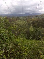
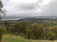
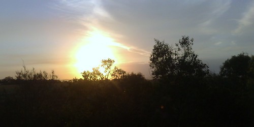
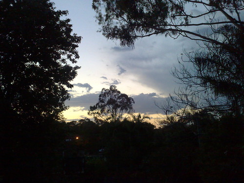
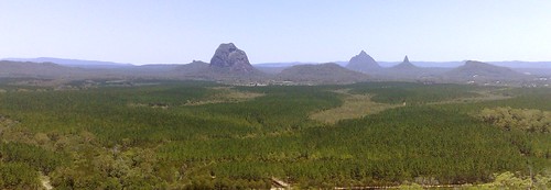
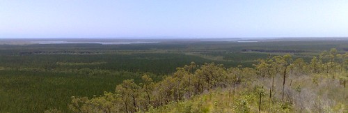
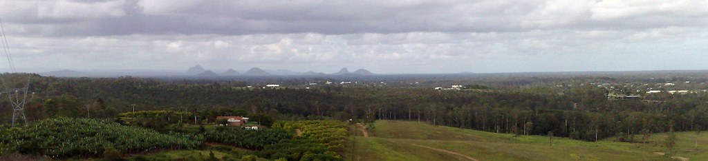
The hill climbs were hard work (Total ascent about 600m), but the views were worth it!


View Larger Map


Tuesday, December 29, 2009

Clear Mountain

Read More

Clear MountainClear MountainClear MountainClear Mountain


Here’s some photos of the "Clear Mountain" loop.


This is basically a gradual climb along the southern shore of lake Samsonvale, and then a monster climb to the top of Clear Mountain.


Coming down the other side, you can achieve speeds of up to 100km/h but it was raining heavily, so we were alot more cautious.


To mix things up a bit, we added some dirt riding as well. All up I burnt 2160 kcal on this ride – one of the toughest I’ve done.


Some of the gradients on the bitumen were 20% (one in five) which is difficult even for a car :)


I really enjoyed the dirt section best. It was slow, dirty, and I was covered in mud, but MTB’s are built for this sort of thing. I would have taken more photos, but it was raining lots, so I couldn’t take the phone out of the plastic to take photos – otherwise it would have got soaked!


I’ve just realized how lucky I am to live so close to so many good quality dirt tracks. But sadly, developers are circling like vultures. New housing estates are springing up everywhere, and soon the best dirt tracks will only be on the roads marked "No Tresspassing".


Thanks, Steve, for showing me this route!


View Larger Map


Sunday, December 27, 2009

Mistake Road

Read More

Mistake RoadMistake Road

I often look at Google Maps to find new places to ride. Some of the roads look fascinating going through some beautiful country. The problem is a lot of them don’t exist.


Mistake Road is a classic example. Driving along Dunlop Lane in Kurwongbah, if you read the Google Map, you’d expect a nice ride through to Shea Road. But the bitumen gives way to gravel, which gives way to dirt and mud, and in the end, all that is left is a horse trail.


And off that horse trail is Mistake Road.


So Steve and I based through some bush on the bikes, down Mistake Road.It went through a creek that was knee deep, so I cunningly took off my shoes and socks to keep them dry and waded through, holding up the bike.


The next creek, Steve said “Ride through it, it’s easy” so I did, stalled mid-way and soaked my lovely dry shoes.


At this point the track disappeared and we found ourselves in a paddock near a farm house.


“Woops, we’re accidentally trespassing” I thought. And just as we were about to get out onto the main road, we met up with the land owner driving her car out.


I had my speil all worked out “I’m really sorry. We’re lost, can you tell us how to get out of here?”. But before I could, she congratulated us telling us that they’d only just prepared a new horse riding trail through their property, and we were the first people to come along it on our bikes.


Wendy was really friendly, and I was relieved that we hadn’t antagonized some old hermit of a farmer who was going to set (in my imagination) hungry dobermans onto us.


But the point is that there are hundreds of old roads that are on maps, that “aren’t really there”. But if you ride down them on a bike, just at the point where they “disappear” you can bash through the bush and find horse trails that are probably more than a century old.


I’ve got a hunch that the “Old North Road” from Brisbane to Durrundur came through here somewhere.


Constance Campbell Petrie writes about a Indian fellow by the name of Shake Brown kidnapped an Aboriginal woman and sailed to what is now Noosa Heads. After he’d had enough of roughing it, he came down the Old North Road on his way back to Brisbane, where he was met by some Aborigies who exacted revenge from Brown and killed him on the banks of what is now Browns Creek.


Browns Creek runs through this area, as you can see on the map, so it’s very likely we rode today near where Shake Brown was killed, which is also where the Archer Brothers would have ridden their horses in the 1840’s on the way to Durrundur Station near present day Woodford.


So next time you drive your car to the end of road that really ought to be there according to the map, remember that the road probably still is there – you just need a good horse (or a mountain bike) to go any furhter.


View Larger Map


Wednesday, December 23, 2009

More pictures from Redcliffe

Read More

Here’s some more pictures from this morning’s ride.


Hayes Inlet from the Hornibrook Bridge

This is the view to the North-West from the Hornibrook Bridge looking towards Hayes Inlet.


Fig Tree Canopy

And this is a great looking street in Redcliffe with a beautiful canopy of Moreton Bay Fig Trees – really enjoyable to ride through.


John Oxley Memorial

Read More

John Oxley Memorial


Some pictures from our ride to Redcliffe this morning.


John Oxley Memorial

“On the morning of

July 17th 1799

Lt MATTHEW FLINDERS

landed near this spot

from the

Sloop Norfolk

and called it

Red Cliff Point

He was the first white man

to land

on this peninsula”


John Oxley Memorial

“Lt JOHN OXLEY

Surveyor General of

NEW SOUTH WALES

Landed here from

HM Cutter Mermaid

December 2nd 1823


The Brig Amity

under his direction

brought hither the first

Moreton Bay Settlement

under Lt Henry Miller

Commandant

September 12th 1824″


Monday, December 21, 2009

Dohles Rocks

Read More

Dohles Rocks is a beautiful place to cycle in the morning. The only downside is dodging some busy traffic to get there!


Today I spotted about a dozen kangaroos grazing beside the road and managed to capture a photo of one of them just staring at me.


The waterfront is beautiful too. This morning a hot air balloon was drifting slowly in the breeze a few kilometres away, and the water was serenely calm.


It’s a bit out of the way – no traffic passes through Dohles Rocks (the road stops there!) But if you’re interested in hiring a boat, relaxing by the water, or fishing, it’s a great place to visit.

Hot Air Balloon, Pine River, Dohles RocksKangaroo, Dohles Rocks Rd, Griffin

Pine River, Dohles RocksPine River, Dohles Rocks


View Larger Map


Friday, December 18, 2009

Fun at Luna Park

Read More

Fun at Luna ParkFun at Luna Park


I had a great time in Sydney today at a client’s Christmas Party.


We had lunch at Luna Park, so I took a few minutes out to take a few photos of this fun place.


The smiley clown looking guy had a girl with him. I told her I was really Seven years old and just looked old, and would she take my picture please.


As you can see she obliged!


Wednesday, December 16, 2009

Land Clearing in Petrie

Read More

The land at the top of Armstrong Street, Petrie, known as “Murrumba Hill”, is special for a number reasons.


Tom Petrie, a pioneer of the area during the nineteenth century, had good friendship with the local aboriginal people. He spoke their language, attended their initiations and bunya feasts, and treated them with a respect that was 150 years ahead of his time.


In return, tribal elder Dalaipi advised Tom to build his house on this hill, and keep his cattle here. He promised that the North Pine tribe would look out for Tom’s family.


So Murrumba Hill is a symbol of rare early mutual respect and friendship between Aborigines and white men.


On this hill you can find some impressive old specimens of Hoop and Bunya Pines, and (until recently) a forest that had been untouched for almost a century, named “Dalaipi’s Forest” in honor of the great aboriginal leader who befriended the Petrie family.


The Petrie family sold the property to the Catholic church in the 1950’s on the proviso that the old homestead remained intact. Sadly, the chuirch renegged on the deal and demolished the homestead about a year after getting their hands on the property.


The Dalaipi Forest was left alone, but it was neglected. Due to lack of maintenance by the new owners, it became infested with Lantana and other noxious weeds.


And then last week, the church decided to bulldoze the Dalaipi Forest to construct another building and more car parking spaces.


Ironically, all this happened in the week of the Copenhagen Climate Change Conference, where people are debating the affects of land clearing on Climate Change.


Forests like this can sequester almost a thousand tons of carbon per hectare. They are habitat to many native species of birds, animals and insects. But more than this, a forest like this brings magnificent peaceful beauty right into the middle of our suburbs.


What a tragedy that it is gone.


To borrow an old phrase from the Dean Brohers demolition company:


“Catholic Church. All we leave are the memories….”


Tuesday, December 15, 2009

Guangzhou – Guangdong Province, China

Read More

A postcrossing post card from Wanyi Ho, who atudies at a boarding school in Guangdong Province.


Wanyi Ho is from a family of 6 people which is very unusual in China.


Thanks for the post card, Wanyi Ho!


Venezia (Venice), Italy

Read More

A postcrossing post card from Luana in Italy.


Thanks for the postcard Luana!


“The Gap”, Albany, Western Australia

Read More

A postcard from our friend, Rachel who’s touring Western Australia at the moment.


Rachel says she went for a drive around Albany and thinks it’s a spectacular place.


Here’s a link to the map of Rachel’s journey to date.


“Natural Bridge” Torndirrup National Park, Western Australia

Read More

A postcard from our friend Rachel who is touring Western Australia at the moment.


Rachel drove here from Esperance and thinks it’s a lovely green place with lots of fat satisfied looking cattle.


Thanks for the great views, Rachel!


Here’s a link to the map of Rachel’s journey to date.


Wagin, Western Australia

Read More

A postcard from our friend Rachel who is currently touring around Australia.


Wagin is famous for grain growing, livestock, sheep, and the two day “Woolorama” which attracts sheep farmers from all over the country.


Rachel says she spent about a week in Wagin at the carava park, and liked it so much that she thought she could easily live there.


Thanks for the postcard Rachel!


Disneyland

Read More

A postcard from our friend, Rosie, who’s holidaying in California at the moment.


She says Disneyland is fun, but exhausting.


Have fun, Rosie, and thanks for the postcard.


Tuesday, December 08, 2009

Afternoon at Boondal

Read More

Boondal Wetlands

Another great afternoon bike ride through the Boondal Wetlands with Liz and the kids.


This is one of my favourite places to ride – especially at sunset


Boondal WetlandsBoondal WetlandsBoondal Wetlands


Boondal Wetlands


Everyday Beauty

Read More

My favourite tree

I see this Eucalyptus Tree every day from my front deck, and never grow tired at looking at it. I’m very grateful that we have such beauty at our front door – literally!


What amazes me is how the same tree can seem so different each time I see it


My favourite treeSunset over Lawnton #3Sunset Over LawntonLightning in LawntonGumtree SilhouetteSunburst


Sunday, December 06, 2009

Beerburrum State Forest

Read More

The Glass House Mountains

Pumicestone Passage

Beerburrum State ForestHitting the WallBeerburrum State Forest


Between Donnybrrok / Toorbul and the Glass House Mountains, there are hundreds of square kilometres of pine forest and dirt tracks.


Some of the tracks are beautiful smooth gravel.


Others are diabolical sand and deep ruts, that stretch on for ages and have you groaning “Are we there yet?”


All in all – a fantastic time on the mountain bikes.


But as Steve and I found out – riding for a few kilometres on sand and through deep tyre ruts is exhausting work!


View Larger Map