Please note: you can find a more up to date version of this blog at http://blog.neilennis.com

Sunday, November 25, 2012

Neurum

Read More

Somerset Lookout

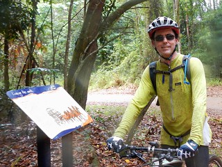
Nick and his family were camping at Neurum Creek Bush Retreat (NCBR), and kindly invited Jason and me to ride with them thorugh the northern section of D’Aguilar National Park.


Neurum Camp Ground


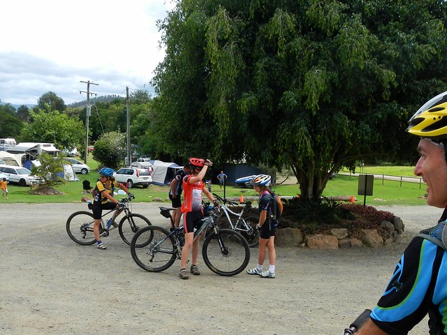
NCBR is a popular camping spot not far from Woodford, about a one hour drive north of Brisbane. If you pop in there on most weekends, you’ll smell camp fires buring, steak sizzling, and notice dozens of tents, caravans, 4wds and kids happily rolling around the place on their BMX bikes. It’s ideally situated on the border of D’Aguilar National Park, and is a perfect spot for launching a full-day epic exploration.


Lovedays Road

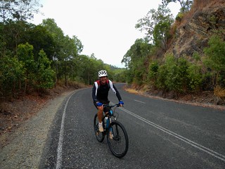
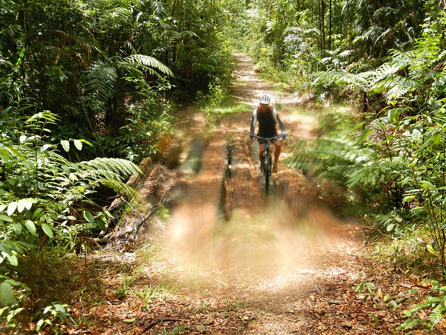
We started the ride with a long climb up Lovedays Road, ascending 400m in about 8.5km. We had fresh legs, so the climb only took us about 50 minutes. We then got to enjoy a brief downhill respite before starting the next long climb.

Hoop Pine Forest

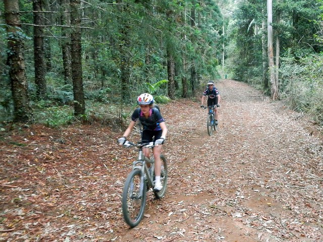
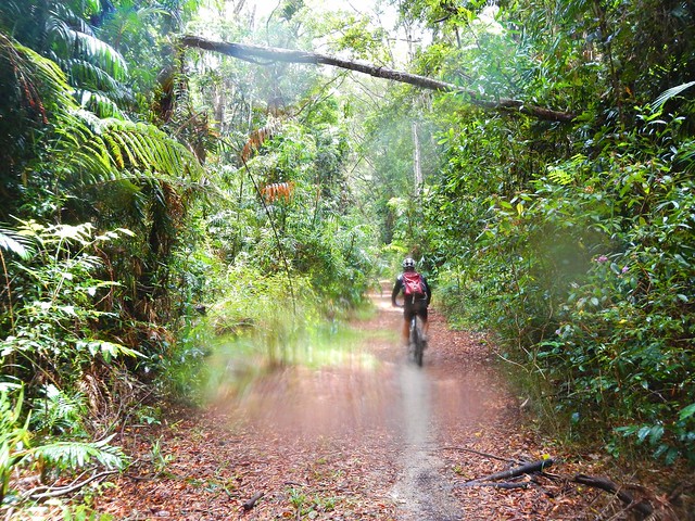
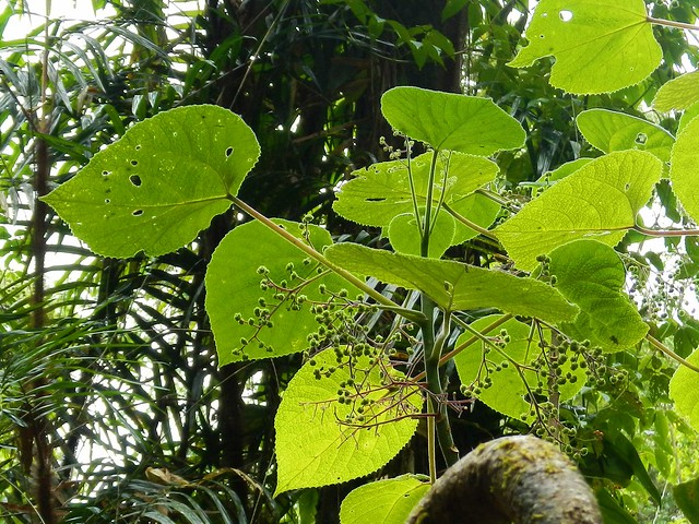
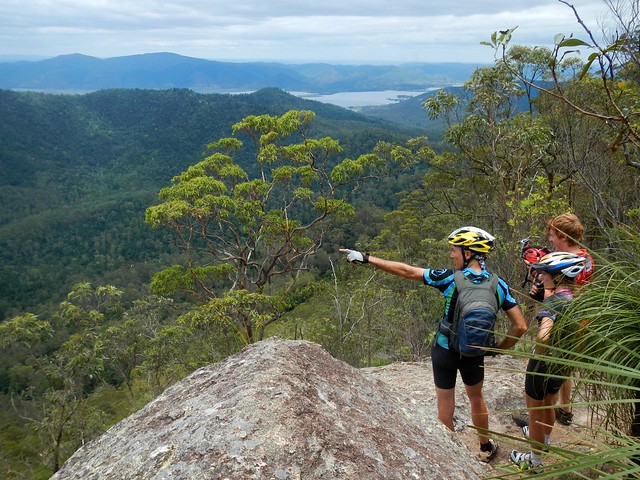
The trail took us through a variety of different types of forest including this Hoop Pine plantation, on the way to the summit at Somerset Lookout.

Somerset Lookout

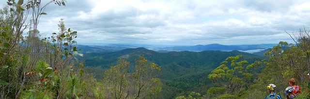
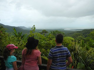
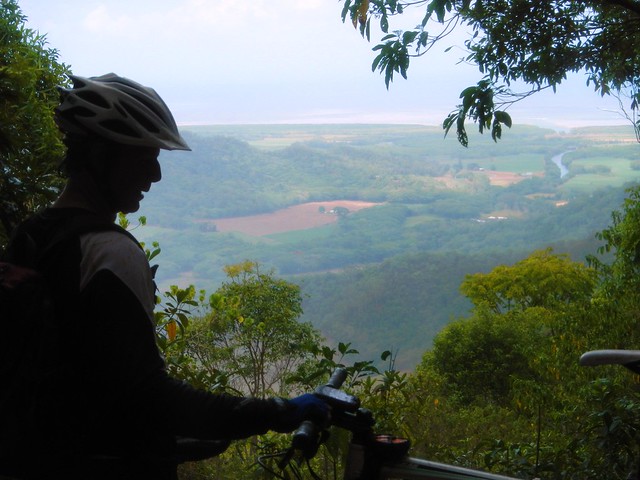
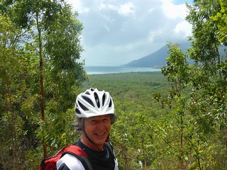
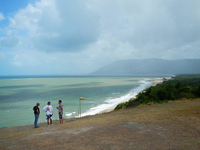
Eventually, after another hour of climbing, we made it to the lookout on the western escarpment with some spectacular views out towards Somerset Dam.

Somerset Lookout

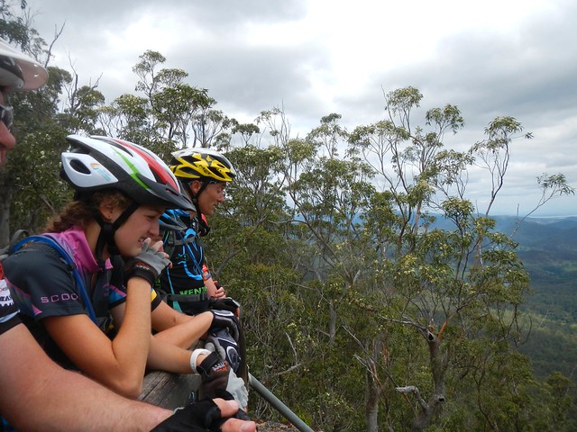
The long climb to the top was worth it for the panorama.

The Gantry

A couiple of Nick’s daughers met us at “The Gantry” with a delicious lunch and a bit of fresh water to top up with. “The Gantry” was once a busy sawmill in the early 20th century when the surrounding forest was logged for Cedar, Eucalyptus and Pine. The quiet lawns around the old sawmill are an idea spot to relax and enjoy lunch.

Dianas Bath

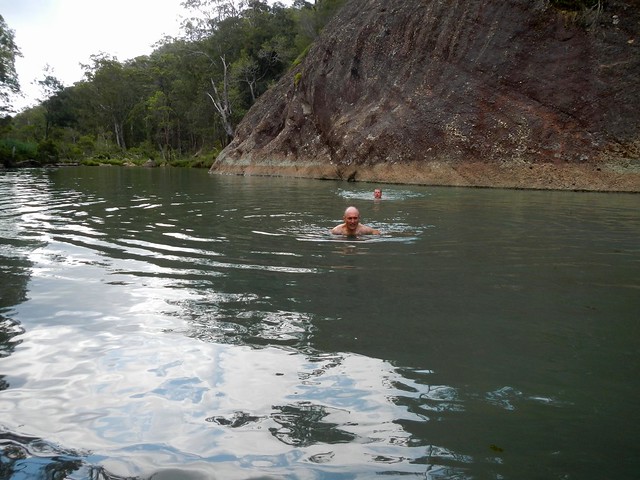
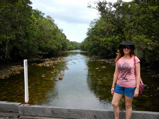
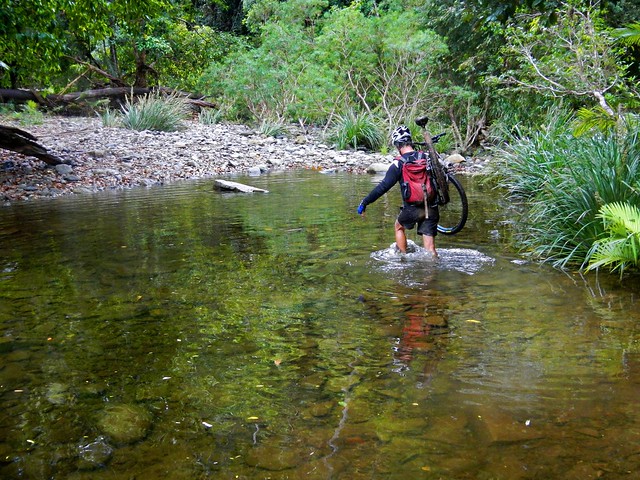
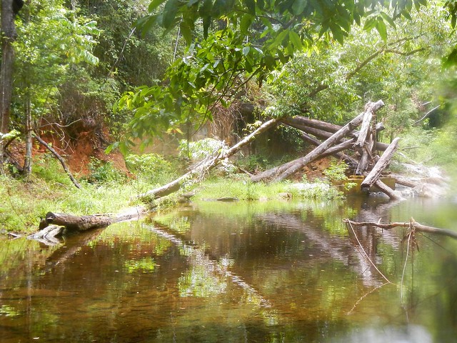
From the Gantry, we rode down the “Mother of all descents”, dropping almost 500m in the space of 10km, to the beautiful rock pool at Dianas Bath.

Dianas BathDianas Bath

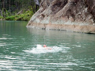
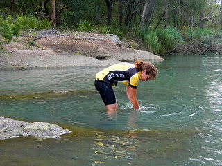
Some of us decided to jump into the cool blue water and wash off the heat, dirt and sweat. Others just had a bit of a paddle on the edge of the pool. It’s a serene place with unusually blue water. And it’s difficult to get to: we had to ditch the bikes and hike about 500 metres through thick scrub to get to the rock pool. It was worth the effort.

A-Break

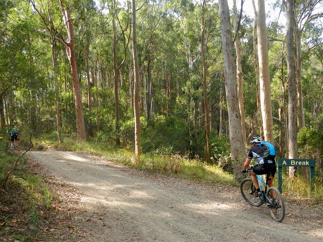
And then the hard work began. The climb from Dianas Bath back to the Gantry is one of the toughest ascents I’ve ever done. After a slow grind to the top of Dianas Bath Road, we then had to contend with the notorious “A-Break”. This heart breaking track has a couple of km of dustry hills with gradients in excess of 30%. It’s exhausting work. I pedalled what I could, and slowly walking up the rest, one step at a time, pushing my bike. I rarely push my bike up hills. If possible I always try to ride them. But this monster beat me.


After an hour and a half of hard uphill work, we finally made it back to The Gantry where we topped up our water and started the final leg back to Neurum.


This ride has a whopping total ascent of 2,200 metres with three big climbs – Lovedays Road, the Climb back from Dianas Bath, and a difficult little grind just before the final descent back to the starting point. The entire 67km trip took us eight and a half hours including breaks, during which I burned over 5,200 kcal. Technically a couple of the descents are challening. Physcially, the climbs are very demanding. You need to be very fit (or slightly insane) to attempt this ride – especially in hot weather. This one rates 10 out of 10 on the tough-o-meter. Complete it, and you can brag about it for years to come. Bring lots of water, food and patient super-human friends.


Wednesday, November 21, 2012

Daintree National Park

Read More

Coconut, Cape Tribulation


Daintree National Park is a special place. I could tell you lots of facts about it, and show you lots of pictures, but none of that would convey the wonder of the place and its stunning beauty.


I have no doubt why this place is sacred to the Kuku Yulanji Aboriginal People. Their traditional country stretches from Mossman in the south almost as far as Cooktown in the north and as far west as Chillagoe on the other side of the Great Dividing Range on Cape York.


The rainforest in this part of the world is over 100 million years old, making it the oldest rainforest on our planet. It survived this long because while other continents were slowly drifting around the planet from hotter to cooler climates (or vice versa), the wet tropics of North Queensland stayed reasonably close to the same latitude for most of that time, with a fairly consistent climate. This meant that species of plants and animals that died out in other parts of the world, stayed alive here. This extensive biodiversity is what sets the Daintree Rainforest apart from almost any other place on earth.

Ferry, Daintree River


It’s difficult to get to the Daintree. For starters, it’s over 1,500 km North-West of Brisbane. And you can’t easily drive there because there’s no bridge over the crocodile infested Daintree River. You have to catch a ferry. Thankfully, the ferry leaves every 10 to 15 minutes. But the roads are steep and twisty, so it’s a slow drive. You’ll have to take your time.


Alexandra Lookout, Daintree NPAlexandra Lookout, Daintree NP

Our first stop after climbing the range was Alexandra Lookout. This gives great views to the east over the forest allowing you to see where the Daintree River meets the sea. It’s also a good place to get photos of butterflies trying to get their face on a photo :)


Noah Creek, Daintree NP

From there we drove north, past a tea plantation and over numerous speed bumps (to stop you hitting cassowaries) to Noah Creek. The bridge is narrow, so there’s no room for pedestrians. To get a picture of the babbling creek we had to park the car, run quickly onto the bridge, take the photo, then get back off the bridge before the next car came round the corner. I think we managed it with a few seconds to spare.


Cape Tribulation

Cape Tribulation

Cape Tribulation was the furthest north we could go in the hire car. After this, the bitumen stops, and the road turns into a 4wd track. At Cape Trib the rainforest reaches down from the mountains right to the edge of the beach. What a beautiful place!

Cape Tribulation

Cape Tribulation

We decided to go for a wander up the beach to see what we could find. I don’t think we were looking for anything in particular. We just wanted to soak it all up.

Mountainbiking at Cape Tribulation Mountainbiking at Cape Tribulation

This mountain biker had the right idea. A simple single-speed rig with no suspension, nice fat tyres and “low tech” rubber footwear. Just the trick for riding on the beach.


Dubuji Boardwalk

Dubuji is a Boardwalk through the forest that gives you an idea of the biodiversity of the area. I was amazed to look down from the walk into shallow creeks and see numerous fish over 30cm (1 foot) long, just quietly sitting the shallows.


Green Ant, Daintree NPSpider, Dubuji Boardwalk

The colors and variety of the wildlife were stunning…

Goanna, Cape TribulationBlack Ant, Dubuji Boardwalk

It didn’t matter where we looked – the place was teeming with life…


Wild Fruit, Cape TribulationRainforest Vine, Dubuji Boardwalk

Wildflowers, Dubuji BoardwalkWildflowers, Dubuji Boardwalk


The rainforest here grows on the sand, which is extremely rare. The Kuku Yalanji people named this place “Dubuji” which means “Place of spirits”. They have stories about many specific places only several metres from the boardwalk.


Cow Bay, Daintree NP

Cape Tribulation

As we slowly made our way back south towards our starting point we stopped at a few different places along the way to have a look around.


Crab

It looked to me like the crabs were making Aboriginal “Dot Art”.


Kulki Lookout, Cape Tribulation

I’m so glad we were able to experience this stunning place. I’d love to go back sometime. Who knows? Perhaps I’ll bring a bike next time :)


Rex Lookout


Sunday, November 18, 2012

The Bump Track

Read More

The Bump Track

We were staying at Palm Cove between Cairns and Port Douglas to watch the Total Solar Eclipse, which provided an ideal opportunity to explore the spectacular rainforest inland from the coast.


Being an adventurous soul, I thought I’d just hop on the bike and follow my GPS, but I’ve learned to listen to the wisdom of my wonderful wife who insisted I ride with someone who actually knew the area. That was how I met Dan Foley from Dans Mountain Biking. Dan has been mountain biking in Far North Queensland for over twenty years and knows the trails intimately. He operates guided tours by mountain bike through places like Cape Tribulation, Daintree National Park, Bloomfield Track, Atherton Tablelands and Mulgrave Valley. Today he took me through Mulgrave National Park and “The Bump Track”. The rainforest is full of things that eat, sting, bite, slice, and/or kill you, so I’m really glad Dan was there to keep me out of harms way.


Funnily enough, while thinking of all the things that could chew me up, we started our ride from the car park at Hartleys Crocodile Farm at Wangetti.

Quaid RoadQuaid Road

The first part of the ride was up Quaid Road – a disused development road which, over the space of 5km, climbs 500m up from Wangetti on the coast into the rainforest. It was built by property developer George Quaid in the 1980′s just before the area was declared a wet tropics world heritage area. So (thankfully) George didn’t get to carve up the rainforest. The road is gated off – so motor vehicles can’t use it. But it’s a really easy way to get from the coast into the mountains by mountain bike.


Mowbray National Park

Once we got into the rainforest (emphasis on “rain”) it started raining. Dan took me along the “twin bridges” track – one of the many management trails in the area.


Red Bellied Black Snake

Not far in, we encountered what I thought was a dead snake. “How sad” I thought as I sidled up close to it to take a picture. Dan suggested we give it a wide berth in case it was still alive. I listed to him, and once past it, we poked it gently with a stick. To my great delight the Red Bellied Black Snake (Pseudechis porphyriacus) reared up at us. It was a alive! And so was I for listening to Dan. Those snakes are venomous and can give you a nasty bite.


Wait a while

Wait A WhileWait a while

A little further along the track, and Dan stopped me again. This time it was for a Wait-A-While or Lawyer Cane (Calamus australis). This is a species of climbing Palm Tree. It drops long thin spike-covered tendrils down to the forest floor below. They’re tough and sharp. If you ran into one (or tried to ride past one on a bike), the sharp tendrils could inflict horrible damage. Dan told me stories of motor cyclists losing limbs to the plant while speeding through the forest on a trail bike. The dangerous thing is that the tendrils are so thin that they’re nearly impossible to see. And with the rain pouring down, and glasses fogged up, it would have been really easy for me to get snagged on one (or two, or three). Thankfully (for me), Dan rode in front. He hit the vines first. I just made sure I took notice when he pointed them out to me.


Aborigines used the mature cane from the vine as struts to build shelters. They wove the spiky tendrils into snares and fish traps. And by cutting the thick canes they were able to collect drinking water when needed. A one meter long section of the vine, when cut, could supply over a cup of drinkable water.


Gympie Gympie (Stringing Tree)

Another nasty surprise in this part of the world is the Gympie Gympie or Stinging Tree (Dendrocnide moroides) – a highly toxic plant that can inflict severe pain at the slightest touch. The cure is duct tape or leg wax applied to the affected area of skin to pull the thin spikes out. The worst thing you can do is rub the area or apply water to it.


Pick a Plank

We slowly continued our ride northwards over several log bridges which crossed quiet creeks. The water is crystal clear and is good to drink as well. The trick with log bridges is to make sure you don’t get your wheel stuck in the gap between the logs, so it’s important to “Pick a plank” and stick to it, or run the risk of flying over the handlebars :)


Spring Creek

Bridge Out

The “Twin Bridges” track is named after two large log bridges which used to span Spring Creek. Floodwaters destroyed the bridges a while ago, and all that is left is a large pile of logs. So we had to wade across the creek in thigh deep water. Thankfully there were no crocodiles :)

The Bump TrackMuddy Me

Eventually we reached the top of “The Bump Track”. This track is part of the Bicentennial National Trail and forms part of the route that Cobb & Co took between Port Douglas and Georgetown in the 1880′s. The 322km trip trip used to take five days. When the coach got to the Bump Track, all the passengers had to get out and walk, while the horses dragged the stage coach up the steep hill.

The Bump Track

Today we were going DOWN the Bump Track, not up it. At its steepest, the track drops over 300 metres in 1.8 km. My brakes were totally cooked by the time we got to the bottom. So I was glad to stop halfway down to enjoy the view of the Mowbray River to the east, and let the brakes cool down.

Rex Lookout

Once at the bottom, we made our way back to the Captain Cook Highway near Port Douglas and made our way south along the bitumen. This must be one of the most scenic highways in the country. On the way back we stopped at Rex Lookout to enjoy an amazing panorama of the coastline to the south.

Beware of the Crocodile


All up we rode 55km in just over 5 hours including breaks. I burned 5,000 kcal as we ascended a total of 1,250m. On the tough-o-meter I’d rate this ride about 7.5 out of 10 for difficulty, but 10 out of 10 for fun and stunning views.


If you’re new to the area, DON’T do this ride by yourself. Get someone who knows the area, like Dan Foley. When you’re taking on a tropical rainforest with “Wait-A-While” vines, Gympie Gympie plants, Black Snakes, Crocodiles, and log bridges with treacherous gaps, a competent guide will ensure that you arrive home happy and in one piece.