Please note: you can find a more up to date version of this blog at http://blog.neilennis.com

Sunday, October 28, 2012

Condamine Gorge

Read More

Condamine Gorge

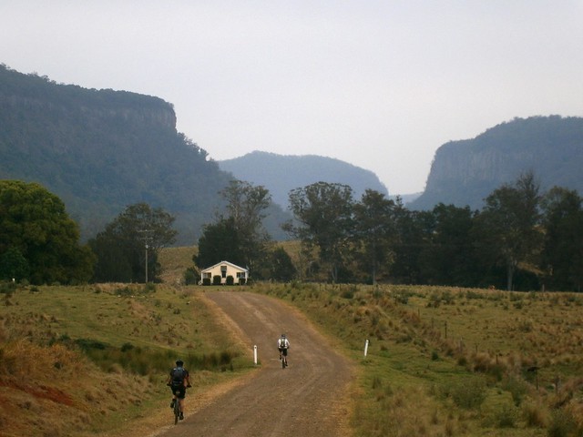
“The Head” is a spectacular spot up in the Great Dividing Range of South East Queensland, near the border. It gets that name from the fact that it forms the headwaters of the Condamine River and the Murrary Darling Basin. Starting as a trickle on the slopes of Mount Superbus, it flows through Condamine Gorge joinng up with the Balonne River, the Darling River and eventually the Murray River before draining into the Great Australian Bight near Adelaide in South Australia.


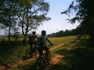
Today we were lucky enough to ride through some of this beautiful country in a loop from the small town of Legume, in Northern NSW up into Acacia Plateau, then along the Border Fence to “Head Gate” and back to our starting point via Condamine Gorge (also known as Cambanoora Gorge).


The traditional Aboriginal owners of this area are the Githubal, Kambuwal and Jocumwal people.

Acacia Plateau

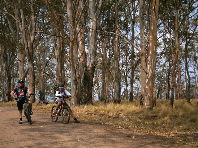
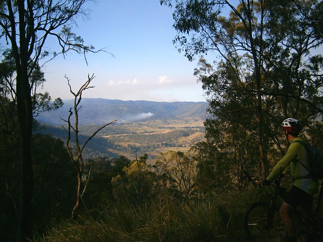
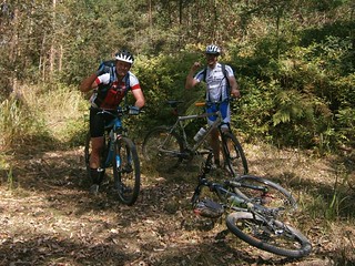
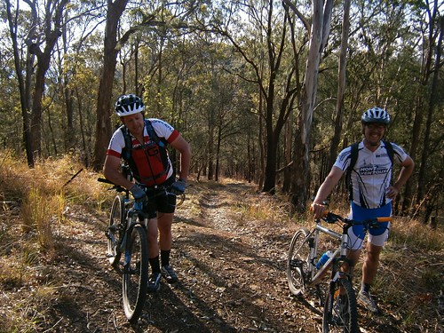
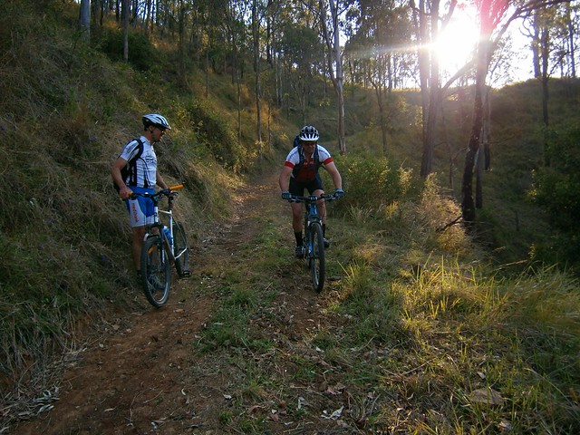
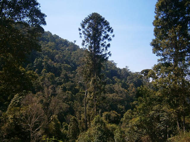
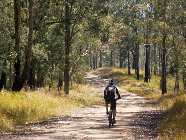
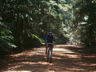
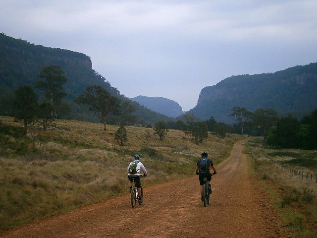
For the first hour of our journey we took a long slow climb up onto Acacia Plateau, while we battled swarms of flies. Thankfully Eric had the foresight to pack some insect repellant which kept the pesky insects away from our faces, allowing us to enjoy to majestic open blue-gum forest.

The Border Track

The Border TrackThe Border Track

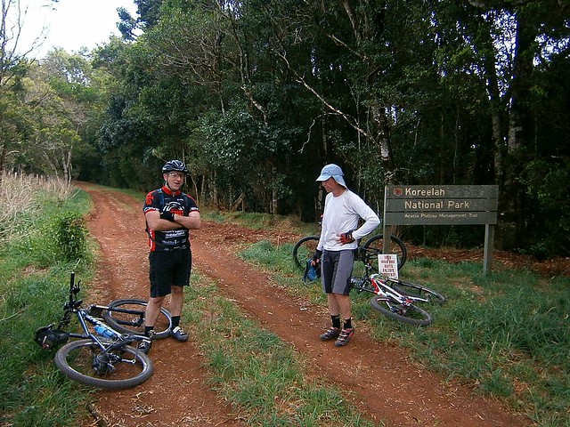
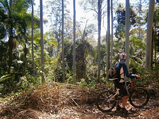
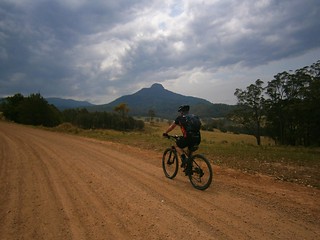
The rocky road eventually rises up to the “Border Track” following the rabbit-proof fence along the border between Queensland and New South Wales. At an altitude of over 1,000 meters, this section has thick rainforest on the NSW side of the fence and open farmland on the Qld side. I’ve seen similar scenarios at other places along the border (such as The Border Ranges) and it makes me wonder about the relative priorities of both states in their early years, and the importance of land-clearing to Queensland in the 19th and early 20th centuries.

Trough Creek

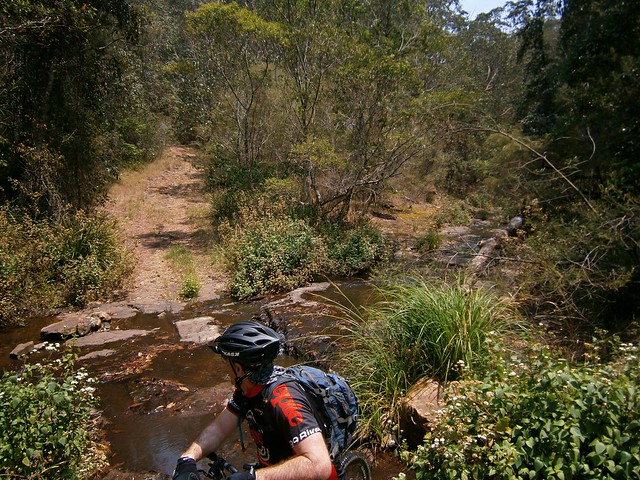
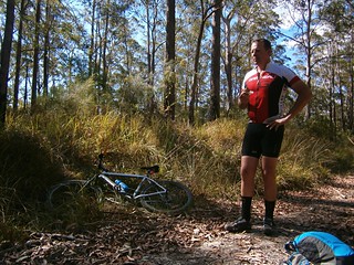
From the border track we dropped about 600 metres in altitude in the space of 8km. I don’t have any pictures of it since I was clinging on to my handlebars for dear life while I bounced down a rocky track, dodging stray logs and precarious ruts. The Trough Creek descent is a mountain bikers delight, but it’s rough. You need good suspension, and a reliable wheel / tyre combination. I suspect riding this on a cheap bike would result in pinch-flats and crashes.


I got to the bottom yelling out “Wow, that was awesome!”

Koreelah Creek

Koreelah Creek

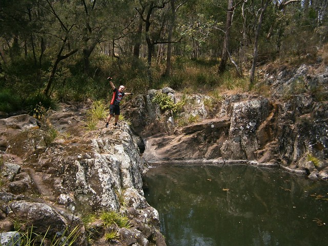
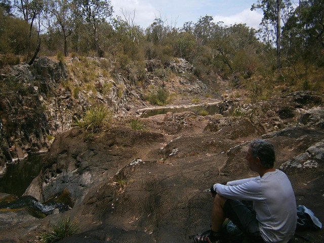
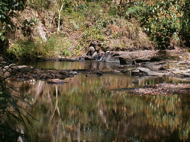
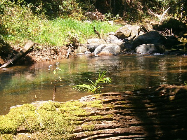
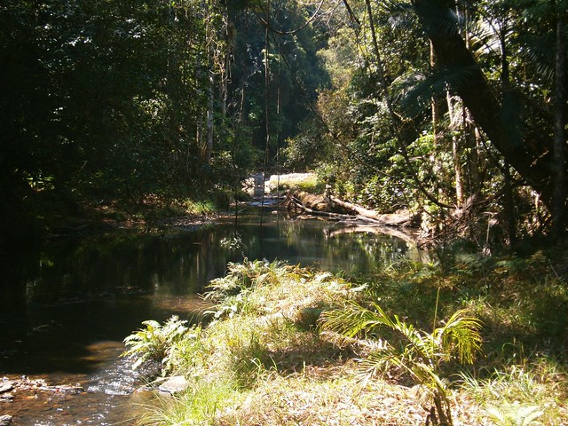
A few minutes later, after bouncing down some more rocky roads, we eventually reached the rock pools at Koreelah Creek, where we stopped for lunch.

White SwampWhite Swamp

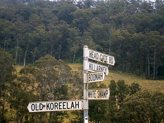
“White Swamp” marked the lowest elevation point of the ride. From here we faced another long slow climb up to “Head Gate” – the Qld / NSW border crossing.

Head Gate

Rabbit Fence

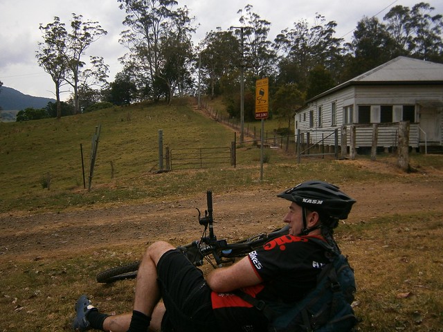
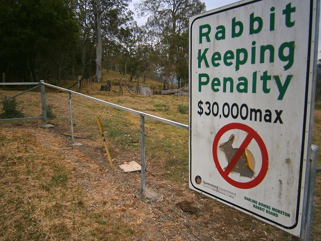
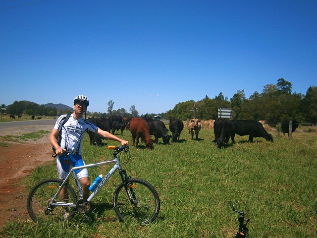
“Head Gate” is a secluded border crossing in the middle of nowhere. It boasts a dilapidaed house, and a shed. If you stand in NSW and look north to Qld, a huge sign tells you how un-welcome rabbits are. In fact, if you try to keep rabbits in Qld, you’re liable for a $30,000 fine. If you stand in Qld and look south, you’ll see a similar huge sign wich tells you you’re not allowed to take livestock into the state along that road.


For us it was a welcome place for a short break. It was also a reminder that we had stopped our long climb and could look forward to some more descending.


Condamine Gorge

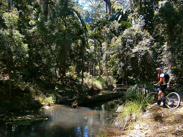
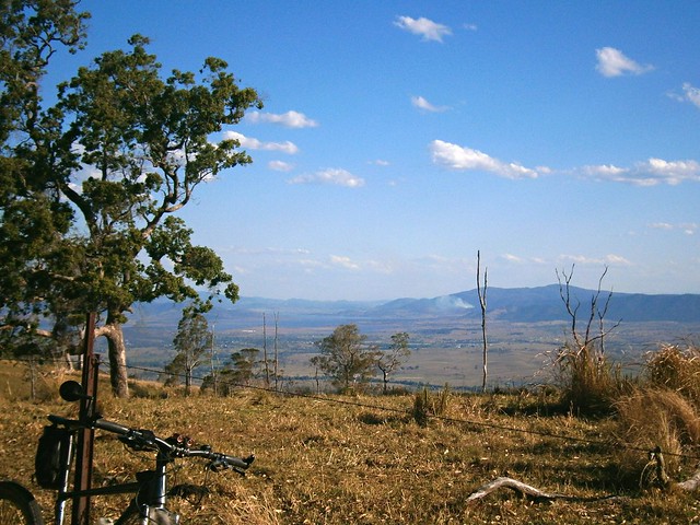
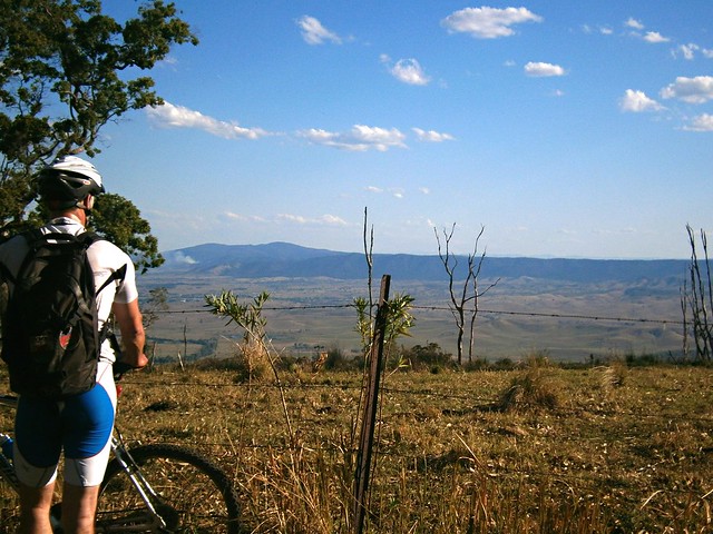
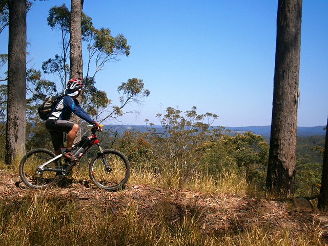
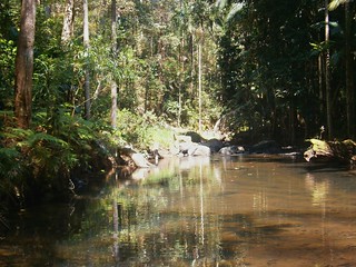
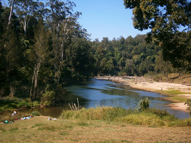
As we rode along Condamine River Road, we enjoyed some amazing views of the Gorge.

Condamine Gorge

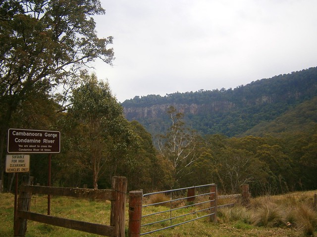
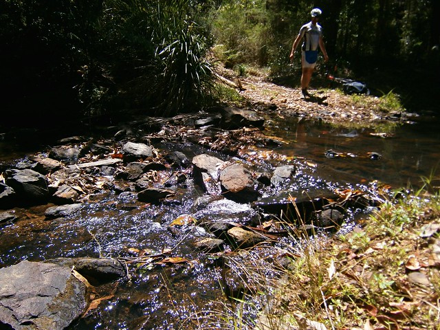
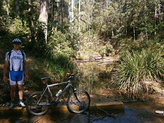
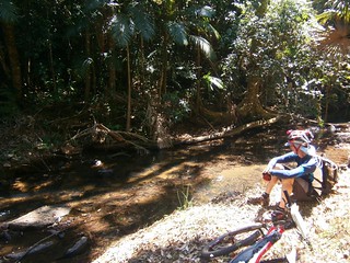
Like the sign says, if you go along Condamine River Road you need to be prepared to cross the river 14 times. And they’re not just shallow little crossings, they’re deep, and you’re definitely going to get wet.

River Crossing Condamine Gorge

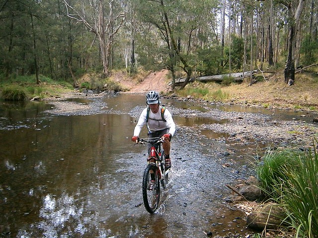
We rode through several crossings. Eric showed us how it was done. We waded through the rest of the crossings, carrying our bikes. Normally I hate getting my feet wet. On this trip, I just accepted the fact that it was going to happen, and didn’t worry about it. I actually discovered that it’s not that bad riding in wet feet – provided it happens towards the END of the journey and not the start :)

Crossing the Border

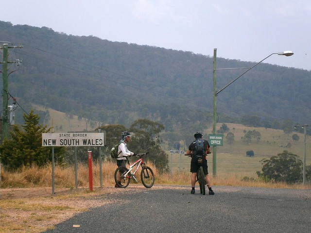
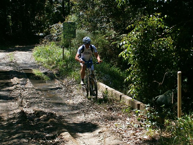
Once we got to the end of Condamine River Road, we headed south along the bitumen, across the border again, and back to our starting point at Legume.

Queen Mary Falls

Queen Mary FallsQueen Mary Falls Lookout


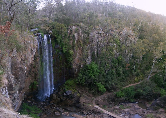
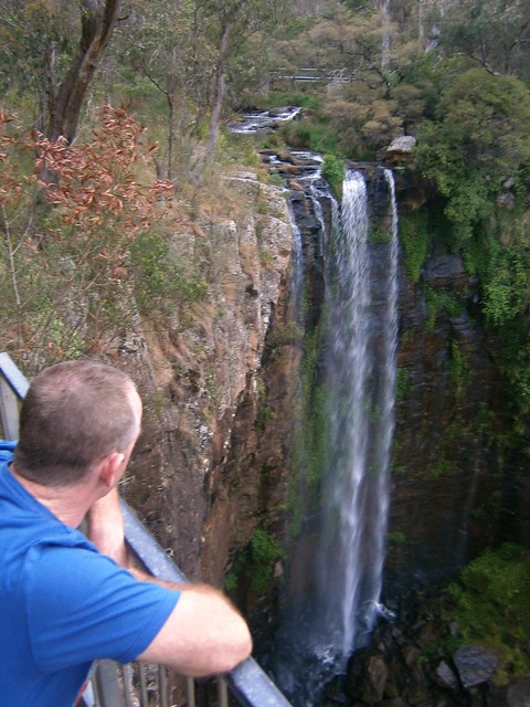
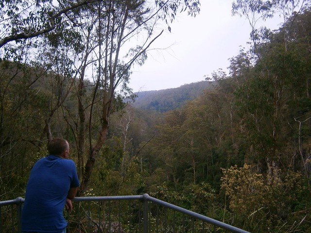
Our route took us in a big circle, in the middle of which was Queen Mary Falls. Since we didn’t actually ride to that point, we decided to drop by in the car on the way home. The falls are only a five minute walk from the car park on Spring Creek Road, so it was worth the detour.

Carrs Lookout,

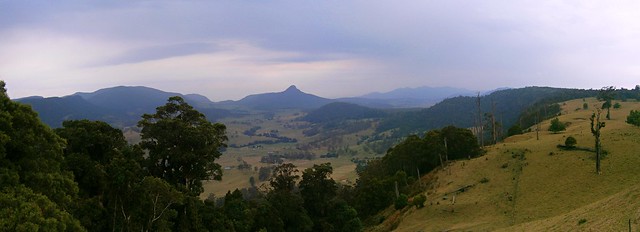
We also stopped at Carrs Lookout where we were gobsmacked by the views of Mount Superbus and Wilsons Peak.


What a stunning way to finish the day.


All up we rode about 64km in 6 hours including breaks. We ascended 1,450m and I burned 3,700 kcal. The ride has two tough climbs, one sketchy descent and numerous river crossings. It also involves a three-hour each way drive from Brisbane. I’m giving it 9 out of 10 on the tough-o-meter. You need medium to high fitness, medium skills, a good bike, and some good riding buddies. Be careful after rain as the river crossings may be impossible to ford – which means a long detour. Take lots of water in Summer – it is hot work. Take lots of snacks.


Monday, October 15, 2012

Mount Kilcoy

Read More

Views from Kerrs Lane

Mount Kilcoy is a small farming community in a secluded valley bounded on three sides by the Conondale Range. I was curious about what it would be like to ride from there into the hills to the north, so I convinced a couple of friends to join me.

Mount Kilcoy Road

Jason, Wil and I started our ride surrounded by contented cattle grazing on the lush grass. This place has known severe drought in the last decade, so it was really nice to see so much green grass and flowing water.

Mount Kilcoy Road

After a few easy kilometres warm-up along Mount Kilcoy Road, we eventually reached the national park boundary. From here, the gradient increased sharply, and we had to start working quite hard. Wil made the mistake of munching on a couple of meat pies before the ride. He regretted that half-way up the 5km climb.

Mount Kilcoy Road

We climbed about 450m in 5km as we wound our way up the range. Hill climbs are a fact of life in mountain biking, so we just sat back, pushed the pedals, and slowly made our way to the top.

Six Mile Creek

Six Mile Creek

Kilcoy Creek (West Branch)

I’m glad we did most of the hard work at the start. From that point our route undulated northwards over the mountain range as we crossed several picturesque creeks. The creeks in the western section of the Conondale Range drain into the Stanley River and Somerset Dam, eventually flowing into the Brisbane River and Moreton Bay.

Bullocky Mural

At the half-way point of our ride we reached the Sunday Creek Environmental Education Centre (EEC). This wonderful facility is run by the Queensland Education Department to provide Environmental Education to our kids. One of the walls of the centre has a mural based on an old photograph of Alf Raung and his bullock dray. Alf used to work his bullock team between the logging towns of Yednia and Jimna. In the early 20th century, the Conondale Range was logged for its magnificent timber. In fact, the EEC is situated where an old sawmill use to be. Some of the buildings used to form part of the sawmill. Alf Raung would collect the huge logs that timber getters had felled. After loading them on his dray, the team of bullocks would haul the heavy load to the sawmill where it would be cut into planks.


In a strange twist of fate, Alf’s grandson, Michael is principal of the EEC.


Before the days of logging, the Sunday Creek area had a gold rush. EEC principal, Michael, tells me that several thousand people lived in this area at the time. While some panned for gold in Sunday Creek, others dug myriads of mines as they feverishly sought the yellow metal. Some accounts say that people were crammed in so closely together in tents and makeshift shelters that it was almost impossible to drive a horse through the area. If you take time to wonder around, you’ll come across small mounds of dirt which at first glimpse appear to be unmarked graves – they’re actually old mine shafts.


It's not here!

Our plan was to then visit the Sunday Creek Fire Tower. It’s clearly marked as a feature on the DERM maps and I thought it would be a great spot to enjoy the view. After grinding for a kilometre up a very steep and overgrown track, we discovered the fire tower was gone. All that was left were a few old stumps. And there was no view. Aparently it was damaged by a forest fire several years ago, and was demolished. I was grateful the guys didn’t take out their disappointment on me physically :)


Six Mile Creek

Six Mile CreekTaking a Break

After the fire tower, we made our way southwards along “Ten Mile Road” over a few more creek crossings, stopping every hour or so to top up on food and rest our legs.

Goanna - Willogan RoadTough Climb

I’m glad we took time to rest. I was expecting a nice steep downhill run back into the valley, and didn’t anticipate the mother of all climbs beforehand. It was only about 500 metres long, but we were all pretty tired by the time we reached the top.

North-West Point, Mount Kilcoy

North-West Point, Mount Kilcoy

The view from North-West Point at the top of the climb was worth the effort. Below us, to the south, we could see the spectacular landscape stretching out towards Lake Somerset.

Kerrs Lane Descent

From this point, Kerrs Lane dropped steeply. It was a mountain bikers dream. We just put our weight back as far as possible, tried not to overheat the brakes, and enjoyed the long ride back down to the valley. We lost over 400m of altitude in about 3km.

Williams Family

At the bottom of our descent, we found ourselves in a paddock next to a farm house. Ed and Kylie Williams live at Cedar Glen – an idyllic cattle property at the end of Kerrs Lane. They kindly explained to us that although Kerrs Lane might look like an “official” road on maps, it doesn’t really exist. While we thought we were hooting down a gazetted road on our bikes, we were actually riding along one of their farm tracks.

Kerrs Lane

From there, it was a quick roll down Kerrs Lane, back to our car, with the contented cattle still munching on the lush grass.

Jimna Road

We rode about 55km in about 6.5 hours including breaks. We climbed a total of about 1,600m and I burned about 4,000 kcal. Due to the tough climbs at the start and finish, and the challenging navigation that it required in parts, I’m giving this one 9 out of 10 on the tough-o-meter.


I’d like to pay tribute to Wil. He doesn’t have much experience in Mountain Biking (he’s a road bike rider). This was his first real cross-country mountain biking experience. Apart from a digestive challenge at the start because of the meat pies, he nailed this ride on an entry-level bike with flat pedals and v-brakes (not disk brakes). I think he did incredibly well. Good on ya, Wil!


Thanks, to Jason, too, for driving us out there, and providing some great company during the ride.


I’d also like to thank the Williams family for their warm welcome when we turned up unannounced at their front door-step. It was really nice to meet you, Ed and Kylie.


Thanks also to Michael from the EEC. It made a big difference to us being able to top up our water at Sunday Creek. What you’re doing there is amazing!


Sunday, October 07, 2012

Conondale Range

Read More

Conondale Bunya

The Conondale Range is a beautiful part of the Sunshine Coast Hinterland located between Maleny, Kilcoy, Kenilworth and Jimna. If forms part of the Great Dividing Range and includes rugged mountainous country, serene creeks, thick rainforest and some challenging but fun riding tracks. It forms the headwaters of the gorgeous Mary River, and is the northern most part of the catchment area for the Brisbane River.


This area is part of the traditional country of the Gubbi Gubbi / Kabi aboriginal people. The Bunya Pine (Araucaria Bidwillii) which grows here is sacred to them as a food source and a focus of cultural activities including the triennial Bunya Feast mentioned by Tom Petrie in 1845. In 1842, New South Wales colonial Governor Gipps recognized this, made it illegal to clear any land north of Moreton Bay if it contained Bunyas. This postponed European settlement of the Sunshine Coast hinterland until the new Queensland Goverment repealed the edict in 1860.


It wasn’t until 110 years later in the 1970′s that the Conondale National Park was established after a campaign by conservationist group, The Conondale Range Committee.

Great Walks

To their great credit, the local Gubbi Gubbi / Kabi people were instrumental in setting up the “Great Walk” trail – a popular route for many hikers today.


I’ve ridden in this area before with my friend Eric: In the southern section around Bellthorpe, and further north near Charlie Moreland Park and Booloumba Falls. After both rides, I started wondering if there was a way we could ride through most of the forest from south to north, starting at Bellthorpe, north of Woodford and ending at Charlie Moreland Park near Keniworth. Today we answered that question!


Rather than ride a big loop, we took two cars, parked one near Charlie Moreland Park (a couple of km from Kenilworth). We then drove the other car up to Bellthorpe in the south to start our ride. This meant we could cover a greater distance.

Brandons MillBellthorpe

After a harrowing drive up Grigors Road from Conondale, we parked Eric’s 4wd at Bellthorpe near the site of the old Brandons timber mill site – a reminder of the logging history of the area.

Bellthorpe Forest

We headed north along the road to Jimna. It’s a popular 80km drive for 4wd enthusiasts. Our aim was to follow the road part of the way, then veer North-East into the forest along one of the fire management roads.

Bellthrope Forest - Looking West

Along the way, we enjoyed the stunning views to the west.

The Road Less TravelledBlue Gum

After about 45 minutes we reached our intersection and stopped for a quick bit to eat.

Mossy Log

Creek - Conondale National ParkEric Chills Out

From there it was an easy roll down the hill to one of the many pristine creeks that flow through the forest. Since we weren’t in much of a hurry, we decided to have another quick break :)

Conondale Rainforest

South Goods Fire Management RoadBlue gums

The climb out of the creek crossing took us through a variety of different landscapes including some ancient rainforest, as well as a small hoop pine plantation and some open Eucalyptus forest.

Booloumba Creek

The Fire Management Road overlaps with the “Great Walk” trail for several kilometres. The Great Walk allows hikers to complete the 56km circuit in about 4 days.


As we headed further north, we eventually crossed Booloumba Creek, then met up with Forest Drive – one of the forest roads we had ridden on one of our previous rides.


Rather than follow this busy gravel road back to Charlie Moreland Park, we detoured via another fire management road in order to find another way down the mountain.


Mary River

The fire management road dropped us out on the main road at Cambroon, and we followed the paved road for a few km back to the end point of the ride on the banks of the beautiful Mary River.


We rode 40km in just over 3 hours (4:15 including leisurely breaks). I burned 3,500kcal and we climbed over 1,100m in vertical ascent. We also enjoyed over 1,500m of descent since we started at a higher point than where we finished. Because of the remote country, and logistical difficulty of setting this ride up, it rates 8 out of 10 on the tough-o-meter. Maybe 7.5 out of 10 if it was part of a well organized ride.