Please note: you can find a more up to date version of this blog at http://blog.neilennis.com

Sunday, June 30, 2013

Toowoomba

Read More

Stevens Road

Eric and I had a couple of objectives today:


I had a few gaps in my Ride Network Map which I wanted to fill in. We’ve done a few rides in this area recently, and it would be satisfying to link them all up.


Also, Eric wanted to check out a few tracks near Toowoomba to help him plan an off-road route from Brisbane to Toowoomba.


Ready, Set....Tabletop

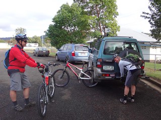
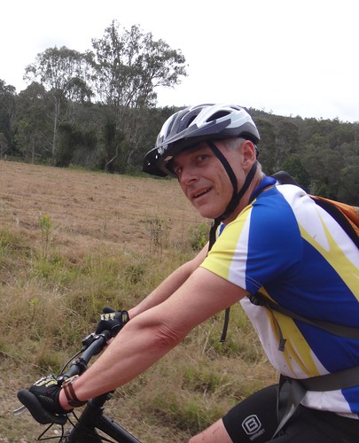
Jaime from Toowoomba Mountain Bike Club kindly agreed to join us for the ride. When exploring new areas, it’s always helpful to bring a local :)


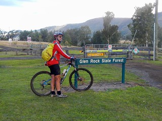
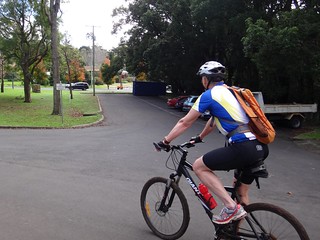
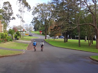
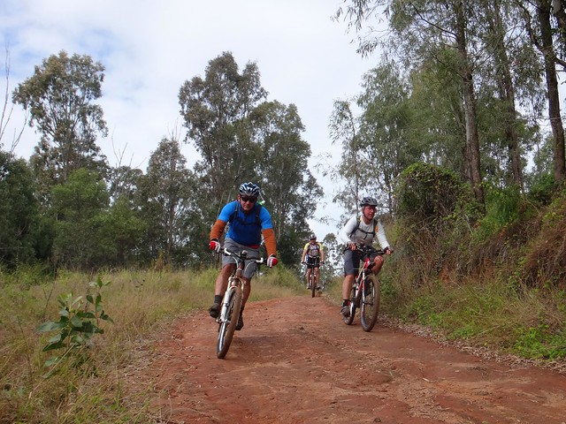
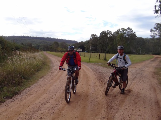
We started our adventure at Withcott – a small town at the bottom of the Great Dividing Range. While heavy traffic whizzes through here trying to pick up speed before climbing up the hill to Toowoomba, our plan was for quieter trails. We rode south from Withcott up some quiet back streets towards Tabletop Mountain. Berghoffer Drive and Tabletop Road are very steep paved roads. If you’re interested, have a look at the Google Street View link here. We slowly ground our way to the top of the road, wondering what we had got ourselves into.


Up, Up, Up

But as any seasoned Mountain Biker will tell you (especially if Road Bike riders are within ear-shot), paved roads, even steep ones, are nothing compared to the challenge of off-road climbs.


Up, Up, UpUp, Up, Up

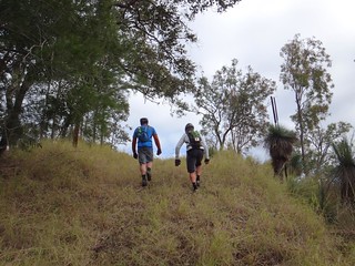
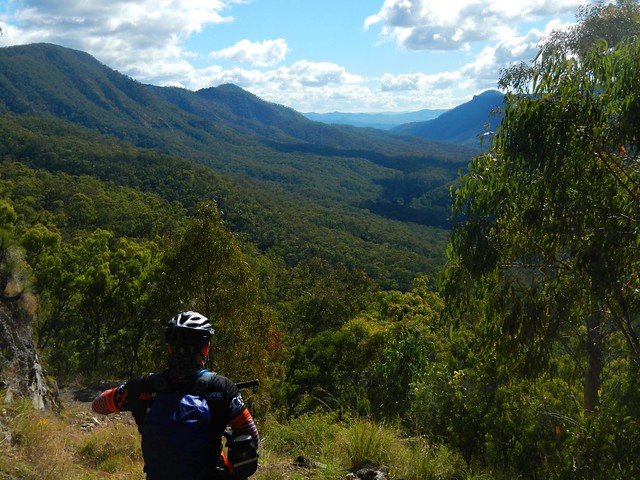
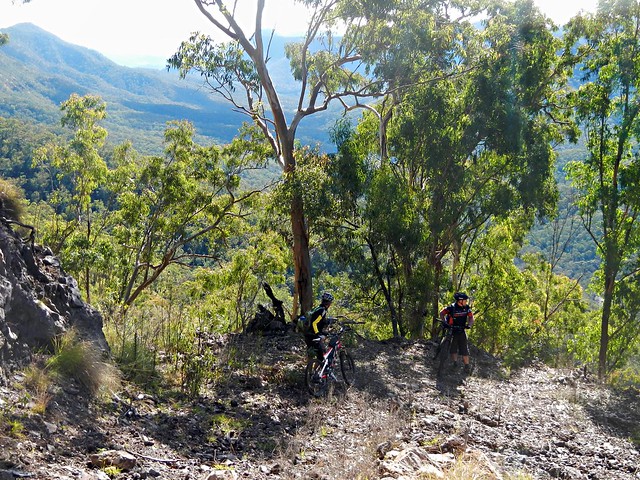
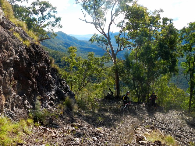
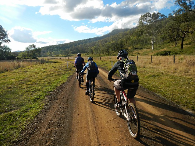
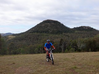
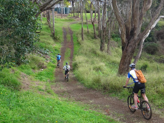
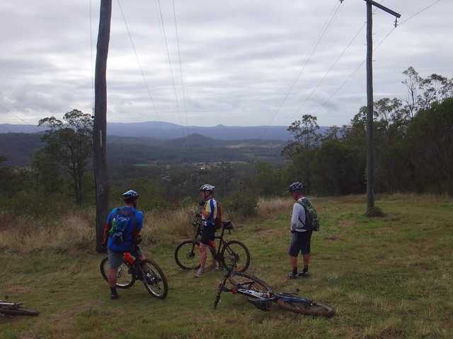
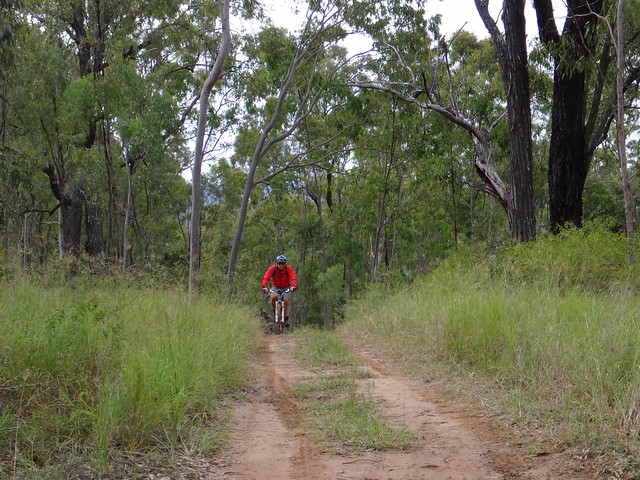
We slowly climbed up the range – sometimes pedalling, mostly pushing our bikes upwards.


Enjoying the View

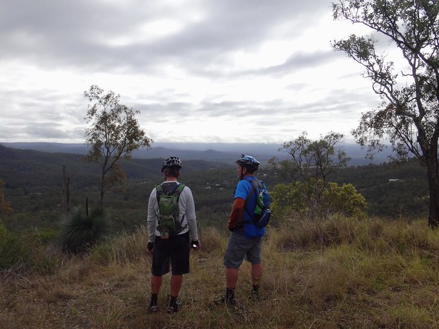
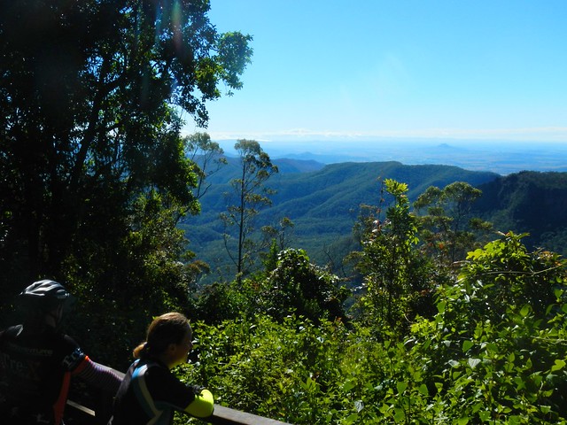
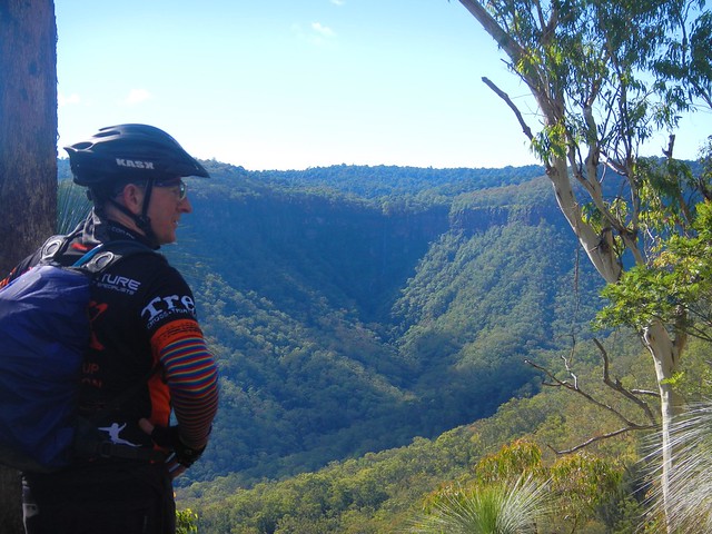
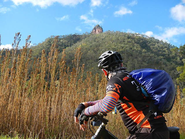
The views to the east were delightful.


East Street ToowoombaEast Street Toowoomba


My brother-in-law, Paul, lives in Toowoomba, and met us at the top. We carefully scurried across the busy Warrego Highway at the top of the Range and made our way towards Jubilee Park.


Bridle Trail - Jubilee Park

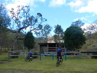
Jubilee Park is a mixed-use reserve which sits on the edge of the mountain stretching down the hill from Prince Henry Heights and Mount Lofty towards Withcott.


Track Sign

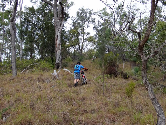
It boasts a variety of single tracks downhill runs, and a “bridle trail”. Because of recent rain, we decided to avoid the single tracks, and rolled down the hill along the bridle trail.


Powerline Track

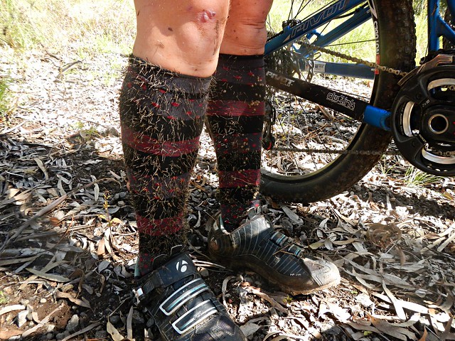
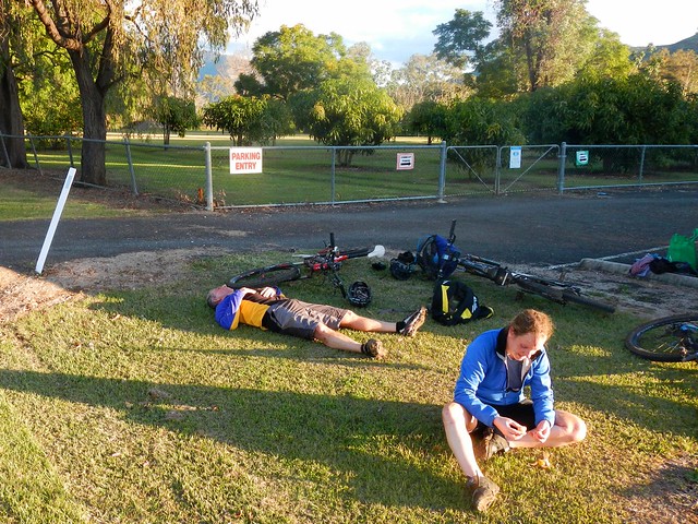
We had more great views on the way down, but the sticky mud quickly collected on my wheels and totally clogged them up. I had to pull out handfulls of mud from the wheel arches and chain stays just so I could get the wheels turning again.


Picnic Shelter - Jubilee ParkPaul


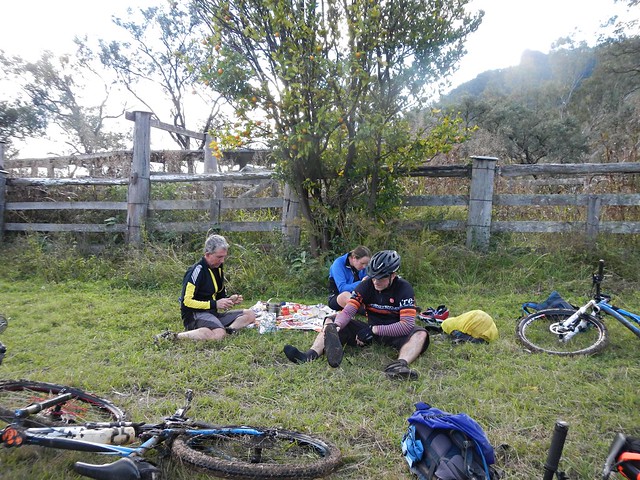
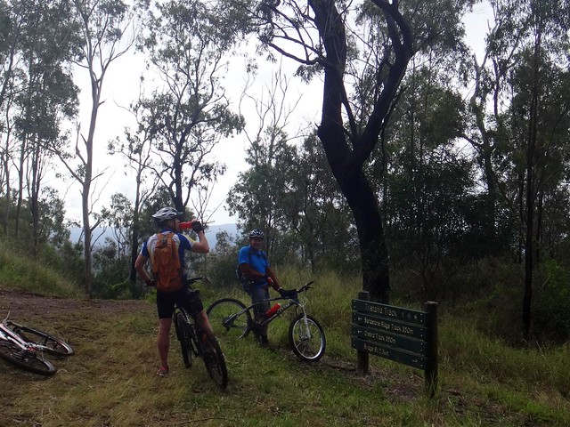
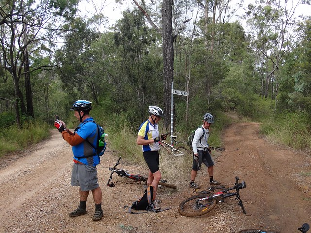
When we reached the bottom we took a few minutes out at the picnic shelter to scrape off the rest of the mud and prepare for the next big climb. I was a bit worried about Paul. He had only ridden a bike once in the last year because of an injury, and I wasn’t sure how he’d cope with the next bunch of steep muddy hills.


Wallens Road

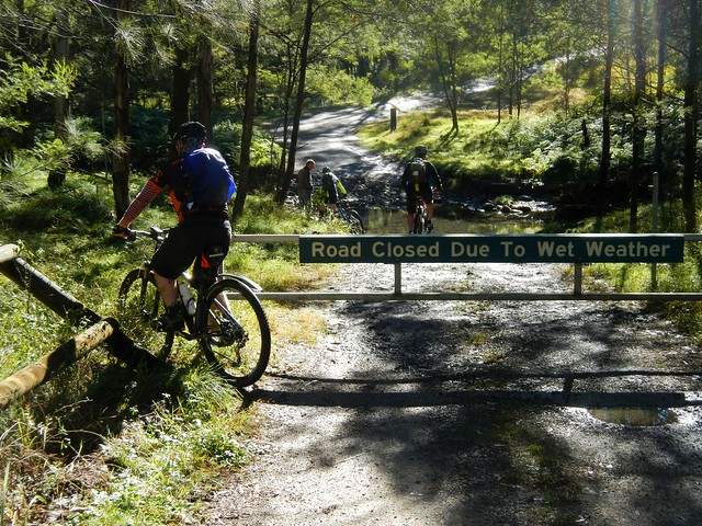
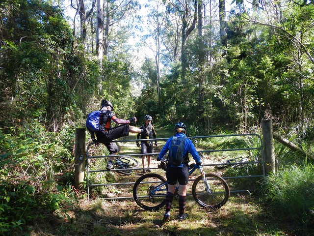
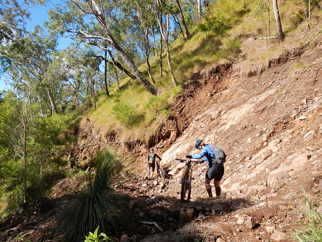
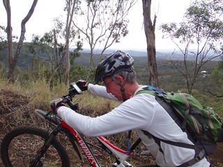
Wallens Road winds back up the range from Withcott to the railway siding at Ballard. There are very few flat sections. It’s all either uphill or down. In wet weather, most of it is muddy.


Ballard

We slid down several precipitous slippery tracks, and heaved the bikes up some equally challenging slopes before finally emerging to the luxury of reasonably graded dirt road. Jaime assured us we were only 15 minutes away from our lunch stop at Spring Bluff, so Paul put in a quick call to Karen to drive down to pick him up and meet us for lunch.


Well Done Paul!

The short drive up to Spring Bluff Railway Station involves a nasty little 25% climb. The thought of lunch kept us turning the pedals. Paul had an added incentive as Karen was watching. Well done, Paul. That was a great effort for someone who hasn’t been on the bike much lately.


Spring Bluff Cafe

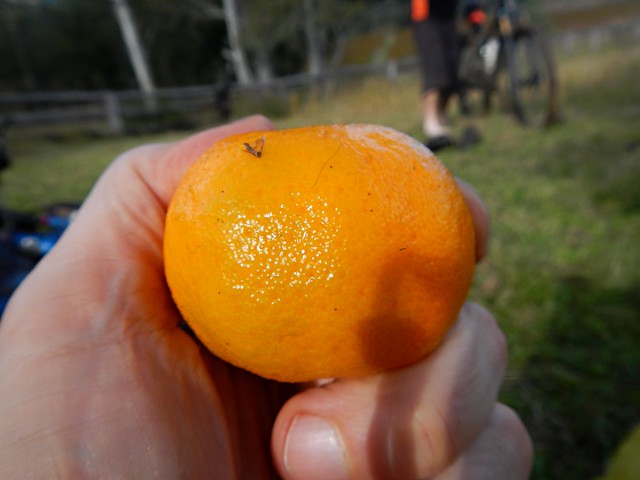
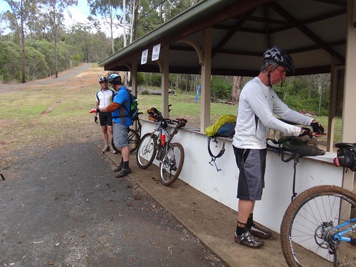
Eric often says “Hunger makes the best sauce”. I agreed with him as I inhaled my delicious burger.


Spring Bluff Railway Station

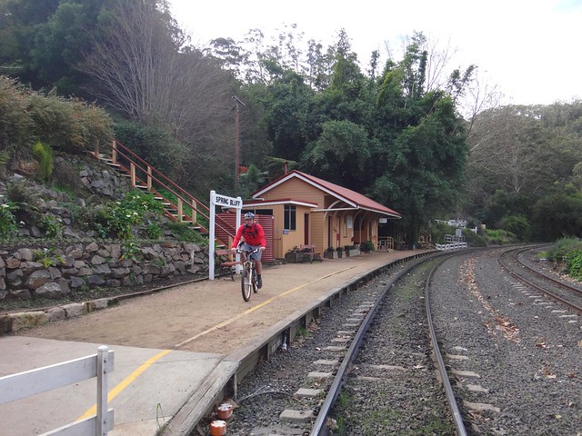
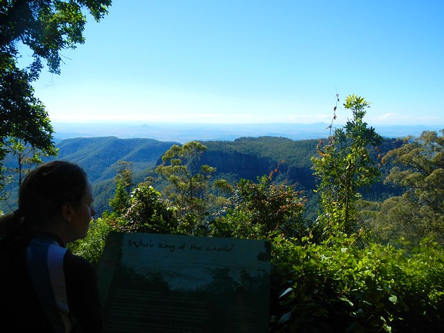
The railway line up the Main Range was constructed between 1864 and 1867. Highfields Railway Station was important because it served as a watering stop for locomotives struggling up the range, and was a loading point for Timber and Dairy products from the Highfields area. Railway Commissioner Gray was particularly fond of the area, and renamed it “Spring Bluff” in 1890. In its heyday in the 1900′s, the station handled over 5,000 passengers per year.


These days it’s much quieter, although you can still sometimes catch a steam train to Warwick.


Green Gully Road

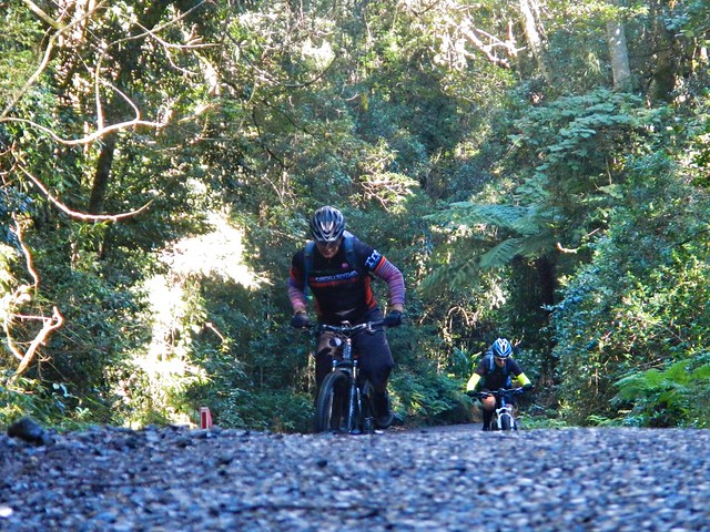
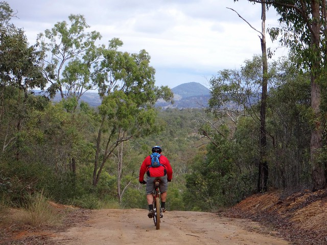
After lunch we enjoyed a leisurely roll down the hill towards Murphys Creek.


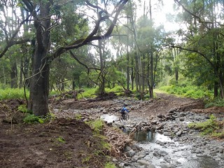
Then, heading into the bush along “Green Gully Road”, we made our way towards the Bicentennial National Trail (BNT).


Horse RiderHorse Rider

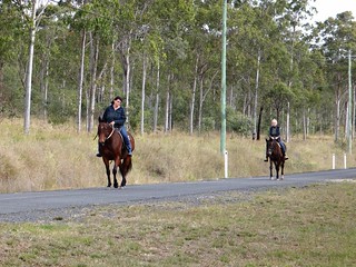
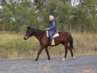
It’s always nice to meet fellow travellers on the trail. I don’t often see bikes like this though :)


Glorious Mud

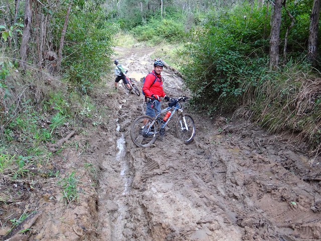
The gruelling mud on Green Gully Road made progress very difficult. We couldn’t ride much of it, because the mud stuck to the wheels. In fact even when I pushed the bike, the wheels became clogged with mud. So I carried it. It was hard work, but I laughed about it – even a muddy day on the bike is better than a day indoors.


Gittens Road

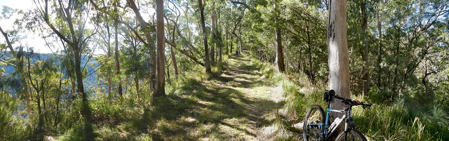
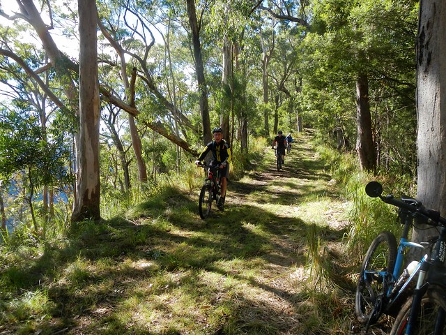
We eventually reached the BNT on Stevens Road and enjoyed a few precarious downhills on the homeward run towards Withcott.


It might look like a quiet country lane, but this trail is an important route stretching from Cooktown to Melbourne down the great dividing range. I often wonder who has recently passed by on their way north or south.


Bike Wash

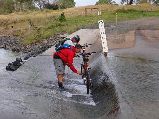
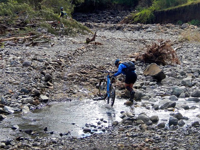
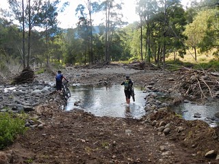
Before finally arriving in Withcott, we washed the mud off the bikes in a flooded causeway. Eric seemed surprised when I joined in because it meant getting my feet wet.


We rode just over 50km in 7 hours. It was slow going. We climbed about 1,600 metres and I burned about 3,500 kcal.


I’d rate this one 8 out of 10 on the tough-o-meter.


A word of warning though – the mud makes it very difficult after wet weather. The climbs would be difficult in summer. This is probably a ride you’d want to try in the drier, cooler weather of early spring.


Thanks Eric, Jaime and Paul for yet another fun adventure!


Sunday, June 23, 2013

Glenrock

Read More

East Haldon Valley


Todays adventure was a point-to-point ride from Goomburra National Park (near Cunninghams Gap) to Mount Sylvia. I wanted to fill in another gap in my Ride Network Map, and Becca, Eric and Darb were kind enough to indulge my whim and ride with me. We’ve ridden in Goomburra before, and were familiar with the steep climb up to the top of the range, peaking at about 1,100 metres above sea level. This was going to be a long day, so we wanted to save some time at the start by driving to the top of the range and starting our ride there…


Carpark - Goomburra


Unfortunately, the road to the top was closed to vehicles – a locked gate blocked the way. So we had to ride our bikes to the top instead.


Steep Road - Goomburra


I thought this was poetic justice. I had recently written an article for The Mountain Bike Life about Hill Climbing in which I enthusiastically described how wonderful it was to ride a bike up steep hills. It seemed like the universe was forcing me to practice what I preached :)


The climb had added an hour’s riding time to our trip, but it was still worth the effort.


Mount Castle Lookout

Mount Castle Lookout


No ride “to the top” at Goomburra is complete without a side-trip to the Mount Castle Lookout, so we left Eric to mind our bikes while we hiked a few hundred metres through the rainforest to enjoy the view. Despite dismal rain the previous day, and heavy fog that morning, it had transformed into a glorious day.


Goomburra Ridgeline Track


From the lookout we turned westward and followed a forestry track along a sharp high ridgeline, jumping a few locked gates as we went. Try doing that in a 4wd :)


Goomburra Ridgeline Track

Goomburra Ridgeline Track


Riding this ridge line is like cycling on a knife’s edge. On either side the terrain drops off steeply. As we rode, on our left and right, we could see the valley below us through the trees.


Blackfellow FallsLookout - Goomburra

Blackfellow FallsLookout - Goomburra


The views up the valley towards the waterfall were stunning. At times like this I’m so glad I’m able to ride a bike in the bush in this part of the world. Doesn’t it look fantastic?


Steep Descent

Eventually we reached the end of the ridgeline. It was time to drop down into the valley. Our plan was very optimistic. We had based the route on faint track marks we could make out from aerial photos. We were aware that the descent would be steep (up to 50% gradient in parts), and that we’d have to be very careful.


Steep Descent

Yep – it was steep alright. What impressed me was that we were actually able to ride any of it :)


Steep Descent

The views were amazing. We stopped every few minutes to soak up the panorama.


Landslip

Recent wet weather had caused land-slips which impeded our progress. Thankfully we were able to walk over the rubble.


Cobblers Pegs

One thing that was unavoidable, however, were the cobblers pegs. After bashing through the undergrowth for a few minutes, it looked like our legs had sprouted wierd hairs that had poked through our socks. I think it’s going to take ages for me to pick them out of my clothes.


East Haldon

Eventually we reached East Haldon “Road” which follows the creek along the valley. I use the term “Road” lightly. It was a rough track to follow.


East Haldon

The track took us past a place on the map known as “Top Yards”. I’m guessing this was a place where graziers kept cattle in earlier times.


East Haldon East Haldon


We had to cross the creek many times. Initally I tried to “rock hop” and keep my feet dry. Eventually I just hardened up, and waded through the water.


Groundhog's Cafe

Eric surprised us. He had told me that he was carrying climbing rope in his frame bag for our precarious descent. But actually he was carrying a gas stove and picnic blanket. When we caught up to Eric at the “Bottom Yards”, he had the water boiling, picnic blanket spread out, coffee and hot chocolate rady, and even some short-bread.


We were cold and hungry. What a pleasant surprise!


Thanks for being so thoughtful, Eric.


Wild Mandarin

As an added bonus, we were sitting under a mandarin tree laden with fruit. We were able to pick some ripe mandarins to enjoy with our lunch. They were delicious!


Here’s Darb’s video of our lunch “surprise”:


Groundhog’s Bottom Yard Cafe from Darb Ryan on Vimeo.


Glenrock

As we rode out of the valley, a prominent rocky outcrop came into view. This is “Glenrock” – it’s what the state forest is named after.


Day Use Area - GlenrockGlenrock State Forest


After countless creek crossings and what seemed like an eternity of rough tracks, we finally made it out of the state forest.


It had taken us over 4 hours, and we’d only ridden 25km. Hard work. That must have been the slowest 25km I’ve ever ridden. In fact I’ve done faster hikes than that.


East Haldon Road

The rough tracks became smooth dirt roads. While we still had about 30km to go, the toughest part of the ride was over, and we were able to enjoy a smooth, fast, ride to Mount Sylvia.


End of the Ride


It had taken us over 6 hours to ride 50km. We were delighted to reach our destination and relax.


We climbed about 860m during this ride, and descended about 1,400m. I burned about 3,000 kcal. We took a vote at the end of the ride and decided this one rates about 8 out of 10 on the tough-o-meter.


If you’re going to try doing it, be prepared for very rough country. There are no groomed trails out here. In places the track is difficult to see. And (of course) the descent from Goomburra is dangerous, so take care.


Thanks Becca, Eric and Darb for a great day out.


Thanks also to Mike for driving us out there, and to my dad, Bruce, for helping me get the Van out to Mount Sylvia the day before.


Point-to-point rides take a bit of extra planning, but they’re worth the effort!