Please note: you can find a more up to date version of this blog at http://blog.neilennis.com

Saturday, June 25, 2011

Lake Manchester

Read More

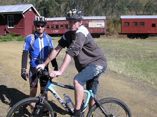
Earlier this year I rode to Lake Manchester. Today I thought I’d try it again, but with a riding buddy.


I’m really glad I did – riding with Mike today had some major advantages:

1. Better photos (it sucks trying to take photos of yourself)

2. It’s safer (if something happens, someone else is there to help out)

3. Better performance (Mike is a better rider than me. He rode up hills that I’d normally walk up, so I tried riding up instead, and I made it!)


Rock Sculpture

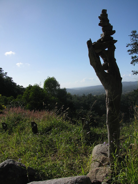
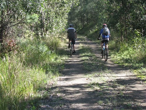
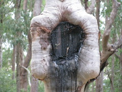
The first leg of the ride out of Samford led us up the Goat Track, home of some wierd and wonderful rock sculptures. Some of them have been knocked down, so some bright and budding artist decided to build their sculpture in a tree. Art knows no bounds :)


Light Line RoadCamping Shelter

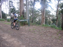
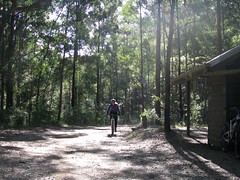
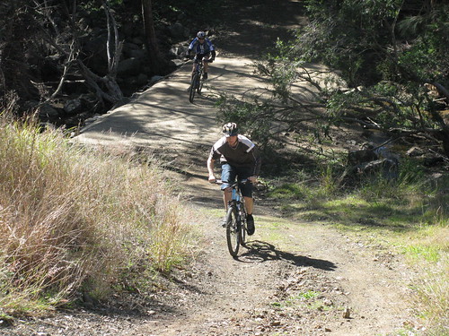
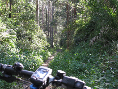
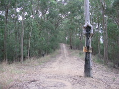
After our 10km climb, we rode down Light Line Road, which is a 10km descent down to Lake Manchester. Along the way we passed this camping shelter. I think I might come back here with Harrison one evening and try an overnighter :)


Lake Manchester

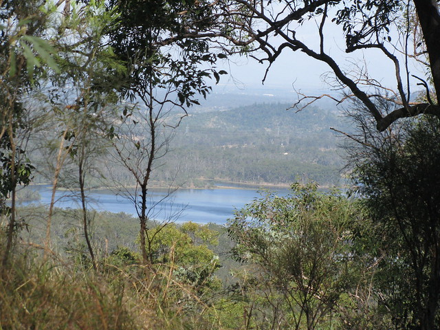
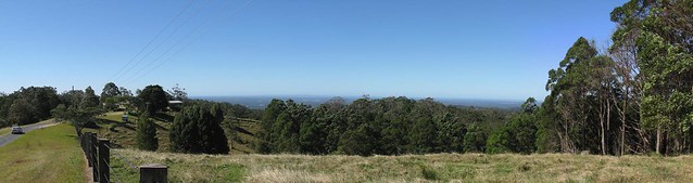
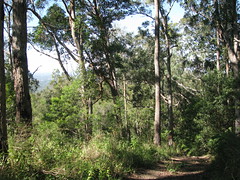
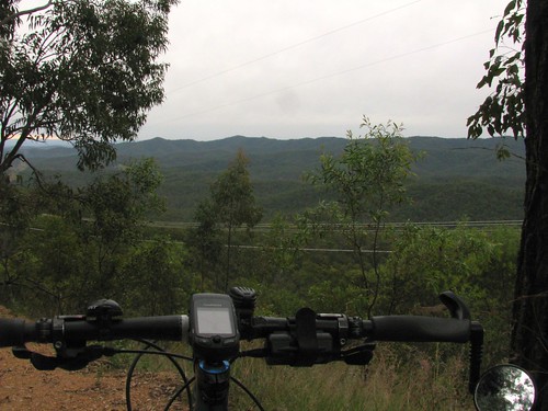
Some of the views on the way down are fantastic, and we had to stop and take the photos. Mike commented that you can never capture the magnificent panorama with one photo, and he’s right. There are some magnificent views of the lake.


Creek CrossingBilabong

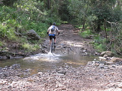
Once we reached the bottom there were (what felt like) dozens of Creek Crossings to ride through and one or two beautiful Bilabongs.

Bilabong

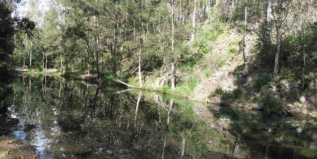
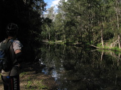
I think this Bilabong on Cabbage Tree Creek would be great for a swim in summer!


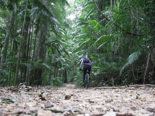
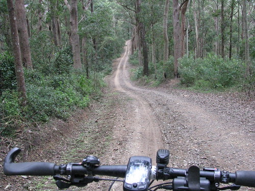
From there we started the long climb up Creek Road to South Boundary Road. Then a quick run down to the creek crossing on Centre Road, and another long slow climb up Centre Road to the bitumen on Mt Nebo Road. We then rode down to Bellbird Grove, before one final long steep climb up Link Road in Camp Mountain before rolling, exhausted but happy, back into Samford.


Check out some of those hills!


The GPS got it wrong. We did almost 56km, with about 1,800m of vertical ascent. I burned up about 4,500 calories, which is the equivalent of about 10 Big Macs.


On the tough-o-metre I’d give this one nine out of ten. The three climbs up Creek Road, Centre Road, and Link Road were tough. Yes. I’d definitely do it again.


Sunday, June 19, 2011

Blackbutt

Read More

A couple of years ago I rode up the Brisbane Valley Rail Trail from Moore to Benarkin. I rode it again today with Lachlan and Isaac. The trail follows the route of an old railway line up the mountain to Blackbutt.

Linville Station

Today we started at Linville. There’s a train at the station, but it’s not going anywhere as the railway line on either side of it has been removed.


Rail Trail

Although the trail climbs about 500 metres, it’s a gentle gradient, which makes the ride really easy for most of the way.


Creek Crossing

There are a couple of places where the railway bridge no longer exists, so there’s a steep descent down to the creek bed, and back out again. It just adds to the fun.


Eventually we reached the top and had a great lunch at a cafe in Blackbutt. Then we explored some of the dirt tracks that ran through the forests to the west of the town. This was fun as the slopes were much steeper than the easy gradients we experienced on the way up, so we were able to pick up a lot of speed down some of the long hills.


The trails finally met up again with the rail trail, and we enjoyed a pleasant 20km descent down the hill back to the car.


Last time I did this ride (Nov 2009) I found it a bit of a challenge as I’d only just started riding. This time I found it really easy. I’d probably give it a score of 4 out of 10 on the tough-o-metre, but 10 out of 10 for fun.


Saturday, June 18, 2011

Mt Mee – Wamuran

Read More

I’ve been reading Gillian Duncan’s book “Where to mountain bike in South East Queensland” and decided to try out one of the trails in that book today. Starting at Mt Mee, I followed some dirt tracks down to the Wamuran Rail Trail, then rode back up the mountain again via some more dirt tracks. All up it was a tad over 31km, but it was hard work, which made it a lot of fun!

Pedwell Road, Mount Mee

I started from Pedwell Road, Mount Mee, which winds down past a few farms with excellent views like this one.


Eventually Pedwell Road turns into a dirt road, which turns into Williams Road:

Glass House MountainsWilliams Road

Williams Road is incredibly steep in some parts. I was going downhill, and if I was riding with some buddies, I would have attempted it, but an over-the-bars out here wouldn’t have been much fun, so I walked down some of the steeper inclines.


Wamuran Rail Trail

At the bottom of the hill, it wasn’t far to the Wamuran Rail Trail which meanders through some beautiful rain forest following the trail of an old railway track.


Eventually it was time to follow the “Trail” signs back up the mountain along McLeods Road. I think whoever nailed up the signs had some new understanding of the word “Trail” because it was more like a scramble up a very steep rocky hill – difficult to walk up with a bike, let alone ride up. Even so, it’s worth the effort.


All up a loop of 31.3km, with about 750m of vertical ascent and just under 1800 cal. On the Tough-O-Meter, I’d rate this 9 out of 10 because of the really treacherous downhill on Williams Road, and the crazily steep “trail” back up on McLeods Road.


Saturday, June 11, 2011

D’Aguilar National Park

Read More

D’Aguilar National Park is spectacular – even on a bleak. cool, cloudy day like it was today.


I rode up “The Goat Track” headed for Mount Glorious, then set off down Joyners Ridge Road.

Joyners Ridge Road

The cool rainforest at the top of Joyners Ridge Road at Mount Glorious is a delight to roll through on the bike.


All up it’s about a 10km descent to the South Branch of England Creek at the bottom. Enjoy the descent, because once you get to the bottom of the hills, you have to go up!


Goodes Road

Goodes Road is a steep fire trail that climbs 550m in 5km from England Creek back up to Mount Glorious.


I must confess I took this photo, not because I was impressed with the view, but because I needed a rest.


That climb is hard work!


In hindsight, the view is pretty good too :)

Tree Swallows SignTree Swallows Sign (Close up)

At the top of Goodes Road there’s a strange looking spotted gum that has a couple of signs on it.


The strange thing is that it looks like it has grown over one of the signs so all that’s left is a square “lump” in the trees “throat”.


Dare we hope that the trees are taking over?

Dundas Road

Once I managed to climb back up to the top of the hill, Dundas Road provided a really pleasant ride along the ridge top back to Mount Glorious.


This is a fun ride after the hard work of the climb – quick easy trails that wind through the rainforest, with Bellbirds tinkling in the background.


All up this ride was just over 35km, with 1240m of ascent and almost 3,000 kcal. It was hard work, but a lot of fun!


Thursday, June 02, 2011

Clear Mountain Hill Climb

Read More

One of my favourite mountain bike challenges is climbing some hills in Clear Mountain State Forest.


It’s a beautiful spot with a few creeks winding through it, tinkling Bellbird calls, and lots of different Eucalypts. But the hills are steep, and often muddy. It’s a test of strength and technical ability to climb them, which is why I keep coming back. There’s always another hill to try and beat.


This afternoon I took Liz’s camera, put it on the ground at strategic spots, and filmed myself riding by. But this time I passed some women hiking through the forest. I didn’t want them to think I was doing anything creepy with the camera in the forest, so I explained what I was trying to do. They kindly offered to help me film the hill climbs, and this video is the result.


I didn’t realize till I got home that while my back was turned they added some funny extra footage of their own.


Thank you, strange ladies of the forest. It was fun having spectators watch me have a go at these hills – even if I did conk out on the last hill!