Please note: you can find a more up to date version of this blog at http://blog.neilennis.com

Saturday, July 30, 2011

Cabbage Tree Range

Read More

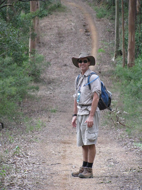
As part of my plans to take some friends on a ride over the D’Aguilar Range in a few weeks, I thought I’d investigate a bit more our planned route.


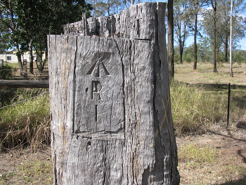
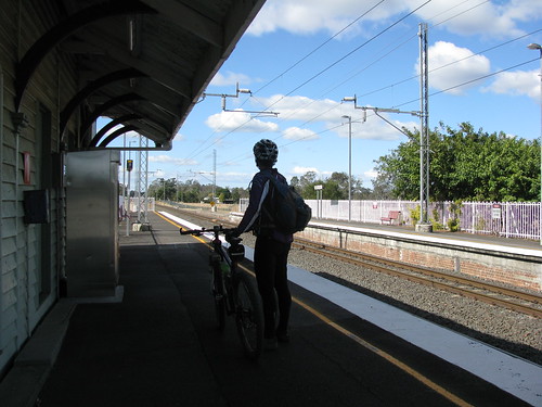
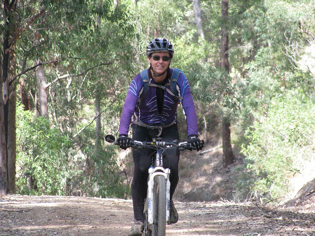
A riding friend, Dean, kindly offered to ride with me, and we met up at the Dundas Road water tower.

Dundas Road Water Tank

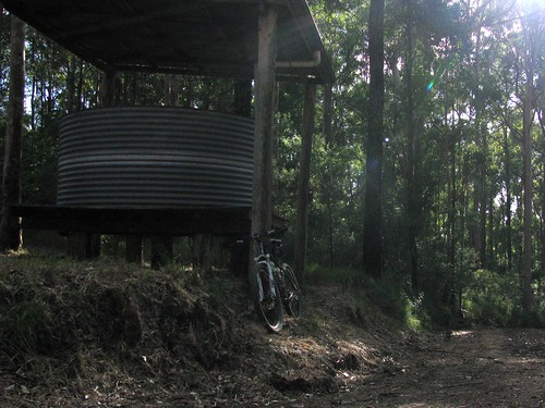
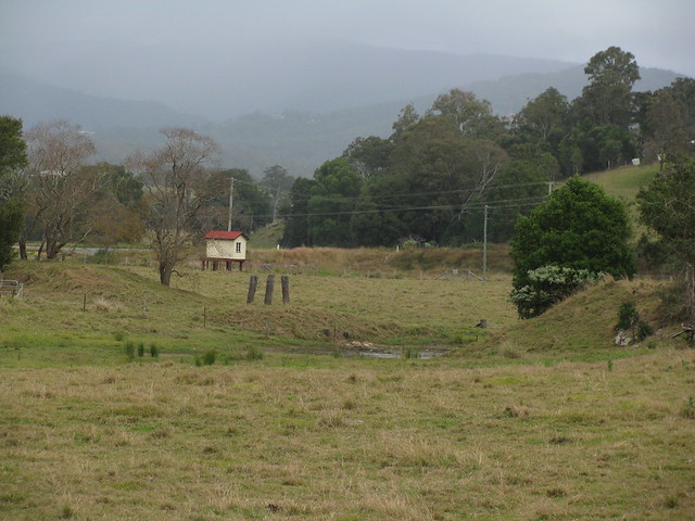
There are a few shelters like this throughout the forest, using a rain tank to provide emergency drinking water to hikers and mountain bikers. If you pass by here in the afternoon you’ll often see hikers setting up camp for the night.


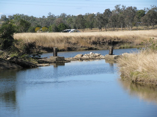
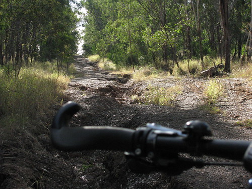
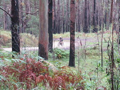
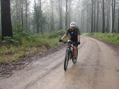
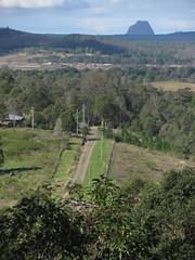
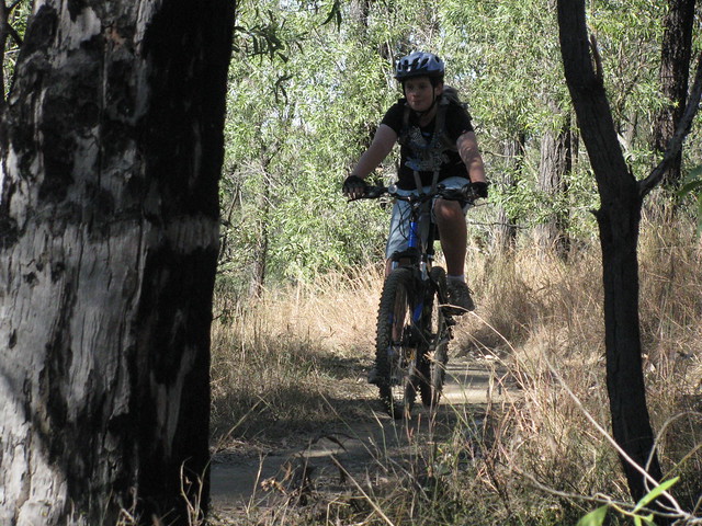
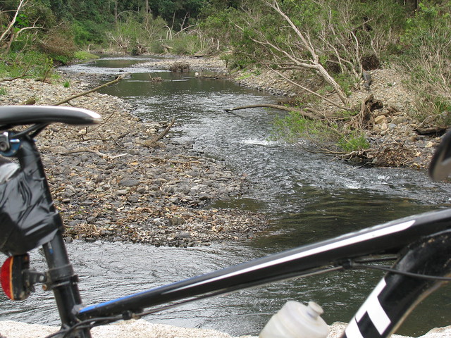
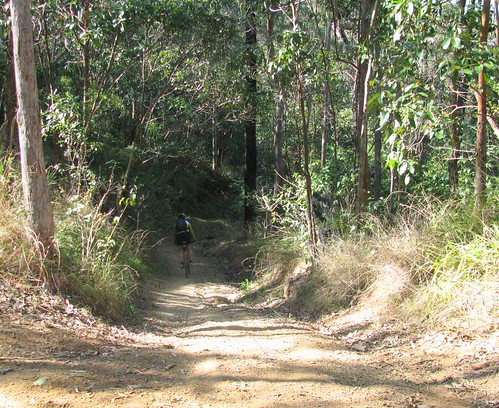
After a long, steep, and loose ride down Dundas Road, we eventually hit the bottom of the range.

Banks Creek Road

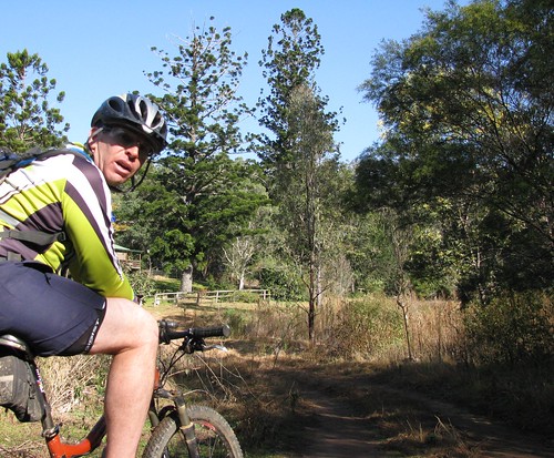
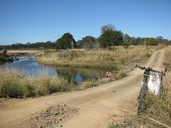
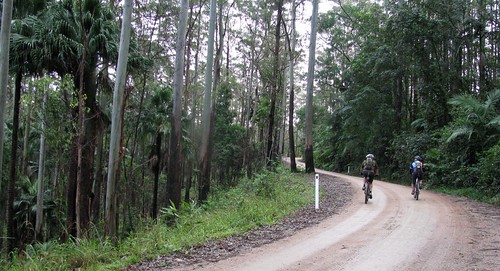
Banks Creek Road starts from the bottom of the D’Aguilar Range and can take you all the way to Fernvale, north-west of Ipswich. We’ll be heading down here in a few weeks. For today, I just admired the old Hoop Pines (Araucaria Cunninghamii).


Down, down, down...

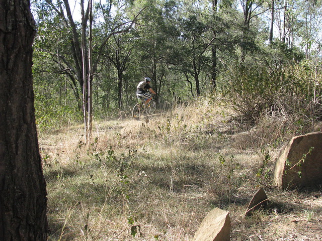
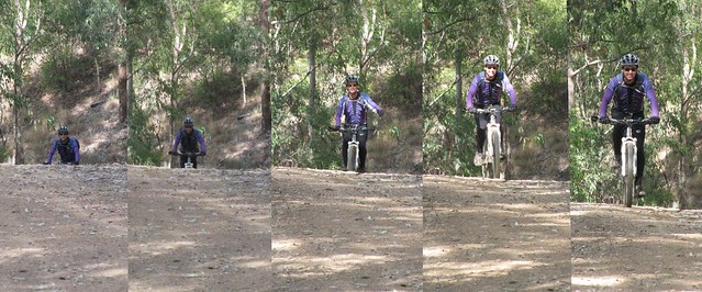
Here’s another steep descent. With more skill, and dual-suspension, Dean flew down most of the hills and over the water bars. I was more circumspect, and often ended up just eating his dust. In fact, I lost traction in one spot and fell off, but luckily I was going pretty slowly and only suffered a few minor scratches and loss of pride :)


Lunch

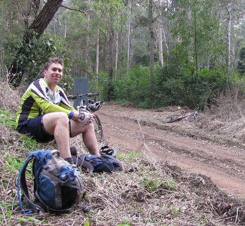
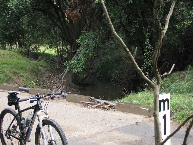
Eventually we reached the bottom of Cabbage Tree Range Road, which is where we stopped for lunch – after riding in the forest for a few hours, you really work up an appetite.


Dean rode a total of about 100km today and chewed through three toasted cheese and bacon sandwiches and numerous jelly snakes.


A vehicle which runs on toasted sandwiches and jelly snakes – who would have thought????


King of the Hill

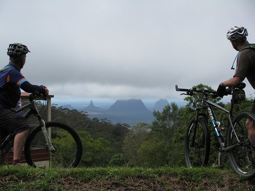
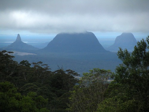
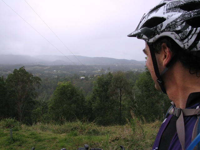
I rode up Cabbage Tree Range Road today non-stop.


It’s a 7.5km climb which gains about 500m in altitude, and takes about an hour.


Last time I rode this, I had to walk some of the steeper bits. Today I kept my head down, kept pushing the pedals, and nailed the hill!


Enjoying the Ride

I really enjoyed today’s ride, and felt great having nailed that last hill. Unlike Dean, I only rode 37km, but ended up climbing almost 1,500m, and burned about 3,500 kcal. On the tough-o-meter I’d give it 8.5 because of the long climb.


Saturday, July 23, 2011

Fernvale

Read More

I spent today exploring some trails south of Fernvale because I’m planning to visit here in a few weeks with some friends on an over-the-mountain 80km ride from Ferny Grove Railway Station. Since this section will be the final part of the ride, and we’ll probably have a few tired riders, I thought it would be worthwhile to double check the area to make sure everything was ok.


The original plan was to follow the Railtrail south from Fernvale. The problem is that this area had some very heavy rain earlier this year, and parts of the trail are still being repaired, and are unrideable.

Missing Bridge

Missing BridgeRail Trail Closed

As you can see in the photos, the Railtrail bridge had been washed away, the creek was too deep to cross, and the trail was closed. So when my original plan was foiled by the “Trail Closed” sign, I had to improvise and find a new route!


I headed off down a gravel road and took some wrong turns which found me at a few dead-ends in the middle of a couple of horse paddocks.

By Road

Eventually, I persevered down a track called “By Road” which my GPS insisted was there, but which just appeared to be more paddocks with thick grass, scrub. logs and spider webs. I persevered and eventually scrambled out the other side on a “real” road.


Coach Lane

Some of the roads aren’t as imaginary as By Road, but they’re still quite rough. But that’s what makes them so much fun to ride on a mountain bike.


The gravel roads and tracks continued south to Haigslea, just off the Cunningham Highway.

Haigslea Cemetery

Commemorative PlaqueHaigslea Cemetery

In the mid to late nineteenth century Haigslea was settled by German migrants. Some of them are buried in this cemetery.


St Pauls Lutheran Church

Here’s a picture of the original church around the turn of the century. While the girls in the white dresses may no longer be there, the pine trees are still on the corner where the road meets the highway as you drive to Toowoomba.


Survey Tree

This blazed survey tree is across the road from the cemetery.


I followed the road which comes to an end and turns into a track, and then into a lovely bit of single trail which winds into the town of Walloon, where we’ll be catching the train in a few weeks :)

Walloon Station


All up, about 60km, with 750m of ascent, and 2500cal. I’d give it about 6.5 out of 10 on the tough-o-meter. It’s an easy pleasant ride, which is perfect for when I bring a few friends next month.


Sunday, July 17, 2011

Bellthorpe

Read More

Today I had a great time riding with some buddies from the MTBDirt mountain biking forum. Ron, Eric and I decided to explore Bellthorpe State Forest north-west of Woodford. It was hilly, muddy and beautiful.

Climbing through the ForestMade it!

Climbing through the Forest

The ride started with a long slow 10km climb up Stony Creek Road as we gained an extra 500m in elevation to reach the summit of the ride at about 650m. The road is steep in parts, but it’s worth the effort to see some of the spectacular rainforest.


Enjoying the View

Head in the Clouds

At the top we were pretty much level with the cloudline, and were treated to some great views of the Glasshouse Mountains, with Mount Beerwah partially obscured by clouds.


Then it’s a fun descent through the forest to the bottom, along some muddy and slippery tracks.

Eric the Invincible

We were both grateful to Eric for showing us a more enjoyable track through the forest. Eric shows us here what real mountain bikers can do at Bellthorpe. I thought (very briefly) about imitating him, but chickened out.


Creek Crossing

The roads through the forest rise and fall very steeply, and there are many creek crossings like this one, as well as muddy bog-holes where 4WD’s have tried to get through.


Glasshouse Mountains

Eventually we came out the other side of the forest, and had to negotiate one more slippery descent with more amazing views.


BeerwahThe Road to Tibrogargan

All up about 50km, 1200m of climbing and 3,300kcal burned. On the tough-o-meter, I’d give it 8 out of 10 because of the steep, slippery ascents and descents in the forest.


Saturday, July 16, 2011

Freshwater Turtle

Read More

Freshwater Turtle

Freshwater TurtleFreshwater Turtle


While riding by Lake Samsonvale today I was delighted to come across this female Freshwater Turtle digging a hole to lay eggs.


The burrow was about 30 to 40m above the shoreline, so she’d come a long way to dig the hole.


She was about 30cm in size, and had dug a 30cm hole for her eggs.


As I approached, she just froze and looked at me as if to say "Can’t a girl have some privacy?"


So I took a few photos and moved on, feeling very privileged.


Today was just a short ride as Liz and I are going to spend a few hours at GOMA this afternoon :)


Tuesday, July 12, 2011

Three For One

Read More

Here’s a poem I wrote recently as part of a competition on the theme “Making pictures”.


For those of you not in the know, a Triptych is a set of three pictures, each related to a similar subject (e.g. Frederick McCubbin’s “The Pioneer”). So in this poem, I tried to create a set of three pictures, all with similar elements – fire / heat, smoke / smells, wondrous sounds, etc.


Enjoy!


Triptych


Ancient flames crackle on wizened twigs.

I crouch upon the dusty cavern floor.

Wisps of sacred smoke caress my hair

While I make pictures on the rocky wall. 


Dark stick-men chase herds of totem beasts.

My ochred fingers craft a timeless scene.

I dream of victory in tomorrow’s hunt

As Tribal voices chant the mystical songs.


Watcher from a future day,

I am like you.

I live and love.

I laugh and dance.

I weep and wonder in the dawn of time.


Holy candles flicker on the altar.

I stretch beneath the vaulted chapel ceiling.

Pungent incense wafts through hallowed halls

While I make pictures on the plaster wall. 


Angels and patriarchs pause in pious pose.

My paint-stained fingers deftly dab and brush.

I dream of eternity and creation’s span

As choral voices echo from the walls.


Watcher from a future day,

I am like you.

I gasp in awe.

I gaze at stars.

I long for answers to eternal questions.


Brilliant sunlight pierces through the clouds.

I stand atop a mountain’s forest glade.

Eucalypt and wattle tinge the air

While I make pictures through my camera lens. 


Exhilarated hikers in the frame,

My sweaty fingers click and twist the dials.

I drink the pristine glory of this place

As bird songs warble in the forest air.


Watcher from a future day,

I am like you.

I conquer hills.

I walk long paths.

I drink the splendour of our world.


Monday, July 11, 2011

If it is to be…

Read More

Harrison and I decided to check out Mount Joyce Recreation Park yesterday.


It’s built on the shores of the new Wyaralong Dam between Beaudesert and Boonah, and has some great Mountain Biking trails.


We really enjoyed the trails, but I made a couple of big mistakes that caused us some major problems….


Harrison at Mt Joyce

Harrison at Mt Joyce


After riding down some beautiful long, smooth, winding downhill single-track, we ended up at the bottom of the hill at a junction of a few different tracks. It was getting late so we thought we’d follow a service road west in the hope of getting back up the top of the hill for one more ride down. The only problem was the service road west just kept going west. After half an hour, it was getting close to sunset, I was worried about it getting dark, but made the mistake of pressing on in the hope the trail would brng me out on the road for a quick ride back.


I failed to take into account that I had an 11 year old boy, so the riding would be slower than usual. Plus I failed to factor in that these were new trails – I didn’t have any of the tracks in my GPS.


Another half hour and it was totally dark. We were in the middle of the bush, with no maps in the GPS on trails I knew nothing about, and all I had was a little night rider light and tail light. Harrison was upset, cold, and tired. All he had on was board shorts and a tee-shirt. I had a garbage bag in my pack and made a poncho out of it to keep him warm, gave him a spare pair of winter gloves that I also had in my pack and soldiered on.


Thankfully I had a Spot GPS Satellite Messenger (Mobile phones don’t work out there). So I sent an “I’m OK but I’m going to be late message” to let everyone know we were ok.


After another half hour of riding in the bush in the dark and we found a gravel road which we followed to Beaudesert / Boonah road, and headed eastwards back to the park along the main road. Since we only had one set of lights, I made Harrison ride in front of me, so my light lit the road in front of him, and cars approacing from behind could see my tail light.


It took us over an hour riding back along the main road in the dark until we reached the turnoff, back to the Mt Joyce car park, to find the carpark empty except for our van.


Freezing and hungry, we stashed the bikes in the van, and headed back to Beaudesert for a bite to eat.


We eventually got home at 10pm.


I feel bad about this because I made some stupid mistakes. I’ve attached the track log so you know where not to go. (Given enough daylight hours, it would have been a really nice XC ride) The worst thing is I put my son thru a pretty distressing experience. He was in tears, had to walk up some steep (to him) hills in the dark, and had to brave highway traffic on a dark main road. I knew he was upset, but I had to be mean and tell him that crying wouldn’t get him home, and that he didn’t have the luxury of feeling sorry for himself.


“If it is to be, it is up to me” I told him. Plus I made a few Bear Grylls jokes about eating our own poo, or him eating me if I couldn’t make it. It seemed to do the trick.


The best thing is that he did it. I’m so proud of him.


I’m annoyed at myself though.


All up, 55km, about 1,000m of ascent, 3,000kcal and 5 hours on the bike. On the tough-o-metre this one was 10 out of 10, not because of the physical difficulty, but the stress of trying to safely get an eleven year old boy out of the bush in the dark in the middle of winter on unknown terrain.


Sunday, July 03, 2011

Dayboro

Read More

I spent a few hours exploring out the back of Dayboro today. It’s a delightful town surrounded by green farms, areas of thick bush, and a backdrop of imposing mountains.


Terrors Creek

A causeway over Terrors creek, south of Dayboro.


According to local historian, Leith Barter, the creek was named after “Terah” – a grey Arab stallion owned in the 1850′s by Captain John Griffin of the Whiteside Run. In fact the whole area at one time was called “Terrors Creek” but the local postmaster didn’t like the name, saying it sounded too much like “Torrens Creek” so the name changed. The only authentic spelling of the name “Terah” I can find in town is the restaurant “Terah’s” on the main drag. I expect you wouldn’t get far naming a restaurant “Terror’s” would you?


Railway Remnants

The wooden pylons are remnants of a bridge that was part of the old railway line between Dayboro and Ferny Grove.


I think the funny looking hut with cream paint and a red roof is related to the old railway line but I’m not sure.


You can read more about my exploration of this railway line here.


Lees Crossing

Lees Crossing

A causeway at Lees Crossing across the North Pine River just out of Dayboro.


Woodward Road, Dayboro

I followed Woodward road to see where it ended up, and discovered some steep hills, friendly people and great views along the way.


This old road actually used to lead from Dayboro to Esk over the D’Aguilar range.


I’m hoping to see if I can retrace it sometime in the next couple of months – at least as far as the top of the range.


Self-repairing tyres

On the way back I ran over some glass which cut my tyre. Tubeless sealant sprayed everywhere, but after about 5 minutes it sealed up of its own accord, and I was able to pump it up and keep riding.


I originally took this pic as a mental note so I knew where to check for damage when I got home (it’s a new tyre), but I thought it was pretty cool to demonstrate the way the tubeless system works.


I think I’ll dab some “Shoe goo” on the scratch from the outside and top up the sealant. Hopefully the tear will stay fixed. Thank goodness for “Stans No-Tubes”!


All up about 39km with about 770m of climbing, and 1900cal. 6 out of 10 for toughness (It was pretty short, and the only steep climbs were on bitumen). I’ll be back to explore this area again!


Saturday, July 02, 2011

Hiking with Liz

Read More

A few months ago, Liz and I hiked Joyners Ridge Road in D’Aguilar National Park. Today we decided to turn the “tough-o-meter” dial a bit harder, and hiked Lightline Road and Cabbage Tree Range Road.


It started out innocuously enough, with a long descent along Lightline Road and Job 6 Road. Job 6 Road? Who ever heard of naming a road after a book of the bible that talks about anguish and misery? (Is it really that steep?) Or was it the next job on the sheet after Job 5 when the forestry people were building roads?


Branch Creek

After 8km we reached the bottom of the walk at Branch Creek.


Cabbage Tree Range Road

Neil

Liz

And they lived happily ever after...

From there it’s a long steep 6km walk to the top of Cabbage Tree Range Road.


Jinbarra was here

Hollow Tree

The last bit of the walk was along Dundas Road, which has some beautiful old Brush Box trees, one of which I think has some great scars of Aboriginal origin.


All up 17km with over 1,000m ascent, and 3100 cal. About 7.5 out of 10 on the tough-o-meter, mostly because of the climb up Cabbage Tree Range Road.