Please note: you can find a more up to date version of this blog at http://blog.neilennis.com

Wednesday, April 25, 2012

Anzac Day 2012

Read More

England Creek

For our Anzac Day holiday today, my son Lachlan and I rode through D’Aguilar National Park down to England Creek and back up to Mount Glorious. I’ve done the ride a few times in either direction, and I wanted to share the experience with Lachlan.


We started from the bottom of the Goat Track at Highvale, riding up to Dundas Road at Mt Nebo, then followed Goodes Road down to England Creek.


Goodes Road is a fairly steep descent, and I was worried how Lachlan (who hasn’t done much off-road riding) would handle it. Instead of his usual hybrid bike with slick tyres, we put him on a similar bike with more agressive tyres and more powerful brakes to make sure everything went smoothly.

England Creek

England Creek, as always, was beautiful. The water was crystal clear. On this particular route it’s the perfect spot for a quick break, because after this point, it’s about 80 to 90 minutes of uphill climbing.


Hill Climbing

Lachlan nailed the long climb. I was very proud of him :)


Looking West

We took a bit of a breather halfway up Joyners Ridge Road to enjoy the view out towards Wivenhoe Dam.


Rainforest

The rainforest at the top of Joyners Ridge Road is one of my favourite parts of the National Park. It’s a wonderful feeling to ride through the tall piccabeen palms and ancient figs in the green light. It’s also a bit of a relief at this stage to realize that the long climb is finally over.


35km, with 1050m of ascent and 3090 kcal. With todays cool weather and the social pace, this one rates 7.5 out of 10 on the tough-o-meter.


Saturday, April 21, 2012

Lockyer

Read More

Wallers Road

Lockyer National Park and State Forest is located in the hills north of Gatton, between Ipswich and Toowoomba. Gillian Duncan and Mark Roberts mentioned it in their excellent book “Where to Mountain Bike in South East Queensland” so I thought I’d check it out today on a solo ride.


This was a “spur of the moment” ride. I woke up on Saturday morning without a plan, so I ended up picking a ride from the book that appealed to me, and set out rather late, not arriving at the trail head till about 11.30am.

Millers Road

I started the ride at Millers Road on the corner of the Gatton-Esk Road. It has the distinction of passing by one of the newest prisons in Queensland. Rather than stop by this impressive looking Lockyer Valley resort, I slowly made my way up the red dusty road into the national park.

Redbank CreekRedbank Creek

Redbank Creek

The road crosses Redbank Creek Several Times as it winds up the hill for 10km. So if you try this ride, be prepared to get your feet wet. Today was hot (30C / 86F) so I didn’t mind cooling my toes in the water as I rode through.

Logans Road

Wallers RoadWallers Road

It’s a 10km climb and takes about an hour to ride to the highest point – about 550m above sea level. There are one or two parts that are quite steep – especially towards the end of the climb. At the start of the climb, after crossing a few creeks, the road is quite dusty. This was a challenging combination as the water, sand and dust got on my chain making it crunchy and difficult to pedal. Luckily I always bring a rag and a bottle of chain lube in my backpack, and was able to give my chain a wipe down.

Wallers Road

At the top of the hill, I was able to look out over some of the lush farmland towards the D’Aguilar Ranges to the north-east.

Wallers Road

The ride down Wallers Road was a lot of fun. It starts as a gentle descent, getting steeper as you get towards the bottom. Apart from one short climb partway down, the whole descent is about 12km long. The steep bits towards the bottom are really enjoyable. They’re rocky with some loose gravel, and the gradient exceeds 30% in some places – it’s what mountain biking is all about. I had to hang my backside as far out over the back of the bike as I could and take a “controlled skid” over the rocks, trusting my wonderful suspension to smooth out most of the bumps. It was hard to stop smiling as I rode down.

Adare

The last part of the ride was through some quiet back roads near Gatton with some spectacular views towards the Great Dividing Range to the South.


This ride was 45km with about 850m of vertical ascent. It took me 3 hours (excluding stops) and I burned 2,500kcal. I think it rates about 7.5 out of 10 on the tough-o-meter. There’s a tough climb and a technical descent, but it’s an enjoyable ride. The only downside for me was having to do the last few km on the busy Gatton-Esk Road.


I might come back here again and see if I can eliminate some of the bitumen road towards the end – I think it would make an excellent social ride.


Allow 90 minutes if driving from the Brisbane CBD – or 2 hours from the Northern Suburbs.


Monday, April 16, 2012

Border Ranges – Deans Pictures

Read More

Dean the Diesel

In my last post I mentioned that my friend Dean successfully completed the 90km Border Ranges Loop, and managed to match our 4wd speed-wise over the last 5 km.


This man is like a diesel engine – he just keeps going. Plus he has a strange ability to get out of bed really early to get to the start point of a ride.


Here’s some of his pictures of his ride on the same day. It overlapped ours for part of the way, but when the weather got wet – he decided to stick to the original plan :)

panorama-1

panorama-2

panorama-3

panorama-4

panorama-5

panorama-7

panorama-8

panorama-10

panorama-13

panorama-15

panorama-16

simes-rd


panorama-6


View Larger Map


Sunday, April 15, 2012

Border Ranges

Read More

Ridgeline

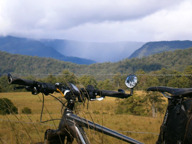
Like its name suggests, the Border Ranges National Park is a mountainous area of rainforest on the border of NSW and Queensland, just south of the border. It rises above 1,100 (3,600ft) in places and is covered with thick lush rainforest, towering trees and fast flowing streams.


The area is the traditional country of the Githabul Aboriginal People. It covers some of Australia’s most scenic country covering a number of natonal parks amd state forests around Kyogle, Woodenbong and Tenterfield, such as Koreelah NP, Mount Clunie NP, Richmond Range NP, Mount Northofagus NP, and Mount Lindesay State Forest.


Our plan was to start an 80km loop at the north-western edge of the park, head south towards Kyogle, then loop back northwards through Lynches Creek. This was quite ambitious considering we had to drive two and a half hours to get there in the first place, and considering the fact that that I find it very difficult to get out of bed early.

Simes Road

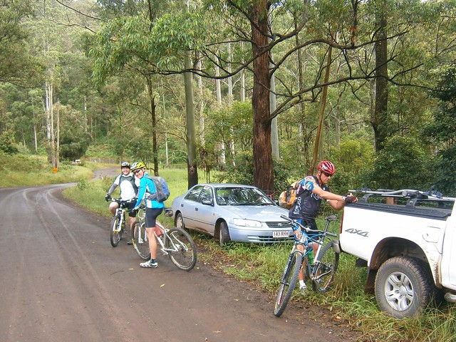
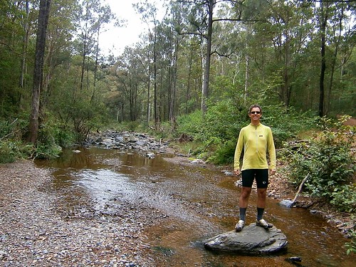
We arrived at the starting point, Simes Road, at 9:30am – a little later than we had anticipated and were optimistic we could make good time if we kept the pace up.

Tweed Range Road

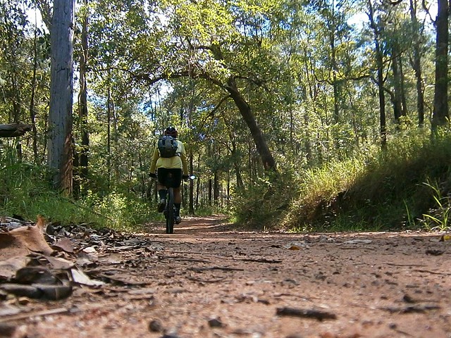
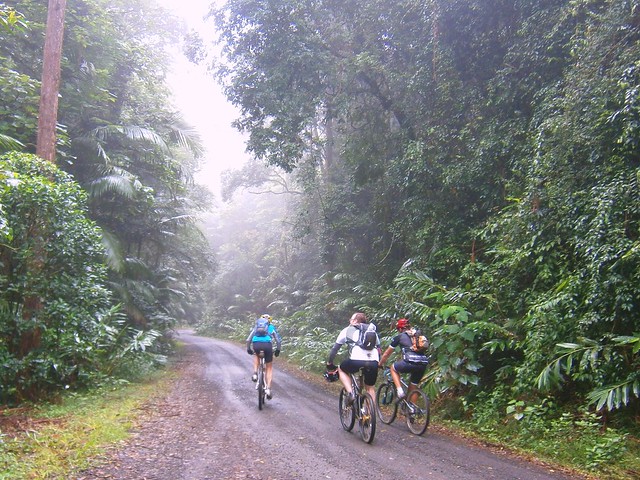
The roads were muddy from the overnight rain. Being from the UK, Adi was used to wet tracks, and showed us how the Brits handle mud by popping a wheelstand while riding up one of the steep hills.

Border Ranges National Park

(Photo by Nick Mills)


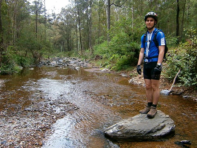
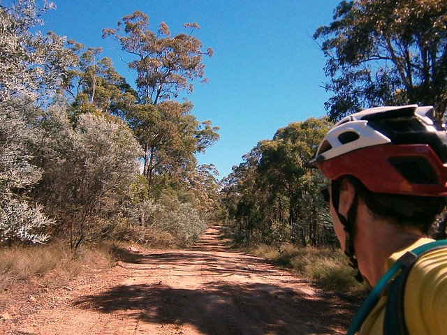
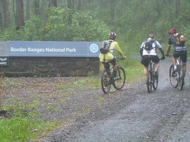
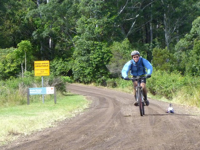
After about half an hour climbing, farmland gave way to rainforest as we reached the entrance to the National Park.

Resting in the Mist

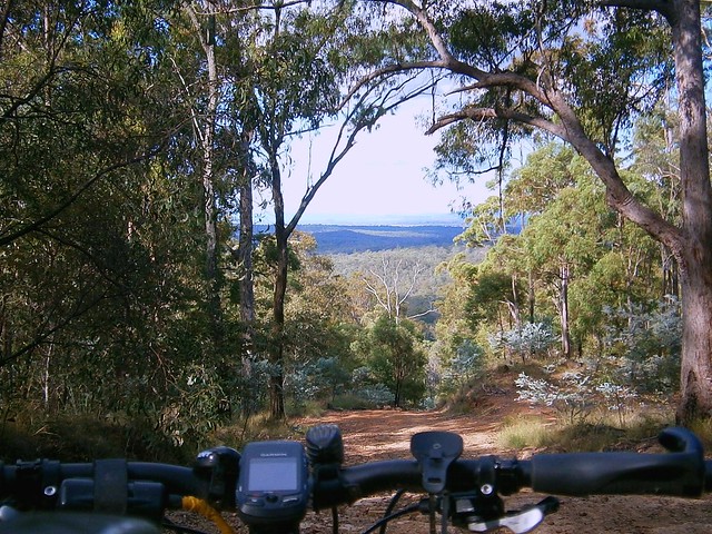
We didn’t realize that we’d be climbing for well over two hours before we reached the top of mountain. Physically this was ok – we were all used to long climbs. You just sit back, turn the pedals, and enjoy the view :) The problem was that it meant we made much slower progress that we had expected, and we didn’t get to the top of the range till about 12:30.

Brindle Creek

(Photo by Nick Mills)


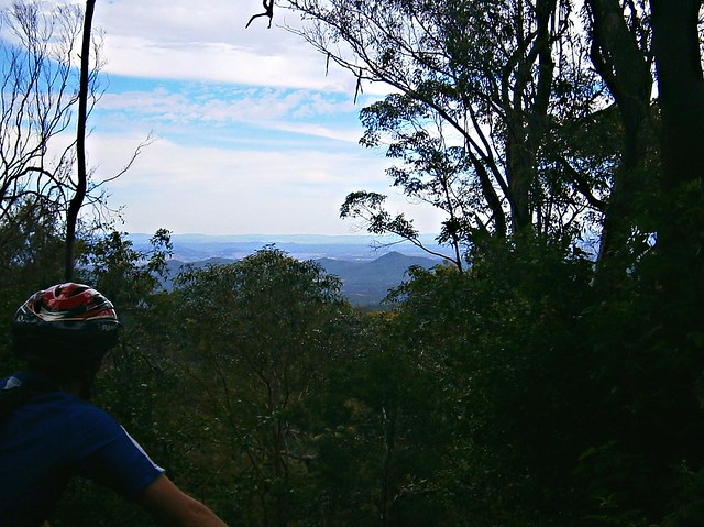
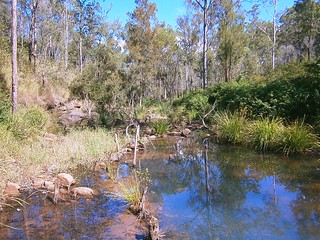
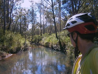
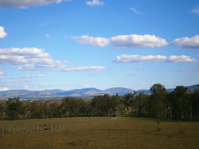
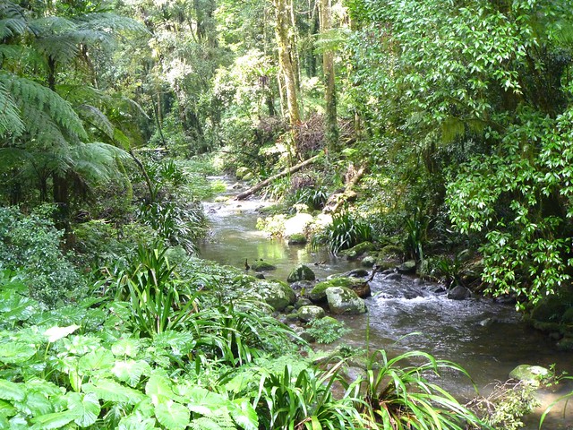
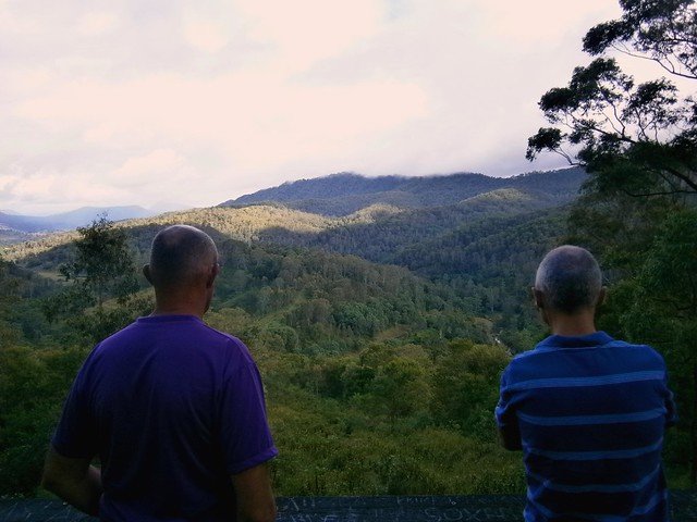
It started to rain fairly heavily on the way up, so we were all quite wet by the time we got to the top. This, and the mist, meant that we couldn’t see anything from the lookout, but Brindle Creek looked spectactular. There’s something about a bubbling creek in the middle of a misty rainforest that stirs my soul.


Brindle Creek Road

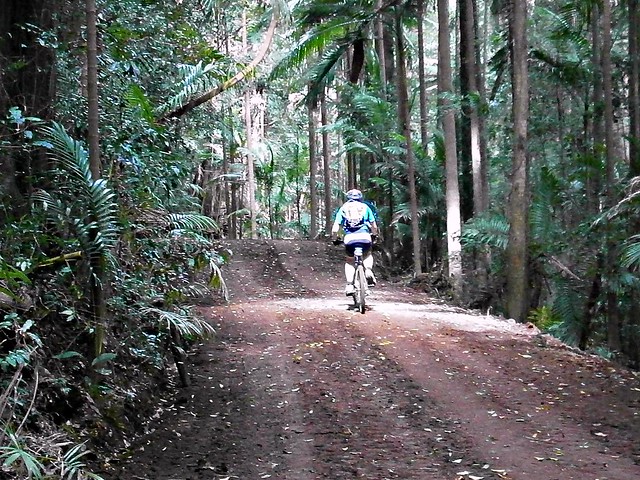
At the eastern edge of the loop through the rainforest the track splits in two where Bridnle Creek Road meets Tweed Range Road. Our intended route was southwards. The other alternative was to take Tweed Range Road westward back to our starting point. This would shorten the ride by more than half. We talked about it for a while. It was getting close to 1pm, our intended route still involved 60km of muddy roads and heavy rain, and we still had a 3 hour drive home after that. So we decided to take the shortcut and head back downhill along Tweed Range Road. At least we’d end up getting home before dark.

Bottom of the Hill

(Photo by Nick Mills)

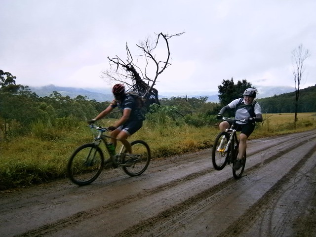
While it took us over two hours to ride UP the range, it only took us about 20 minutes to ride down. It was incredible fun. Riding downhill at close to 60km/h in a wet jersey makes you very cold, so I decided to put on a jacket to keep the wind out. One consequence of that is that the wind inflated the jacket, so by the time I reached the bottom I looked like the Michelin Tyre man :)


Nick

Being a much tougher rider, Nick decided to give the jacket a miss. But he still ended up wearing a fine mask of mud all over his face by the time he got to the bottom of the hill.


Dean

Perhaps the biggest surprise of the day was when we got back to the car, and met our exhausted and mud covered friend Dean grinding his bike up the hill from the other direction. He had actually started the ride two and a half hours before us. Unlike us, he slogged it out the entire way finishing the 80km loop at about the same time we finished our 35km loop.


What was most impressive was that he had parked 5km down the road from us at the top of Simes Road. So he kept pedalling on while we got in the cars to leave. 5km later when we had driven to the top of Simes Road, we looked in the rear view mirror, and there was Dean right behind us on the bike. After an 85km slog through the hills, he was able to go head to head with a 4wd over 5km in about the same time. Good on ya, Dean!


Lookout

On the drive home we stopped at the Railway Loop Lookout. Just before it reaches the Qld / NSW border, the railway line has to climb several hundred metres in a short time. The engineers came up with a novel way of overcoming this obstacle by making the railway loop over itself in a big circle (see the google map below). You can see this unusual bit of railway from the lookout.


View Larger Map


All up, 35km in 3 hours with 1,100m of ascent and 4,000kcal bunred. I can’t rate our intended loop as we didn’t finish it. I’m rating our actual loop 8 out of 10 on the tough-o-meter. I would have rated it lower, but the rain made it more difficult, as well as the logistics of getting to and from the starting point. It’s a great loop for anyone who’d like to see some great views over a short distance. But make sure you do it in dry weather!