Please note: you can find a more up to date version of this blog at http://blog.neilennis.com

Sunday, November 24, 2013

Caloundra

Read More

Strangler Fig

I’ve got pretty close to Caloundra on some of my previous rides, but never quite made it there for one reason or another.


The challenging part for a mountain biker is the busy traffic between the beaches of Caloundra and the quiet trails to the west.


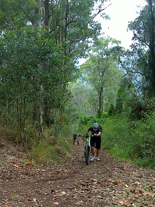
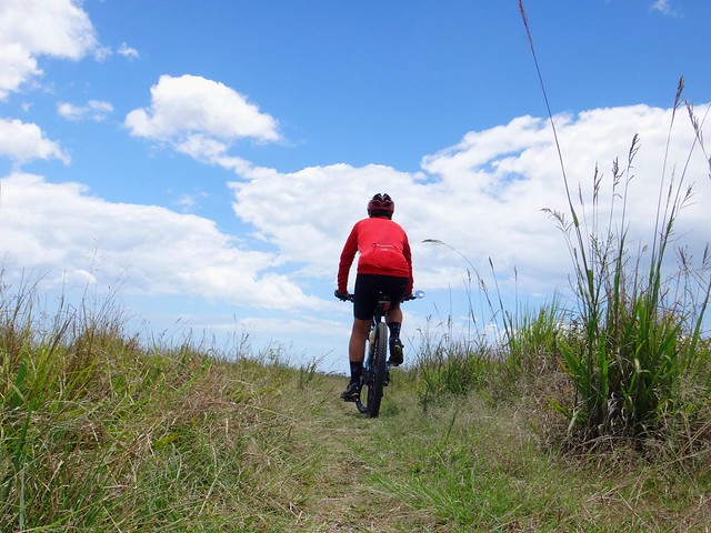
I’m unable to ride rough trails while I recover from injury, so today’s mission was to try fnd a quiet off-road route between Landsborough and Caloundra.


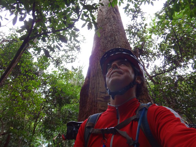
(BTW If you look very closely at my knee in the above photo you might be able to make out the really small puckered mark below my left knee. I’ve got one of those on either side of my left knee where the surgeon did the arthroscopy. I was surprised at how small the hole was. Apart from a bit of pain when I extend it, the op was a success and I’m now working on getting the leg as straight as possible)

Ewen Maddock Dam


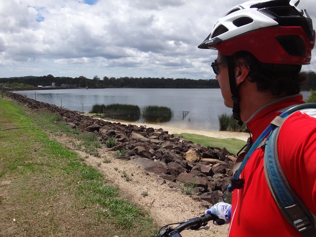
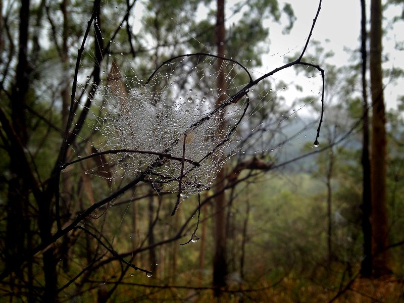
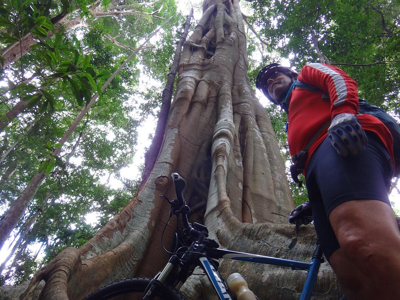
I started from Ewen Maddock Dam. I’ve enjoyed many of the trails around the dam in the past, as well as some of the cross-country options through here to the Glass House Mountains, and back up into rainforests of Dullarcha National Park.


Today’s ride would be towards the coast, so I had little option but to follow the main road for a short way.

Steve Irwin WayCaloundra Overpass, Bruce Highway


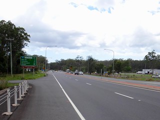
The road shoulder on this part of Steve Irwin way is nice and wide, so I didn’t have any problems with the passing traffic.


Giant Eucalypt


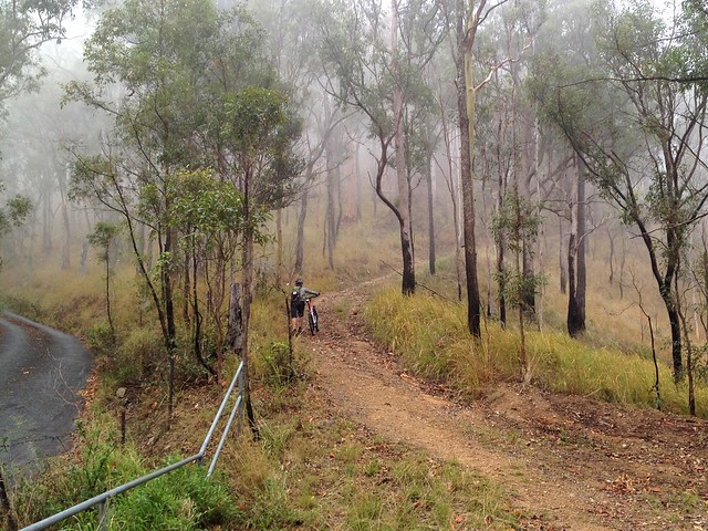
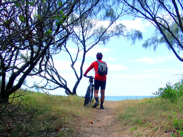
Before crossing the highway I took a small detour along a quiet path in the Jowarra Section of Mooloolah River National Park. This small rainforest is on the banks of the Mooloolah River with some quiet tracks winding through the strangler figs, ferns and melaleucas. It has about 2km of well-maintained tracks, picnic tables and a nearby shop. If you’re ever passing by it well worth a look.


Sattler Road

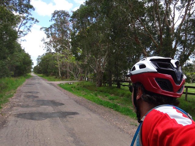
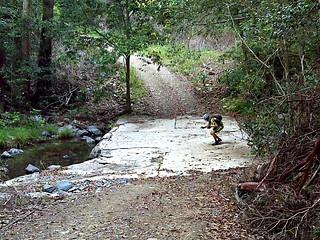
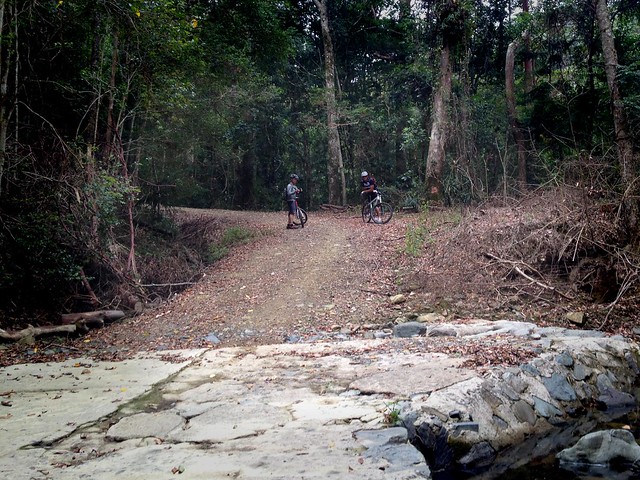
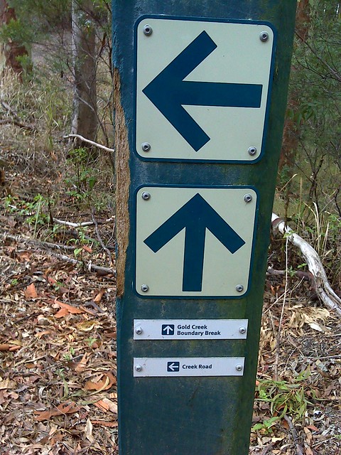
I only had to endure about two kilometres of busy road east of the highway before Sattler Road beckoned me northward. This quiet road slowly devolves into a gravel track…


Sattler Road

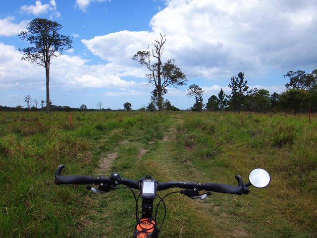
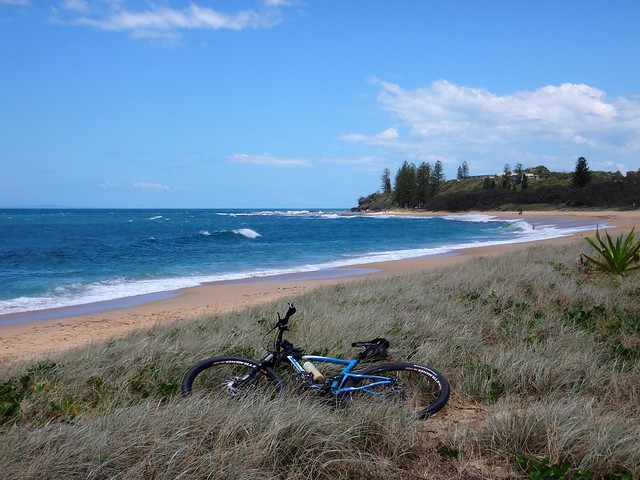
… then a grassy trail…


Sattler Road

I had a grin from ear to ear as I pedalled through the fields of Meridan Plains. This was perfect.


A couple of huge black cockatoos leapt out of a tree in surprise as I rolled by.


“Hello brothers!” I yelled out happily. These gentle birds have a soft call that I love. They always seem to turn up when I’m having a good time in the bush, so I always associate them with delight and happy times.


Sattler Road

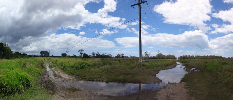
For any mountain bikers looking for a quiet off-road way to get from Steve Irwin Way to Caloundra, I’d thoroughly recommend Sattler Road. The flat terrain makes for an easy ride, but it also has the disadvantage of flooding easily. It’s probably best not to attempt it after heavy rain as I think this ground would be heartbreaking when muddy.


Sunshine Coast Motorway

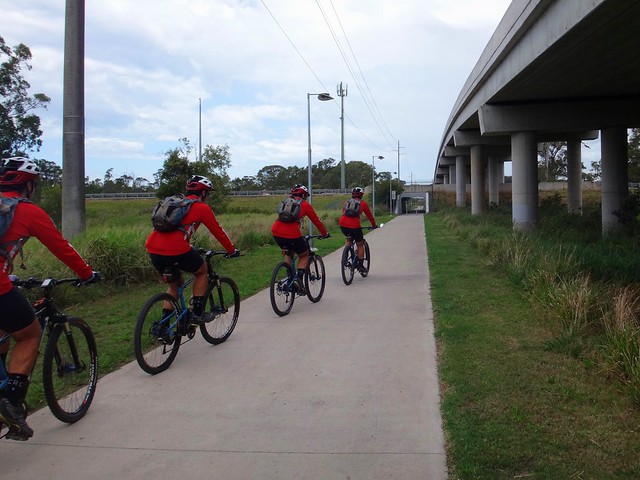
After a another couple of kilometres of quiet back streets I eventually met up with this bikeway which passes under the Sunshine Motorway towards the Meridan State College. It was now a pretty easy ride on bike lanes to Dicky Beach.


Dicky Beach

Dicky Beach


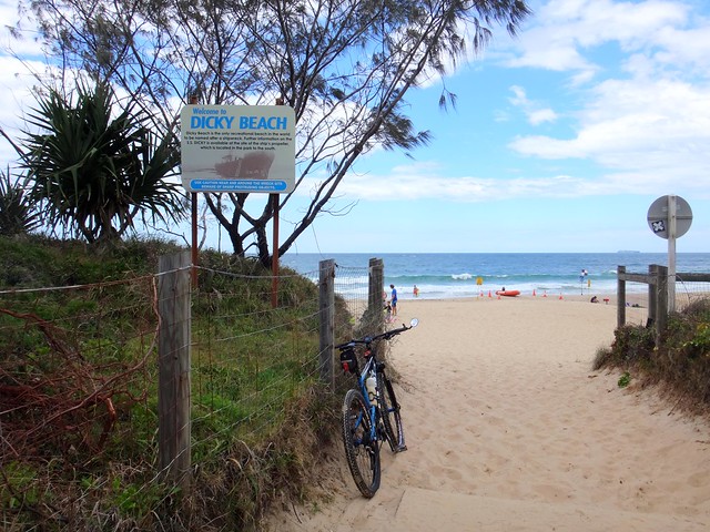
There have been a couple of ship wrecks in this area. The iron steam boat, S S Dicky ran aground here during a heavy storm in 1893. It has been there ever since. As a kid in the 1970′s I remember playing amongst the rusty remains. It seemed much larger then. Today, all I could make out was one bit of reddish metal poking out above the waves. The sea appears to be winning a long battle of attrition with the ship.


Moffat Beach

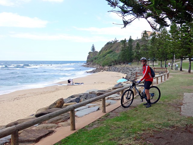
Moffat Beach is just round the corner near the headland. I ran into an English tourist who kindly offered to take my photo when he saw me battling with the auto-timer on the camera. It was difficult but I managed not to gloat about the cricket – I think we both knew what was going in my head, but neither of us went there :)


Moffat Beach

R 103


Riding up Queen of Colonies Parade, I passed another chilhood haunt. As a kid we used to share a beach house with a couple of other families. Named “Bimbo”, the house had million dollar northward views from the headland looking up towards Noosa. Those priceless views are probably the main reason “Bimbo” is no longer there today.


The street is named after another shipwreck. The “Queen of Colonies” ran aground on this headland in 1863. The survivors were marooned for a couple of weeks living on shellfish and berries. One of the sailors carved the name of the ship on the trunk of a pandanus tree, which enabled resuers to eventually find them.


Shelly Beach

Shelly Beach


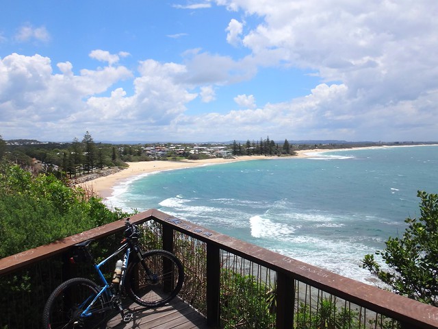
Shelly Beach is just round the corner from the headland. With rocky cliffs at either end, this I think this secluded stretch of coast is the gem of all of Caloundras beaches. It’s quiet, unspoilt and gorgous. The perfect place to chill out among the dunes.


Caloundra Headland

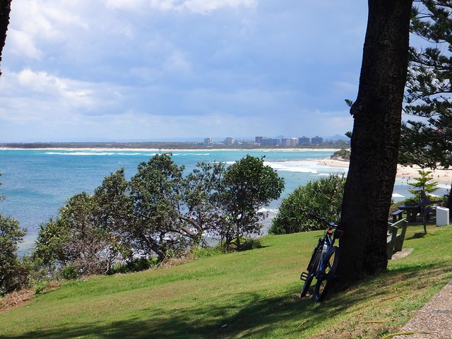
As I rounded the southern headland, I had a great view of the surf rolling into Bribie Passage and Kings Beach. The Moreton Bay shipping lanes come in very close to shore here, so the clifftop seats are a perfect spot for ship-watching as the ocean-bound behemoths slowly change course and head seaward.


Kings Beach Cruisers


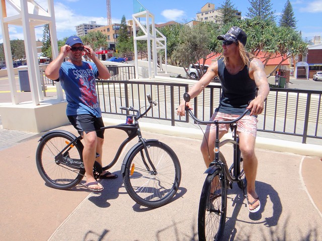
“Excuse me mate, you wouldn’t happen to have an Allen Key by any chance?”


“Yeah. Of course I do!”


“Oh great – my handle bars are loose and need tightening” he said as I wiggled them back and forth.


“My mates make fun of all the crap I carry in my bag”, I said as I tighted the handlebars. “Times like this I’m glad I do”, I added.


I checked out what they were riding. “Wow those bikes look amazing!”


“Yeah, my girlfriend bought them as a Christmas present…. Hey thanks so much for fixing our bikes.”


“No problems”, I said. “Just let me take your picture!”


The coolest thing about these single-speed bikes? A stubby holder on the top tube! Drop a can of your favourite drink in the holder, get your rubber footwear on, and cruise the beachside paths. Awesome!


Bullcock Beach

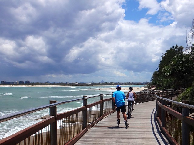
I followed a skater and a cyclist along the boardwalk from Kings to Bullcock Beach. The skater had a horn that he honked at unwary pedestrians like a circus clown. I rode in his wake, as the pedestrians got out of his way.


The pedestrians seemed to prefer being honked at by a skater, rather than me ringing my bell. Strange.


Bullcock Beach

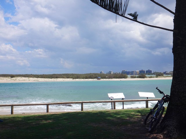
I couldn’t resist taking a quick pic of the spot that Murray and I stood at on Bribie Island during our fat bike adventure a couple of weeks ago. It’s amazing how close these two spots are, but how “far apart” they are from a cycling perspective. I think one day I’ll paddle across this section of water at slack tide, just to close the 100m gap in my map.


Bullcock Beach

At the western end of the boardwalk on Bullcock Beach, I took one last look back at the water before heading back along the main road to my starting point.


Caloundra is a beautiful part of the world. It seems much more relaxed than some of the more developed sea-side cities to its immediate north, and it has some gorgeous views.


Caloundra RoadSteve Irwin Way, Glenview


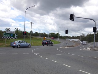
After a bit of a climb up “Little Mountain” I followed the wide road shoulder back to my starting point, waving some furious hand signals as I went through the intersection at the Bruce Highway, to make drivers saw me. It looks comical, but instead of sticking my arm out to the right, in heavy traffic I stick it out and flap it wildly so motorists behind me can see me more easily. The probably think I’m crazy, or pretending to be a bird, but I’d rather be crazy, visible and alive than respectable, invisible, dead.


This ride was about 45km with about 400m of climbing. It took me Three and a half hours during which I burned about 1,600 kcal.


Apart from short sections of busy traffic, it’s an easy laid-back ride with spectacular views of the ocean.


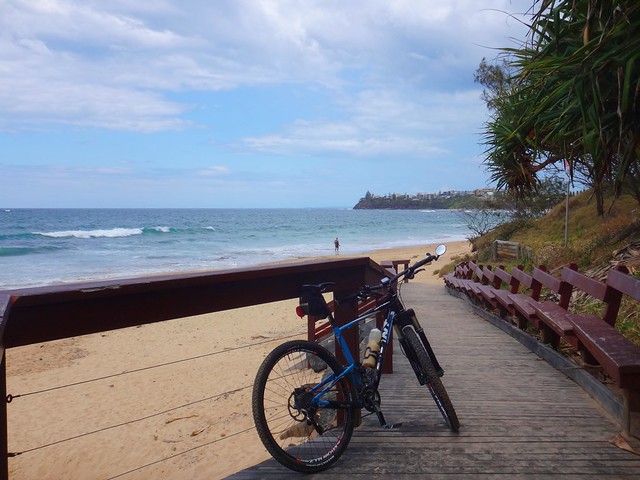
If you’re vacationing at Caloundra, I’d thoroughly recommend the coastal bikepath / board walk between Dicky Beach and Bullcock Beach.


I’ll rate it 5.5 out of 10 on the tough-o-meter.


Monday, November 18, 2013

Becca’s Suicide Loop

Read More

Dewy Web

Becca emailed me a couple of months ago…


“I was wondering if you could link the following up to make a rideable loop….”


Then she rattled off a list of improbable places all over South East Queensland ranging from Moggill (near Ipswich), to Mount Glorious, Samford and Bunyaville.


She signed off by adding, “Please feel free to tell me if this is a daft idea”.


Hike-A-Bike


After a few exchanges with her, I eventually sent Becca a route labelled “Becca’s Suicide Loop” and the comment “Don’t do it!!!!”. The original route covered 112km and involved 3,000m of ascent. I’d never done a ride that tough, and felt a strange combination of guilt, worry, and goulish curiosity as I thought about my friends following my directions on this tough adventure without me.


As you probably know, I’m recovering (very well thanks) from knee surgery, and am unable to get out on the bike for a while. So I feel a bit like the colonial government in 19th century Australia, sending vulnerable explorers like Burke & Wills, and Buckley (of “Buckleys Chance” fame) into the hostile wilderness.


Gold Creek Boundary Break

I was relieved when common-sense prevailed. My riding buddies: Becca, Eric, Jason and Paul decided to try about half of the original loop, starting at Upper Brookfield, and riding into the D’Aguilar Range via Mt Nebo before looping back via Camp Mountain and Gap Creek. It was still going to be a tough ride, with a hell of a lot of climbing, but I was now pretty sure they’d all get back alive.


The Road Less Travelled


My ride notes to Becca started off like this:

1. Start at the Cricket Ground opposite Brookfield Cemetery at 548 Brookfield Road

2. Head west along Upper Brookfield Road

3. Consider how much this ride is like a bottle of Gin. It starts off pleasantly. By the end of the bottle it will kill you.

4. Turn right into Galvin Road.


Upper Brookfield is a beautiful green part of the world, with rolling hills, plenty of trees and quiet creeks. But once the riders had ground to the top of Galvin Road and hit the dirt, they discovered how tough it can be.


Steep climbs, rough surfaces, water damage from recent rain, and ruts from motorized traffic had turned the park entry into a rugged hike-a-bike section that required a lot of walking.


Scrub Road Shelter

The ride up to the water tank and shelter on Scrub Road was a 16km up-hill slog with about 650m of climbing. In parts the gradient exceeded 22%. As Becca signed the guest book in the shelter, everyone rested, ate a few snacks and secretly thought a few angry thoughts about the evil architect of this loop – yours truly.


Creek Crossing, Scrub RoadBeareded Dragon


Most Mountain Bikers love the long fast descent down to the creek crossing on Scrub Road. After all the climbing it’s a delight to feel the cool breeze cutting through your sweatty clothes as you roll down-hill.


Jason is often on the lookout for ancient indigenous tree markings, historical remnants, or wildlife. It was no surprise when he jumped off his bike at the bottom of the hill and tried to convince this bearded dragon to pose for a photo.


Creek Crossing, Scrub Road


Despite its steepness, Scrub Road a great place to ride or hike, but it’s best done in drier weather. After rain the track becomes muddy and difficult to traverse.


Don't Hit the Worm!Don't Hit the Worm!


The riders left Scrub Road and followed the paved road towards Camp Mountain. This is another tough climb, but as Becca explained, “The climb up Camp Mountain seemed like a piece of cake after the steep hills at Brookfield”.


Once again, Jason spotted some wildlife on the road – a huge worm / millipede creature, and yelled out to Becca “Don’t run over the slug!!!” (When you’re in a hurry to save something, getting a correct taxonomic identification is not high on the list of priorities).


Luckily, the worm / millipede / slug creature was saved from death by mountain bike tyre, and gratefully agreed to be photographed by Jason.


Brisbane CBD from Camp Mountain

The views from the lookout at Camp Mountain are always spectacular – especially if you’ve worked hard to reach the top. On this day, however, everyone decided to keep riding, and rolled past the lookout towards the “Short Side” track down the other side of the mountain.


Eric explained that a couple of trees had fallen on the track which slowed everyone on the way down. Becca said the short side was “a lot of fun as usual”. I think any mountain biker would agree that it’s much more enjoyable riding DOWN the short side of Camp Mountain than riding UP.


Creek Crossing, Scrub Road


The trails eventually led the riders to the Bellbird Grove picnic area followed by another long climb up the paved drive way to Mount Nebo Road.


“Look out for cars on the way up”, Eric said. “Drivers are usually looking out for a picnic area and won’t see you”.


Ironically, an elderly driver collided with Eric as she passed him. He was ok, and banged his fist on the side of the car as it pushed him off the road. “I’m sorry, I didn’t see you”, the elderly driver explained as she got out of the vehicle.


I suspect Eric was relieved to reach the top of the hill and get back onto the dirt tracks away from the dangers of motor vehicles and careless drivers.


Hike-A-Bike

It’s only a 2km climb, but it’s hard work climbing out of Centre Road towards the end of a ride. Eric described it as a very hot and tiring climb. Becca added that because much of the route is in open unshaded terrain this would not be a good ride to do in summer.


Trail Marker, D'Aguilar NP

Once they were back on South Boundary Road, Eric, Becca, Paul and Jason headed towards the single tracks at Gap Creek following the “Death Adder” and Boscome Road trails towards Gold Creek Road. Thankfully this final 10km section was mostly downhill, and gave everyone a chance to recover before finishing back at the sports oval at Upper Brookfield.


View Larger Map


This ride covered 45km in just over 5 hours. During that time the riders climbed about 1,600m in vertical ascent.


When I asked them about the ride, three of them gave it 9 out of 10 on the tough-o-meter, with one person giving it 10 out of 10.


Jason described it as a “hard slog” and a good training ride for anyone wanting to “toughen up” before a race.


Eric said it was “as hard as I had anticipated” and thought that aspirations had exceeded abilities.


Paul said he would have liked more hills. I really hope you were joking, Paul!


And Becca said it was “Fun” and “A good loop if you don’t mind walking”.


Considering these people are some of the toughest mountain bikers I know, I’d suggest you only attempt this loop if you’re very fit.


Congratulations, everyone, on a huge effort. Mostly I am sorry I didn’t get to share it with you. But if I’m honest, part of me is relieved too.


And Becca, in answer to your original question:  No!  You are no dafter that I am :)