Please note: you can find a more up to date version of this blog at http://blog.neilennis.com

Sunday, February 24, 2013

Spicers Gap

Read More

Mount Greville

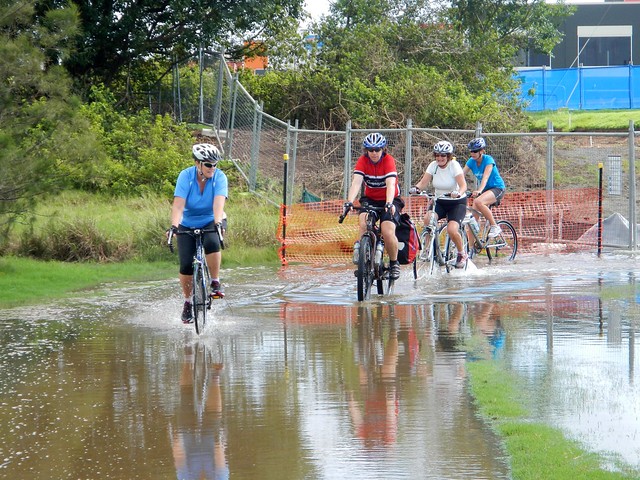
The aim of today’s ride was a reasonably long cross-country ride from the Southern Queensland town of Boonah, to Spicers Gap on the top of the Great Dividing Range and back again. It was challenging but had the benefit of being enjoyable despite recent wet weather.


Tunstall RoadOn the Road

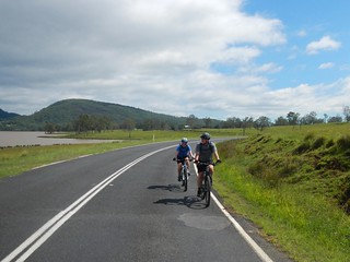
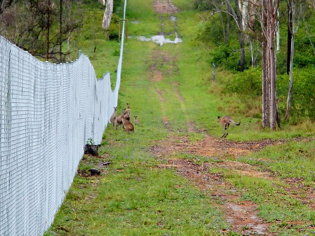
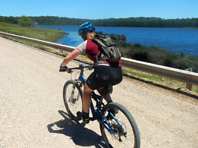
We left Boonah and made our way towards Lake Moogerah via some quiet back-roads. Most of the country around Lake Moogerah is hilly, so we had to work reasobly hard. But it’s worth the effort. The views are amazing!


Mount Greville

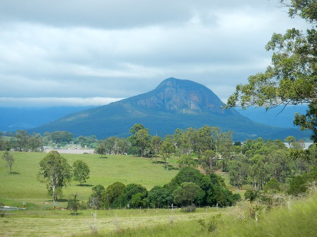
The Ugarapul Aboriginal people called this area “Moojirah” meaning “Place of thunderstorms”. When Reynolds Creek was dammed in 1962, the local authorities named the new dam “Moogerah” after the local aboriginal place name. When I saw the clouds brooding over Mount Greville in the distance, I agreed with the Ugarapul. It’s a perfect name :)


Lake Moogerah Road

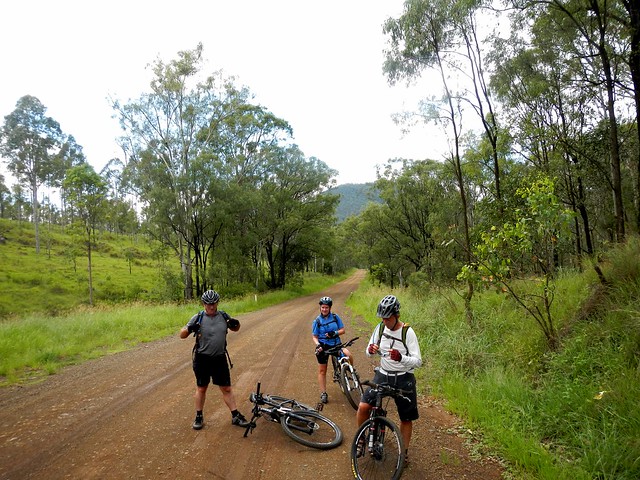
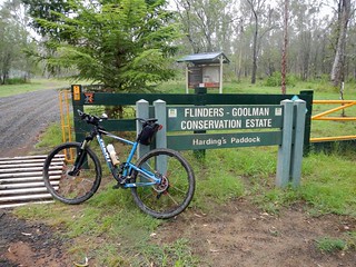
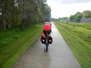
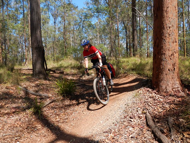
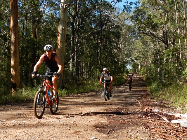
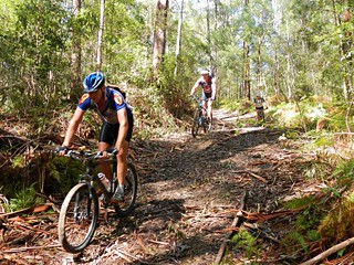
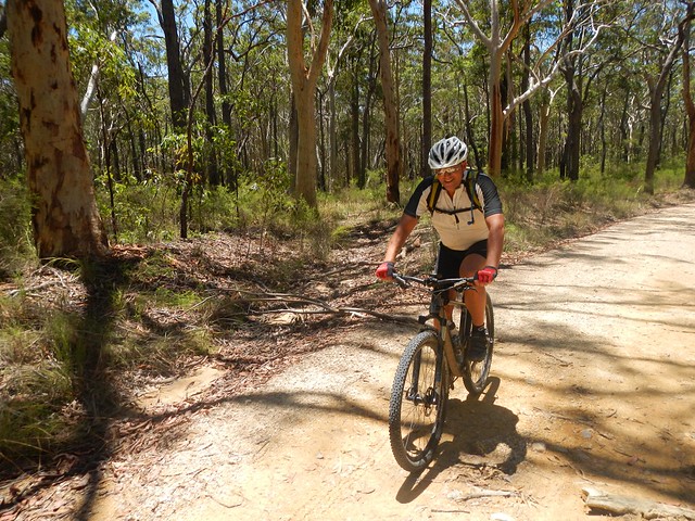
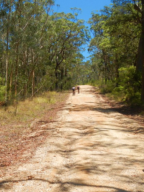
Our track took us around the back of the lake and up towards Spicers Gap Road. We took it easy on the undulating tarmac and gravel roads, aware of the impending long climb up the Great Dividing Range.


Spicers Gap Road

Spicers Gap RoadSpicers Gap Road

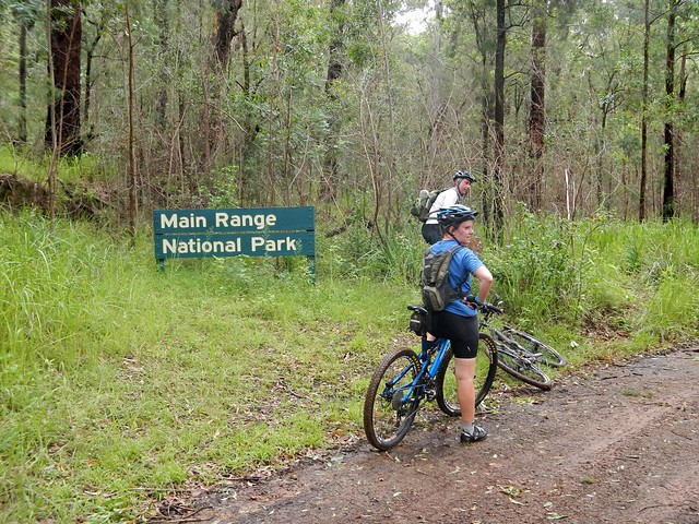
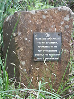
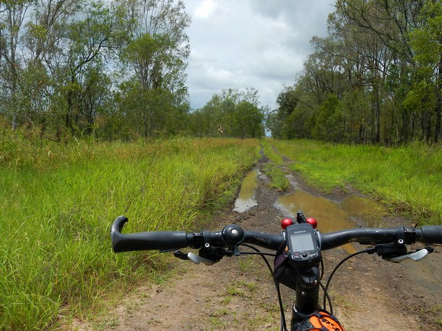
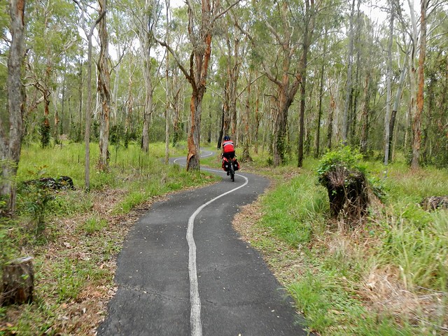
Spicers Gap road has been used for thousands of years by Aboriginal people as a (relatively easy) way of getting over the Great Dividing Range. In the 1840′s, stockman Henry Alphen discovered it was a much easier route for moving bullock drays than nearby Cunninghams Gap. So in 1847, with the help of convict labor, the government built the road along the ancient Aboriginal pathway. It’s steep – rising 600 metres in about 8km. That makes it a perfect mountain biking route :)


Pioneers Graves

Moss's WellPioneers Graves

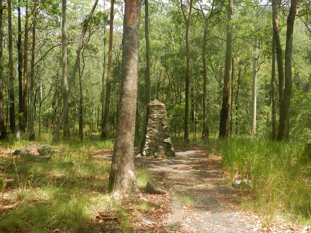
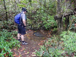
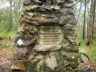
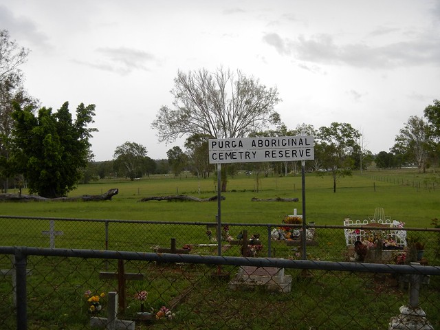
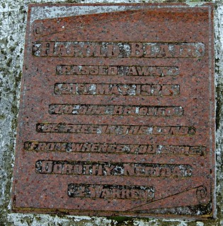
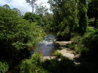
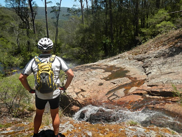
On the way up, there are some historical sites that provide a welcome break from the long climb, including a small cemetery containing the graves of several 19th century pioneers, and a curious freshwater spring, known as “Moss’s Well”.

Enjoying the view

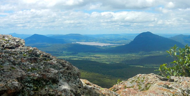
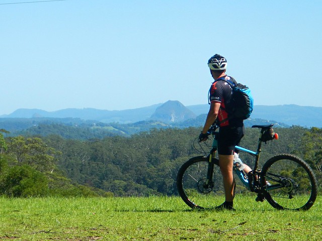
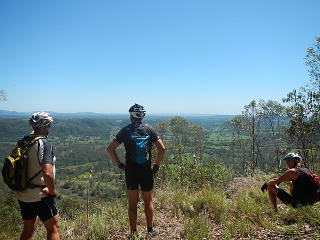
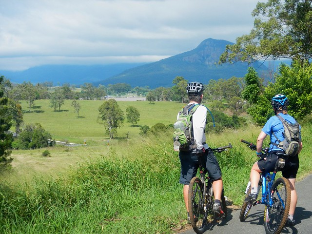
The “highlight” for me was the wonderful view at the top of the long climb.

Enjoying the view

Enjoying the view

Enjoying the view

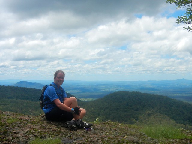
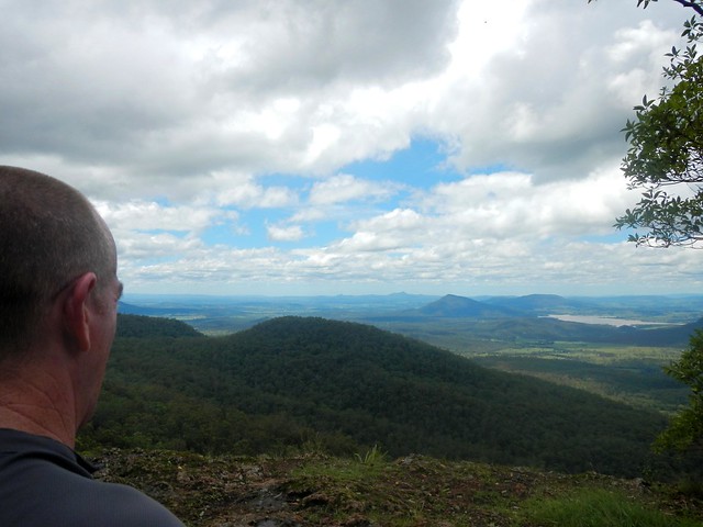
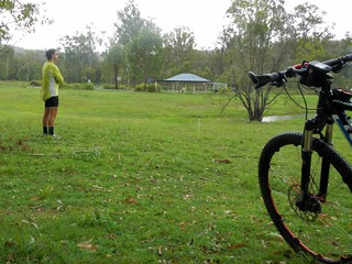
The views to the east are stunning. It was a perfect place to stop for a bite to eat, take in the panorama, and cool off.

Spicers Gap Road

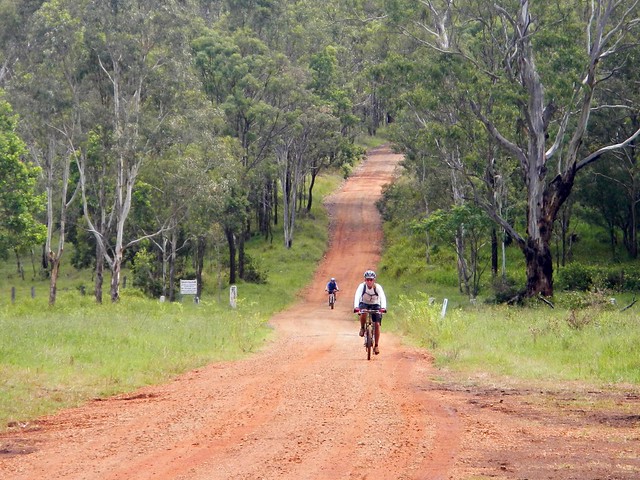
And the up-side of any long climb on a bike is that you get to enjoy a long fast descent back down the hill. Riding down the steep, winding, muddy road with flecks of clay flying up into my face, hitting speeds of 65 km/h was a lot of fun.

Mount Alford Pub

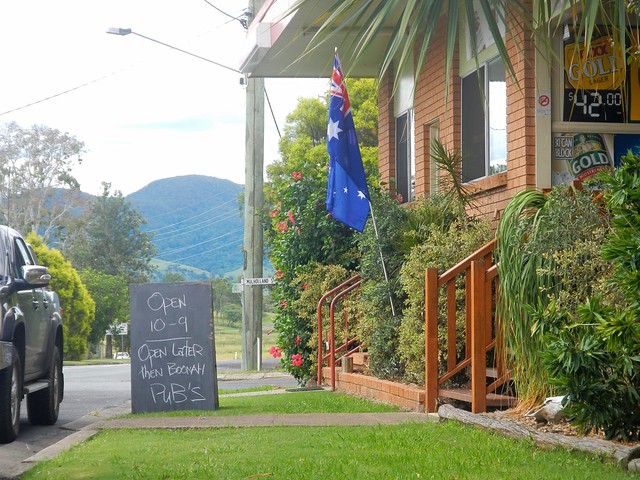
Thoroughly exhausted, we made our way back to Boonah via the small town of Mount Alford. The local pub beckoned to us with its proud boast that it has longer opening hours than neighboring Boonah. We couldn’t resist. Hard work on a bike makes a drink at a pub taste so much better.


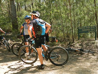
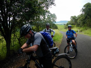
I’m grateful to Becca, Eric and Tony for agreeing to ride with me on yet another whimsical day of adventure and exploration on the bike. And especially grateful to Eric who let me “slipstream” behind him for some of the ride when I was feeling tired. We call it “getting a tow” because sitting behind a stronger rider makes so much difference when you’re tired.


We rode almost 80km in 6.5 hours including breaks. During that time we climbed about 1,300m, and I burned about 3,700 kcal. This is a tough ride. You have to first ride 40km, and then do a long 600m ascent up a dirt track, made more difficult by the soft wet surface. I’m rating this one 9 out of 10 on the tough-o-meter. On a hot mid-summer day it would be even harder. In dry winter weather I’d probably rate it 8 to 8.5.


Saturday, February 16, 2013

Hardings Paddock

Read More

Horses


The purpose of today’s ride was to fill in a “missing link” on my map between Walloon and Hardings Paddock. I’ve done some fun rides with friends at both places in the past. Today’s wet weather provided an ideal opportunity to complete the 27 km gap between the two places and enjoy some scenic country out the back of Ipswich in South-East Queensland.

Car Wreck

In typical mtb style I headed south out of Walloon looking for a dirt track I could follow. It wasn’t long before I found Mount Elliot Mine Road – a road casement which runs along sone one of the many mines around Ipswich.

The Road Less Travelled

The track was a bit muddy in parts, but was very rideable despite the wet weather. It eventually led me to the small town of Willowbank near the RAAF base at Amberley.

Horses

After battling some busy traffic along the Cunningham Highway for a couple of hundred metres, I turned south and followed another dirt track past some beautiful properties with some gorgeous horses galloping around. They were pretty curious and galloped up to me as I rode past. A bunch of horses galloping towards you is a wonderful sight.

Purga Aboriginal Cemetery Reserve

This small cemetery is a couple of kilometres from Hardings Paddock. It’s unusual in that it’s a reserve dedicated specifically to Aborigines. I had a bit of a look around and was gobsmacked by what I found….

Harold BlairHarold Blair


Harold Blair

Passed away 21 May 1976

Go our beloved

Be free in the land

From whence you came

Dorothy, Nerida

& Warren


Harold Blair was a a world-famous Aboriginal Singer and activist. He was born in Cherbourg Aboriginal Reserve and grew up in Purga, south of Ipswich. The Australian federal electorate of Blair is named in his honor.


Hardings PaddockHardings Paddock

A little further down the road and I eventually reached Hardings Paddock. Feeling pretty pleased with my self, I stopped for a quick lunch before heading back to Walloon.


Kangaroos

Hardings Paddock borders on a military firing range. As I rode past I saw these kangaroos huddled by the fence. They looked like they wanted to get out. Who knows? Perhaps they had decided that the military life wasn’t for them? Who can blame them?


The Walloon Hotel

I rolled back into Walloon after riding about three and a half hours including breaks. The total ride was just under 50km, with almost 400m of ascent, and about 1,800 kcal.


This was a pretty easy ride – flatter than what I’m used to, and with a large amount of quiet bitumen roads. It was ideal for a wet day, but I imagine it might get a bit hot on a fine summer day. The short stint on the Cunningham Highway was unpleasant, but the rest of the ride was quite enjoyable. I’ll rate this one 6.5 out of 10 on the tough-o-meter.


Best of all, my map has one less missing gap :)


Sunday, February 10, 2013

Daisy Hill

Read More

Quarry Lake - Daisy Hill

I felt like doing a big ride today, so my friend Dean agreed to accompany me on a long cross-town ride from my place to Daisy Hill. The plan was to try to stick to Bikeways as we rode the 75km across town, then do a few off-road tracks at Daisy Hill Conservation Park, then I’d finish the ride by heading west across town to visit my parents at Forest Lake.


It was also a chance to fill in some of the “missing links” on my global ride map.

Bikeway - Bracken RidgeBikeway - Bracken Ridge

Dean surprised me when he turned up on a fully laden Salsa Fargo touring bike, complete with panniers and bottle holders on the forks. It weighed a ton – which is saying something because a lot of my mates tell my I should send my bike to weight watchers.


As if on cue, as we started the ride, the rain started falling, so our first few kilometres along the bike paths were in cool humid dampness – which was actually more comfortable than riding in the blazing sun.

Moreton Bay Cycleway

Before long we were winding through the swampy She-oak and Paperbark forests of the Boondall Wetlands. I love this part of the Moreton Bay Cycleway. Being so peaceful makes it hard to imagine that this track is so close to the busy Gateway Arterial Road.


And since I was in a lazy mood, I just stuck behind Dean all of the way, in his slipstream. He’s a strong rider and we were able to maintain some really fast speeds as we powered along the cycleway in our mini peloton of two mountain bikers.

Moreton Bay Cycleway

A combination of high tides and recent rain meant that the track was slightly flooded in one or two places.

Gateway Bridge

Eventually we reached the Gateway Bridge and made our way over the slow hump of the bridge and down the other side.

Crit Track - Murarie

From there we rode through the Minnippi Parklands towards the Critereon track at Murrarie. Since I was still tailgating Dean and riding in his slipstream, he passed the Finish Line on the track just a split second before I did :)

Bulimba Creek BikewayBulimba Creek Bikeway

We continued to head south, towards Daisy Hill along the Bulimba Creek bikeway.

Daisy Hill Conservation Park

When we eventually reached Daisy Hill, Dean led me up “Second Coming” track near the Buddhist Temple on Underwood Road. It was amazing to watch him push this heavy bike with no suspension along some winding steep single track. The bike rattled a bit on the bumps, by Dean handled it really well.

Quarry Lake - Daisy Hill

We rode down “Stringybark” trail and did a loop of the Quarry Lake in Neville Lawrie Reserve. By this time the sun was high in the sky, the day was starting to get hot, and I was sorely tempted to ditch my gear and jump in the water. I think Dean was relieved when I decided not to :)

Quarry Lake - Daisy HillQuarry Lake - Daisy Hill

Next time I’m there, I’ll definitely jump in. The water looked great on a hot day.


From there we headed up to the “Top Carpark” to top up on water, before riding down “Possum Box”.


And I got a lesson from Dean in how to ride a heavy no-suspension touring bike on some twisty single tracks.


Including the last leg of my ride to Forest Lake, I rode a total of 117km in just over 6 hours (excluding breaks). I burned 5,100 kcal and climbed a total of 1,150 metres. Riding this with Dean made it much easier – especially being able to slipstream him, and to benefit from his knowledge of where to go in a part of town that I don’t normally ride. I’ll rate this 8.5 out of 10 on the tough-o-meter. But if I did it solo, I’d probably rate it 9.5 out of 10.


Saturday, February 02, 2013

Mapleton National Park

Read More

Mount Cooroora

Most of the National Parks and State Forests around Brisbane were closed this week because of recent heavy rain. Luckily, Mapleton National Park (about 100km North of Brisbane) was open, so a few of us decided to go for a ride up there this morning.

Mapleton National Park

We started in Mapleton, and rode northwards along the main vehicle track through some beautiful open Eucalyptus forest towards Cooloolabin Dam.

Mapleton National ParkMapleton National Park

At the dam, we decided to take our chances and took the less-travelled fire trail to the west. The track was covered in fallen branches, bark, and a couple of fallen trees. But it was rideable. We only had to climb over one large fallen tree.

Point Glorious

The climb up to the lookout is hard work, but it’s worth it for the great views.

Cooloolabin Dam

From the lookout it’s a quick fast descent back down the hill to Cooloolabin Dam.

Mapleton National Park

Mapleton National Park

On the way back up to Mapleton from the Dam, we stopped at the waterfalls on East Cedar Creek to enjoy yet another spectacular view.

Mapleton National Park

The steep ride back up the hill to Mapleton was tough, but the Eucalyptus trees looked stunning after all the rain.

Mapleton National Park

Many thanks to Becca, Jason, Simon, and Ron; and also to local riders Dave and Ross. I really enjoyed being able to share such a perfect day with a great bunch of people.

This was a lot tougher ride than I anticipated. It’s only 22km from Mapleton to Point Glorious, so it’s a 44km out-and-back ride. But there are some long climbs between Mapleton and Cooloolabin. The hot and humid summer weather and the muddy branch-strewn path west of Cooloolabin added to the challenge.


Today we climbed 1,100m in 44km in just over four and a half hours including breaks. I burned 3,000 kcal.


Based on today’s conditions I think this ride deserves 8.5 out of 10 on the tough-o-meter. In cooler months when the tracks are drier and there’s less debris laying around, I’d rate it 7.5.