Please note: you can find a more up to date version of this blog at http://blog.neilennis.com

Saturday, October 30, 2010

The Bat Cave

Read More

The Bat Cave

The Bat Cave

The Bat Cave

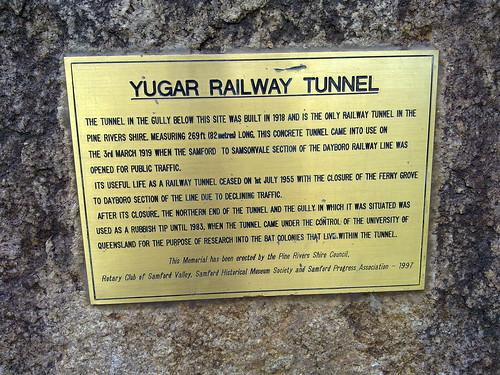
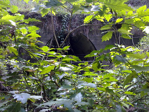
North of Samford, the railway line passes through Yugar. This is the only place on the line where a tunnel was necessary to pass under the roadway.


After the railway line was closed, this gully was used as a rubbish dump, but in 1983 the University of Queensland acquired the site to study the bats that now live in the tunnel.


Today my only other companion was a large hungry Brown Snake who was obviously looking for some bat-flavored fast food take-away!


Thursday, October 28, 2010

North Pine River

Read More

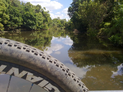
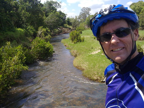
Just a couple of quick photos of the river this morning during my ride.


Sometimes I need to remind myself that I do live in paradise!


North Pine River

North Pine River


Friday, October 22, 2010

Gavan Newman was here

Read More

Survey Tree - Gavan Newman

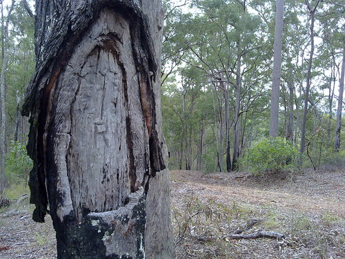
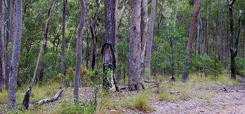
One morning while I was zooming down Clear Mountain Road on my bicycle at about 70km/h this strange looking tree caught my attention. The next day I came back to have a closer look and discovered it had been “blazed” by a surveyor. Surveyors often used to mark survey points by cutting out a semi-circular patch on the bark, and emblazoning it with survey symbol.


My friend, and local historian, Leith Barter informed me that the tree was recorded on a survey by Gavan Newman in 1938. It was either blazed by him then, or during an earlier survey in 1920.


Gavan Newman was born in Caboolture in 1888 and was registered as a surveyor from 1914 to 1970. In other words he was a surveyor for 56 years.


If you’re interested there’s a copy of part of his original survey plan here:

gavan-newman-survey-1938


In history we often think of explorers embarking on exciting voyages of discovery, but in Australia’s past, much of the “exploration” was done by men of maps – surveyors like Newman:


John Oxley was a surveyor in the Royal Navy. James Cook and Matthew Flinders were arguably the best cartographers of their age.


But if you ever stumble across a blazed survey tree, spare a thought for the unsung explorers like Gavan Newman.

Survey Tree - Gavan Newman


View larger map


Sunday, October 17, 2010

Samsonvale Railway

Read More

I rode out to Mt Samson and Samsonvale again this morning to continue my search for any remnants of the old Railway line, and to check out the Samsonvale Bora Ring.

Follow that train!

The railway line heads north from Mount Samson to Samsonvale. Unfortunately it disappears into the lake now. This is the view looking South towards Mount Samson station. The embankments are still evident.


Mount Samson, D'Aguilar Ranges

South of Mt Samson village the railway line runs under Kunde’s Road. This is the view west towards the unmistakable pyramid shape of Mount Samson in the D’Aguilar ranges.


Towards Kobble

The line continues north of Samsonvale through Gold’s Scrub towards Kobble.


Ancient Sentinel

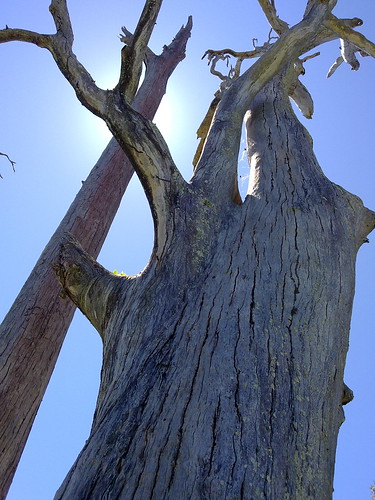
This dead tree marks the site of the Samsonvale Bora Ring.


Samsonvale Bora Ring

The Samsonvale Bora Ring was an ancient, sacred, ceremonial site used by the Turrbal Aborigines for corroborees and initiation ceremonies. It stands less than a hundred metres from a busy road and is easy to see, although I’m sure most of the people driving by would have no idea about the important events that have transpired here for thousands years.


View Larger Map


Note: My GPS had a glitch between Mt Samson and Samsonvale so I wasn’t able to record those tracks.


Saturday, October 16, 2010

Mount Samson Railway

Read More

As part of my project to explore the railway line west of lake Samsonvale, Harrison and I rode out to the small village of Mount Samson this morning.


There was a small railway station in the town until 1955 which provided transport to the city and allowed local farmers to get their produce to market.


No train in sight

(A photo of the old Railway Station from the Samford Historical museum)

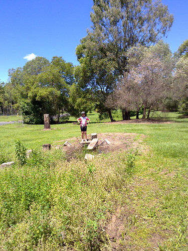
Harrison stands on the ruins of Mt Samson railway station. The railway line would have passed by on the right of the picture.


Mount Samson Railway

The railway line passed under Kunde’s Road. The cut-away is visible as the line approaches the roadway.


Riding to Mount Samson

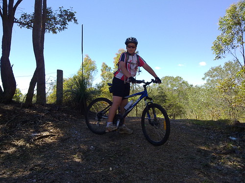
Harrison takes a break on the ride out to Mount Samson.


Saturday, October 09, 2010

Harrisons Pocket

Read More


harrisonspocketinset


It was raining heavily this morning, so I decided to postpone my trip out to the old Ferny Grove to Dayboro railway, and instead visit another “place that is no more”.


Harrisons Pocket once was a thriving little farming community almost 10km directly west of Petrie. In this area, the North Pine River twisted around almost three quarters of a circle forming a “pocket”, and Harrisons pocket nestled along the banks of the river at this point.


It had a school, formerly known as Harrisons Pocket Provisional School, then State School, and a Post and Telegraph Office.


You didn’t really drive through, because it was located in a natural cul-de-sac in the river. The way out was over a shallow part of the river about 3km south east, called “Gordon’s Crossing”. This was one of the earliest crossings of the North Pine River, predating Youngs Crossing by at least twenty years. Incidentally, if you’ve ever been on Gordons Crossing Road, now you know what it’s named after.


Sadly, these places are now inundated by the North Pine dam. You can get pretty close by riding through some scrubby bushland along some fire roads, which is what Harrison and I did today in the pouring rain. (I think he was curious about a place that shared the same name as him).


He found the ride very difficult, especially on some of the muddy tracks. To his credit, he persevered and we made it back home safely.


In the map below you can see the original course (in blue) of the North Pine River before it was dammed. The red track is the path that Harrison and I took. You can click on some of the markers on the map to see the location of the post office, the school and Gordon’s Crossing.


View Larger Map

Thursday, October 07, 2010

Ghost Train

Read More


View Larger Map

From 1920 to 1955 there used to be a railway line between Ferny Grove and Dayboro. It ran via Camp Mountain, Samford, west of present day Lake Samsonvale and north to a terminus at Dayboro.


This line was the scene of Queensland’s worst rail disaster in 1947, where 16 people were killed and 38 were injured. Even today it ranks as Australia’s second worst rail tragedy after Granville.


There’s not much of a trace of the old line left today except for a short rail-trail between Ferny Grove and Samford, and a Tunnel (affectionately called “The Bat Cave”) which is now used by Queensland University to research bats.


I’ve included the map here, and a link to the KML file here because I intend to visit some of the places on the map over the next few weeks to see if I can find any clues. Also, the map / kml might come in handy for anyone else interested in exploring the area.


I’ve included some scanned copies of old maps I used to plot the route of the line. Many thanks to local historian, Leith Barter, for helping me locate the old maps and providing copies.

1955 Military Map - Part 11955 Military Map - Part 21930s Cadastral Map


Wednesday, October 06, 2010

Grass Tree

Read More

The Grass Tree (Xanthorrhoea latifolia) is a very slow growing plant that grows widely throughout eastern Australia.


It can take more than twenty years for a trunk to appear, and then they normally grow at a rate of 1 to 2 cm per year.


The two larger specimens here had 2m trunks taller than me, so I’m guessing they would probably predate European settlement in the area. I.e. they’re probably at least 200 years old.


Aborigines used grass trees to make fishing spears. They also used resin from the plant as an adhesive and to mend leaking water containers.


The trees provide a habitat for native insects and lizards.


Some of the lakeside shores around here have forests of grass trees. When you think of how old some of these trees are, it’s an overwhelming sensation to stand among them.


Saturday, October 02, 2010

The Road to Nowhere

Read More

There’s a large dam in our area (The North Pine Dam) which was built in the 1970’s. It has created a lake (Lake Samsonvale) which has flooded a lot of old historical places, including roads, bridges, homesteads, farms and townships.


About a year ago Steve and I visited this area on foot.


My ride today covered a lot of the shoreline of the lake, and I was pleasantly surprised by some of the remnants I found.


One interesting road is Samsonvale Road. As you can see from this map large parts of it are now under several metres of water, but portions of it rise out of the water like a sleepy sea-serpent.


Those above-water portions are hidden away in bushland – unused and overgrown.


These photos are of a road cut-away – where engineers have dug away a hill to smooth the course of the road to reduce its gradient. The only problem these days, apart from the overgrowth, is that if you walk along the road for a hundred metres in either direction you end up in the water.


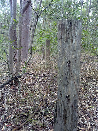
In a way it’s eerie. Old fence posts and pieces of barbed wire mark old boundaries that are meaningless today.


Strange looking exotic / domestic plants such as umbrella trees spring up in unexpected places – a quaint reminder that this once was a garden, not overgrown bushland.


Who knows? Perhaps one day a few hundred years in the future someone will cut through the overgrowth on our street and find old fence posts, gardens and tracks that once meant something to us.

Road to nowhereRoad to nowhereRoad to nowhere


Friday, October 01, 2010

Whiteside

Read More

Today I made a quick visit to the approximate location of the former Whiteside homestead – one of the earliest European settlements in the Pine Rivers district. Francis Griffin founded Whiteside Station in 1843. He was joined by his brother William in 1844, and his parents George and Jane in 1845.


Francis was a formerly the captain of a steamer called “James Watt” which had carried the Petrie family to Moreton Bay in 1837.


Unfortunately he had a disagreement with his brother, William, which resulted in Francis leaving the station in 1848, and in fact being sent back to Sydney.


William’s time at Whiteside didn’t last long either. The next year, his father, George, expelled him from the station “for bad conduct”.


George died in 1851, and his youngest son, John took over the property. He married the widow, Isabella Joyner in 1852. She owned the “Samsonvale Run” on the other side of the North Pine river. This meant that collectively, the Griffin and Joyner families owned large tracts of land north and south of the river.


Some of the Whiteside Run (east of Sideling Creek) was eventually sold to Tom Petrie in 1858 to establish “Murrumba”.


View Larger Map