
Today’s ride was a point-to-point epic starting at Mount Sylvia south of Gatton, following the Bicentennial National Trail (BNT) towards Cunningham’s Gap.
The BNT is an amazing recreational trekking route stretching 5,300 km along Australia’s Great Dividing Range from Cooktown in North Queensland to Healseville in Victoria. Following historic aboriginal trails and stock routes, the trail was opened in 1988, allowing self-supporting adventurers to traverse one of the longest off-road touring trails in the world, passing through some stunningly scenic country.
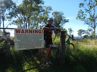
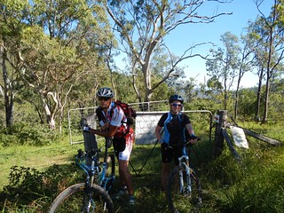
We decided to explore one small 90km section of the trail, starting at Mount Sylvia (near Gatton in the Lockyer Valley) and passing south-eastwards over a couple of mountain ranges before finally ending up at Clumber near Cunningham’s Gap.
We planned to finish our ride at a different place to where we started. This usually involves time-consuming arrangements where we bring multiple vehicles, leave one at the destination, then all drive back to the start. To save time, my friend Jason kindly volunteered to drive us to Mount Sylvia (two hours drive from Brisbane), drop us off, then meet us again at the end of the day at Cunningham’s Gap. It’s the first time we’ve had a “chauffeur” and I appreciated the convenience that it gave us.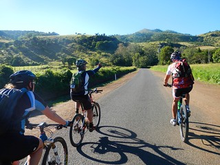
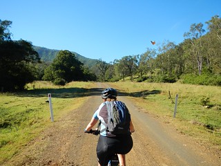
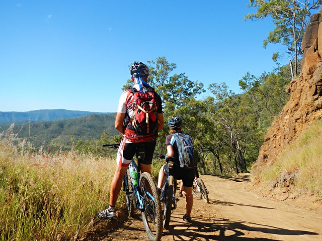
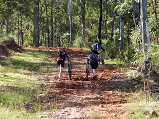
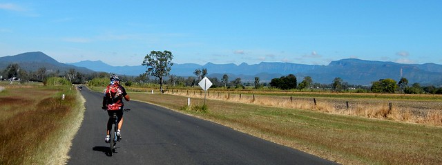
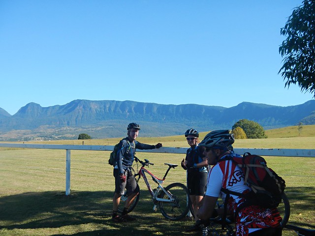
We set off down Left-Hand Branch Road which follows a long narrow valley along Tenthill Creek up into the Liverpool Range. Blue skies, low temperatures, and a nice flat-ish road – what a perfect way to start the day!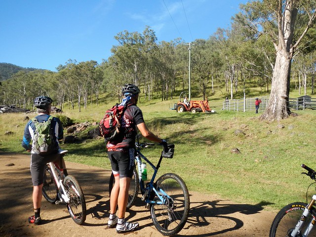
At the end of the valley, we met a friendly farming couple who happily told us that the local council had only just fixed the road yesterday, and that if we’d come any earler we would have had to contend with land-slips and blockages. They then added:
“Oh and by the way, I hope you realize it’s all up-hill from here?”
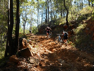
They were right. The road slowly started getting steeper. All good mountain bikers like a decent hill climb, but the road up to Laidley Gap is not your average hill!
We all gave it an honest attempt. My GPS tells me the gradient maxed-out at just under 40%. Not even Eric, with his deisel moter of a heart and iron legs could ride up it. So we pushed….
…and eventually reached the top. The friendly little red arrows let us know we were on the right route. Paul actually made and placed these arrows on the track a couple of years ago when it was used as part of a famous mountain biking race called “The Epic”. In those days, this 120km race ran from Toowoomba to Grandchester through some of the toughest country around. In 2010, Andrew Pioch set the record for this climb, completing it in just over 11 minutes averaging almost 10km/h. It took me 17 minutes. Andrew must be an amazing rider.
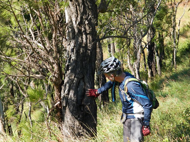
Keen-eyed Eric spied a “Blaze” in the trunk of an old Ironbark Tree. If you look closely above his head you’ll see a yellow triangular BNT marker. These little markers are all along the trail and help to let you know that you’re on the right track.
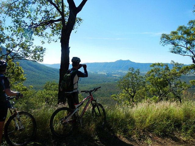
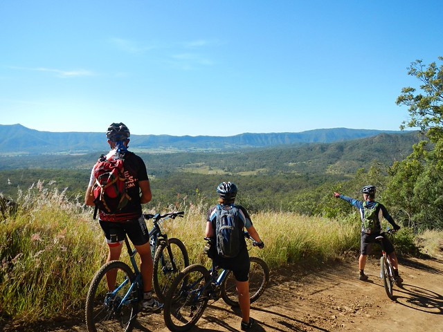
As with all big climbs, it was worth the effort for the views and the exhillarating descent down the other side. Superlatives can’t do it justice. I was stunned by the views I saw.
And for the next short while, a huge grin was plastered across my face as I enjoyed a steep 10 km descent, wind howling in my ears, gravel crunching under my tyres, and trees rushing by in an adrenaline induced blur.
I was a kid again ![]()

After rolling into the small town of Thornton, it didn’t take long to discover some major damage caused by floods earlier this year. The bridge had been totally washed away. There was no way across the creek. A deep ditch lay in front of us. We briefly contemplated climbing down, and then up the other side, but common-sense overruled. We decided to make a short detour and cross the creek several kilometres further north.
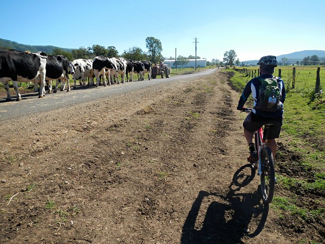
Along the way we dodged a some cattle being herded along the road by a farmer in his tractor.
It’s strange. When I usually come upon a bunch of cows on the road while riding a bike, they’re usually skittish and run away. But these animals seemed much calmer, and weren’t spooked by us. And the only difference I can come up with is that the farmer was behind them in his tractor. I imagine they felt more secure while being herded than they would be on their own.
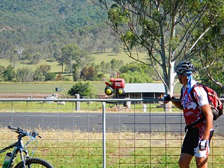
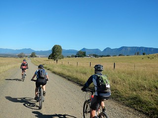
After a brief stint on the bitumen, we followed the trail markers across another paddock towards Edwards Gap – our second big climb of the day. Paul was impressed with a letter box that someone had made to look like a tractor.
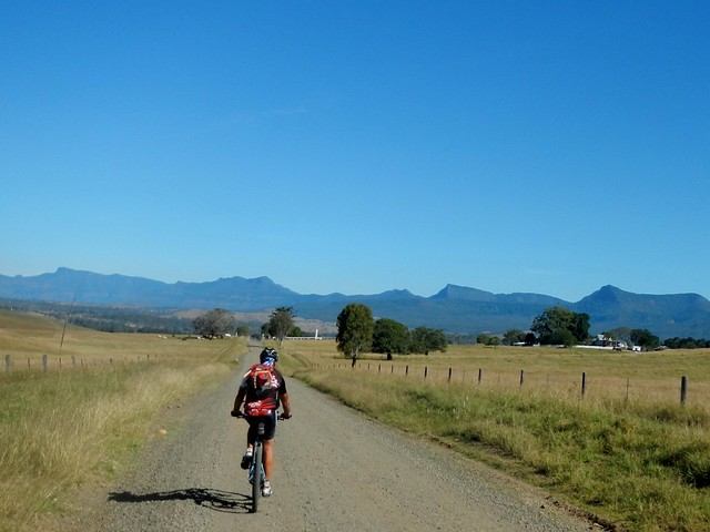
In the distance we could see the Liverpool Range and Laidley Gap where we had recently descended.
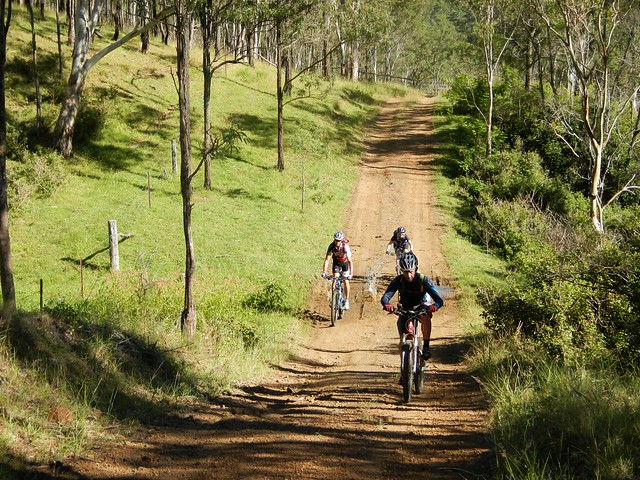
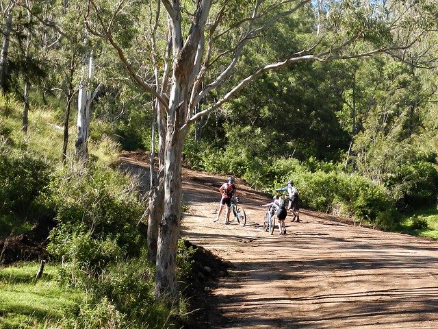
The climb up to Edwards Gap is another “hike-a-bike”. The track is steep and rough, but (thankfully) it’s not very long.
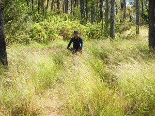
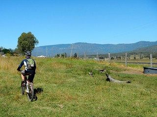
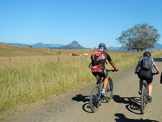
It wasn’t long before we reached the grassy summit of Edwards Gap and yet another pleasant bumpy descent down the other side towards Mount Mort.
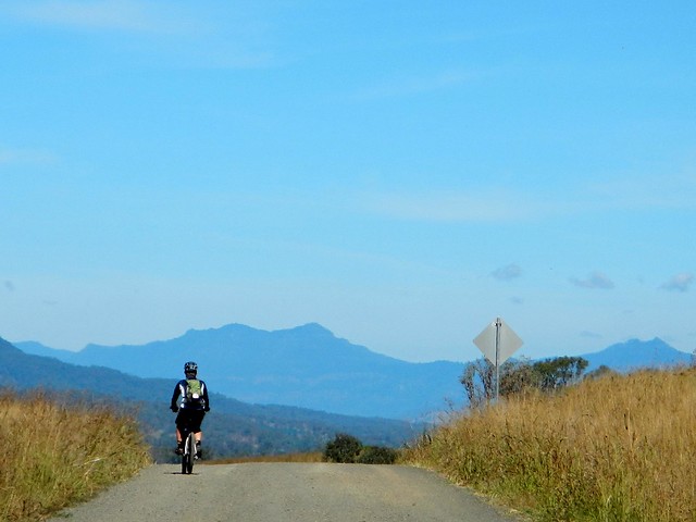
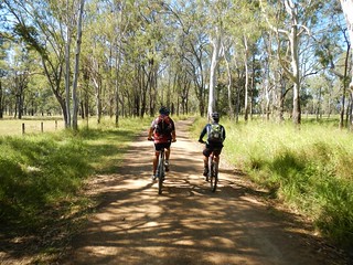
From here we headed south with the towering cliffs of the Great Dividing Range on our right.
The exhillarating views provided a pleasant distraction to the hard work of pedalling the bike into a stiff headwind.
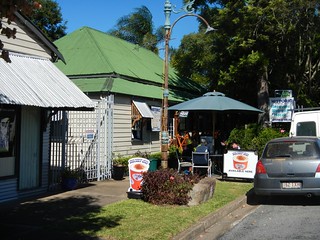
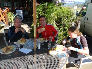
And so we reached the wonderful Rosevale Pub – our lunch stop. And we were early ![]()
I had pre-arranged with Jason that I’d send him a message via my Spot Satellite Messenger once we reached Rosevale. If we got there late, we would take the shorter option and ride to Aratula. If we were on time we’d take the longer route over the Cunningham Highway and down to Clumber on Spicers Gap Road. I was excited to send Jason the “All ok” message that we’d be able to stick to the original plan and do the full route.
The Rosevale Pub has a fascinating story. Today it’s in the middle of nowhere by the side of the BNT.
It’s the oldest pub in Queensland, built in 1852 as a Homestead that provided liquor to travellers. Mathew Carmody was granted a victuallers license in 1887. In 1893 there was a huge flood which covered most of the surrounding plains, so the owners decided to move the pub about 1 mile to its present location.
The move required a couple of bullock teams to haul the building across the fields.
It took five days. During that time, while the building was on the wagons, it still traded. Can you imagine thirsty travellers buying grog fron a pub building that was rolling along on a dray as it was pulled through a field by a couple of teams of bullocks? Where else but Queensland? ![]()
Today, the publican tells us that a few days prior some people came through leading a pack of camels heading south. A few days before that it was a bloke on horseback. In a few days time he’s expecting a young lady riding northwards from NSW.
What an amazing place.
But, after a delicious lunch, we set off on the final leg of our trip…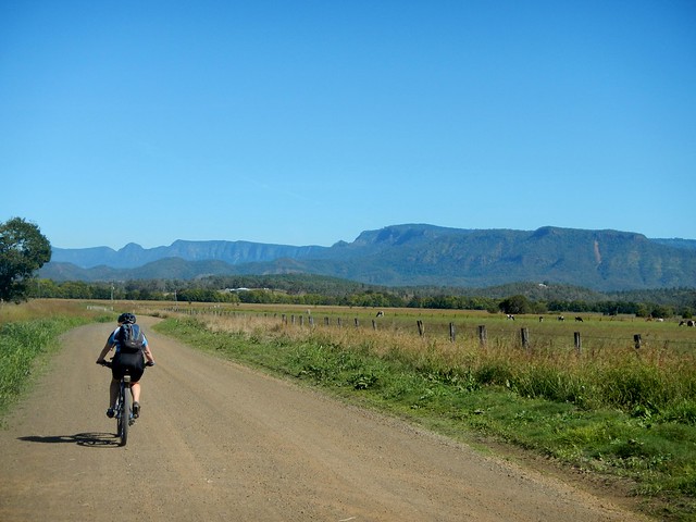
I can’t do the views justice by trying to describe them. They were awesome in the true sense.
Imagine waking up to views like this every day?
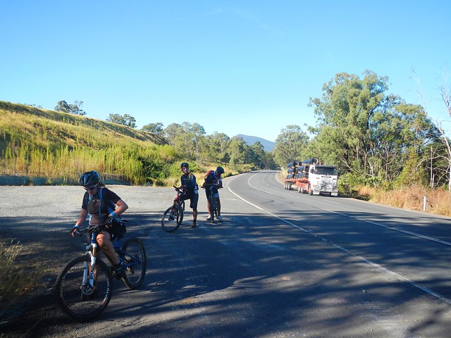
We received a rude shock when we eventually reached the Cunningham Highway. The quiet rural tracks and solitude gave way to busy national highway with massive trucks whizzing by. We accidentally missed the track that passed through the bush 100m from the road, so decided to soldier on for a short way on the shoulder of the highway.
We were following the notes in the BNT guide book, but they seemed vague at this point, and we ended up crossing the highway near an old quarry. While this might have been appropriate for travellers on horseback it was too rough for bikes.
If you’re planning to ride this section of the BNT by bike, I’d suggest you follow the highway up to the Helipad 1km to the west, and cross there. You’ll save yourself a lot of hassle.
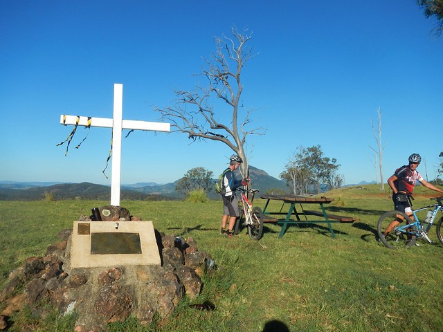
At the top of one last hill by the side of the highway we came across this memorial. Erected by the Vagabond Motorcycle Cllub I think it commemorates members who have died. There are a few empty beer bottles cemented into the monument, so I can imagine a few melancholy bikies standing in this scenic spot drinking wistful a toast to absent friends.
From this point we rolled southwards down the hill towards Pat Speedy’s farm, trying not to bother his cattle too much. Pat used to be a rodeo clown – one of the toughest jobs you can do. The man must have nerves of steel. He survived a horrible encounter with the horn of an angry bull.
I would have liked to meet him today, but unfortunately he wasn’t home.
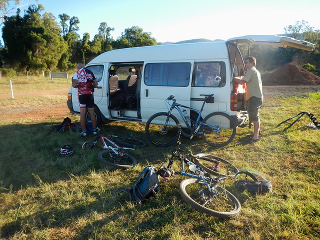
And off in the distance, across a paddock, we spied our cheerful van and generous driver. We’d made it. We were half an hour late, but delighted to have finished this small part of our trip.
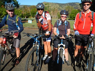
Thank you to Eric, Paul and Becca for another amazing ride.
BIG thanks to Jason, our driver, for giving up a Saturday to drive a van full of sweatty mountain bikers around the country side. Our van travelled a total of 520 km for the day and went through one complete tank of fuel.
We ended up riding 87km in about seven and a half hours. We climbed about 1,300m and I burned about 3,500 kcal.
This is a tough ride, logistically and physically. It helps to do it with other experienced riders.
If you take the route we did, and finish at Spicers Gap Road, I’d rate it 9.5 out of 10 on the tough-o-meter.
If you take the easier option and finish at Aratula instead, I’d rate it 8.5 out of 10.
No comments:
Post a Comment