
“Eighty percent of success is just showing up” – Woody Allen
In the midst of the Queensland wet-season, it would be tempting to get up at 5am, look out the window at the rain, and decide to go back to bed for another couple of hours. But instead, I recalled Woody Allen’s famous words, and decided to “turn up” and hope for the best.
The aim of todays adventure was to ride from Moogerah Dam up to the headwaters of the Condamine River at “The Head” via Koreelah National Park. I also wanted to fill in another missing link on my map. Eric and Becca kindly agreed to indulge yet another hare-brained whim, and so we set off full of hope from Lake Moogerah in the drizzle.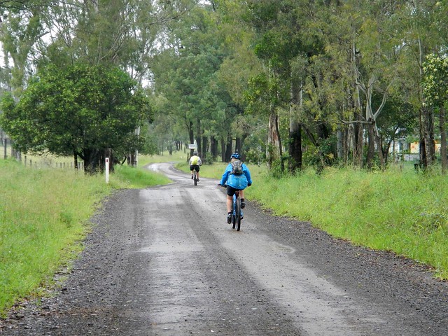
On long cross-country rides like this, I prefer to use non-paved roads as much as possible, so we headed south towards the NSW border along Croftby Road.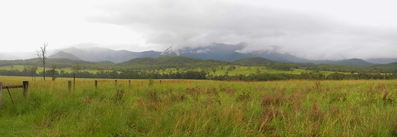
The views of the Great Dividing Range to the west were stunning, but also served as a gentle reminder that we had a lot of climbing ahead of us. The Condamine River flows westwards into the Murray-Darling basin, so to get to its headwaters, we had to get over the Great Divide. And that meant a lot of hills.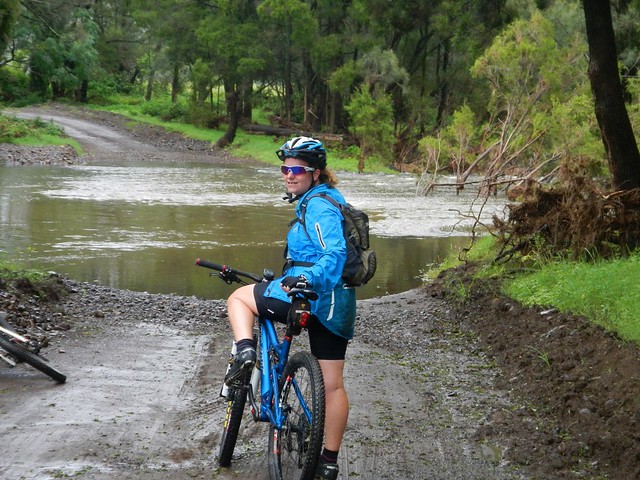
We also wanted to check out the “Bicentennial National Trail” which runs through this region. It’s a mammoth 5,000km trail that runs from Cape York in Far North Queensland to Healsville in Victoria. It covers some of the toughest terrain in Australia, and we were lucky enough to be riding some of it today. The crossing at Reynolds Creek was flooded, but we were able to be able to avoid the flooded crossing by passing a couple of kilometres to the east.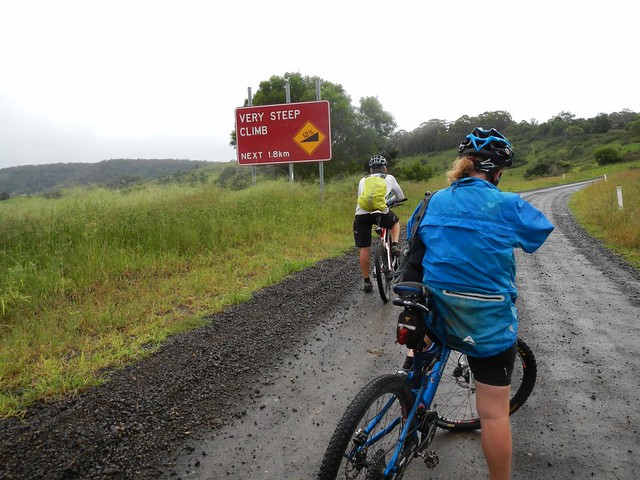
A few kilometres of flattish terrain lulled us into thinking this was going to be an easy ride, until we hit Carney’s Creek Road. Instead of the 1.8km climb that the cruel sign would have you believe, the climb here is actually about 11km and ascends about 600 metres into the cloudy rainforest of Koreelah National Park.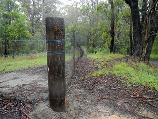
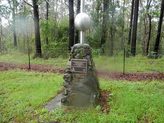
After what seemed like hours of climbing, we finally reached the NSW border. A rabbit-proof fence stretches for most of the length of the 1,300km border between NSW and Qld – part of a vain attempt to keep the voracious animals out. The fence winds its way over mountain ranges, through thick rainforests, and across wide plains. It’s also a tangible sign of the work done by surveyors Roberts and Rowland in the 1860′s as they marked out the imaginary line between the two states. These and other early surveyors like Oxley, Dixon, Stapylton, Warner, Delisser and Lavelle were the true explorers of the Austrailan wilderness – blazing trails that we are still able to follow more than a century later.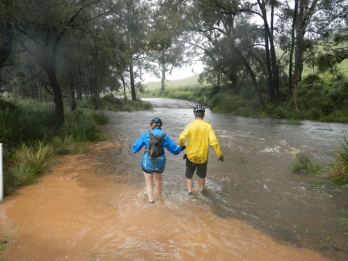
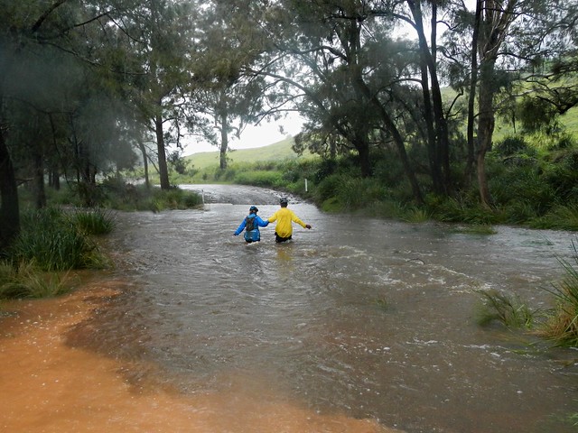
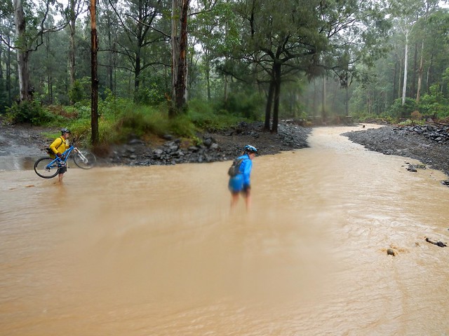
As we rode, the rain continued to increase in intensity. By the time we got to Koreelah Creek the crossing was flooded and we had to wade through. We took it carefully, making sure no-one slipped in the fast flowing water. Just to be on the safe side, Eric carefullly waded into the water first, to check that it was ok to cross.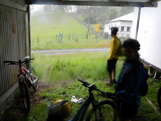
After yet another long climb, we made it to the top of Head Gate Road, to the border crossing known as “Head Gate”. The old shed was a perfect spot to get out of the rain, dry off, and have a bit of lunch.
Normally, this spot would have been the most scenic of the ride, with views to the west of Condamine Gorge with craggy cliffs rising on either side, and Mount Superbus towering in the distance. Today it was rainy and foggy, and we could see nothing, so we started the long descent down Head Road…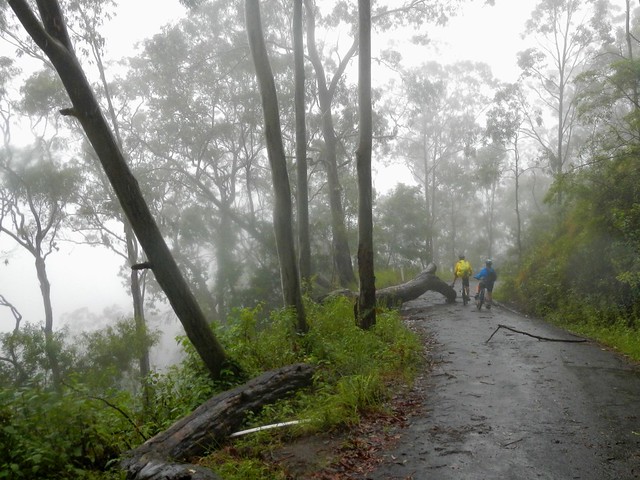
Head Road was closed to traffic. It was strewn with fallen trees, boulders and land-slips. Thankfully we were able to navigate around these obstacles with our bikes. It would have been impossible in a larger vehicle. As mountain bikers, we coined a new phrase for this sort of damage. It had been “Goat Tracked” – a reference to how damage to the Goat Track between Highvale and Mount Nebo had rendered it impassable to most vehicles except mountain bikes – not necessarily a bad thing ![]()
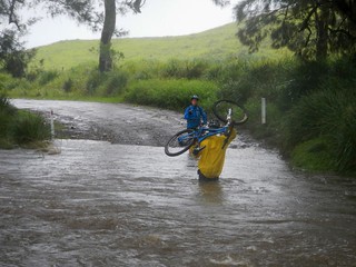
At the bottom of Head Road we had to contend with the swollen Teviott Brook. It crosses the road several times, and we had to carefully make our way across several flooded causeways.
I think it’s important to point out that wherever possible I don’t cross flooded creeks. It’s dangerous. It’s not something that we set out intentionally to do. There was no other realistic option for us, and we only crossed when we were certain it was safe to do so.
All up we rode about 90km in 7.5 hours including breaks. We ascended just under 1,800m and I burned 4,200 kcal. Taking the weather into account, the obstacles, and the tough terrain, this one deserves a rating on the tough-o-meter of 10 out of 10. Not for the faint-hearted. In cooler dryer weather it would be slightly easier and would probably rate 9 out of 10.
No comments:
Post a Comment